Southern
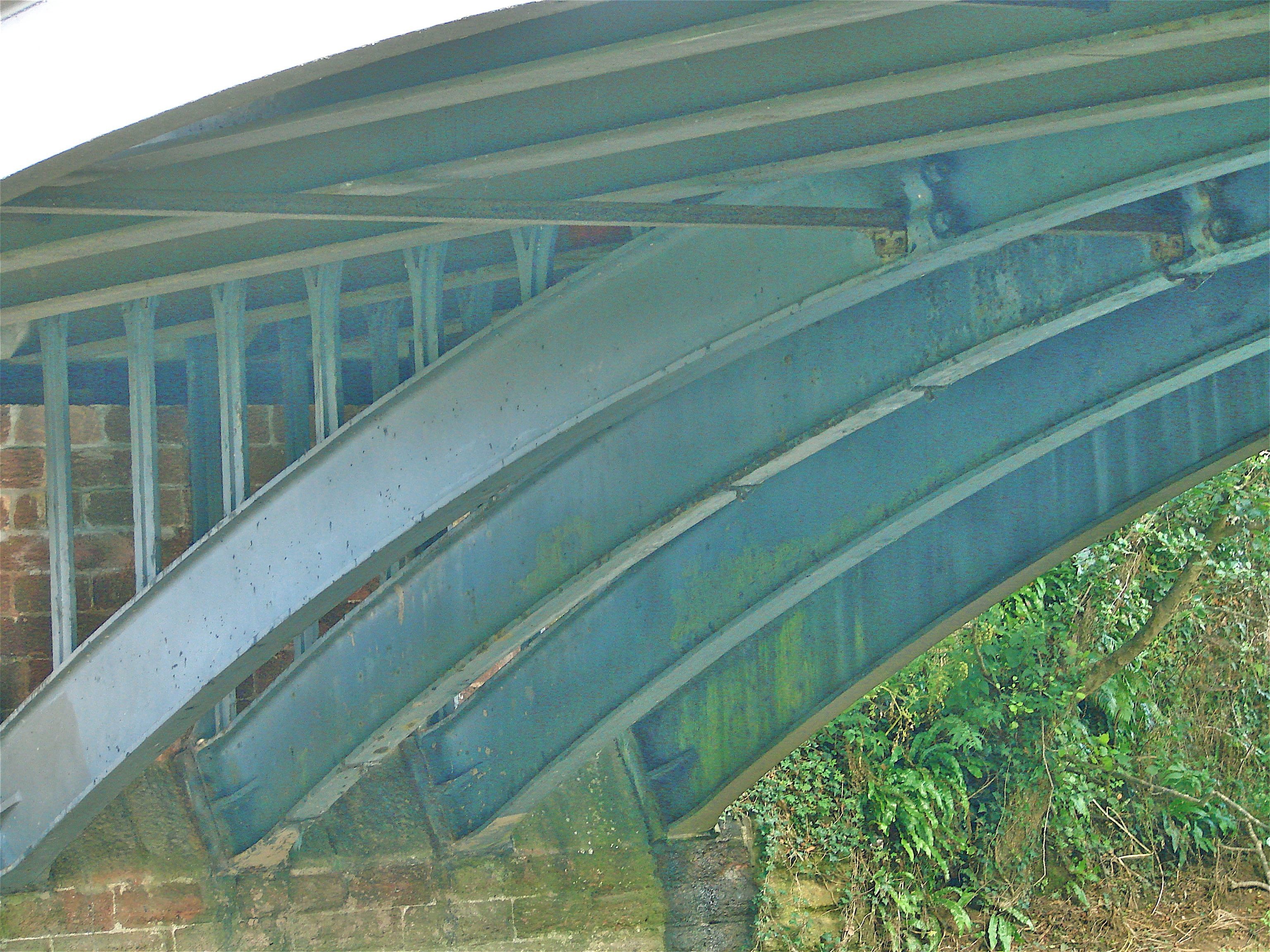
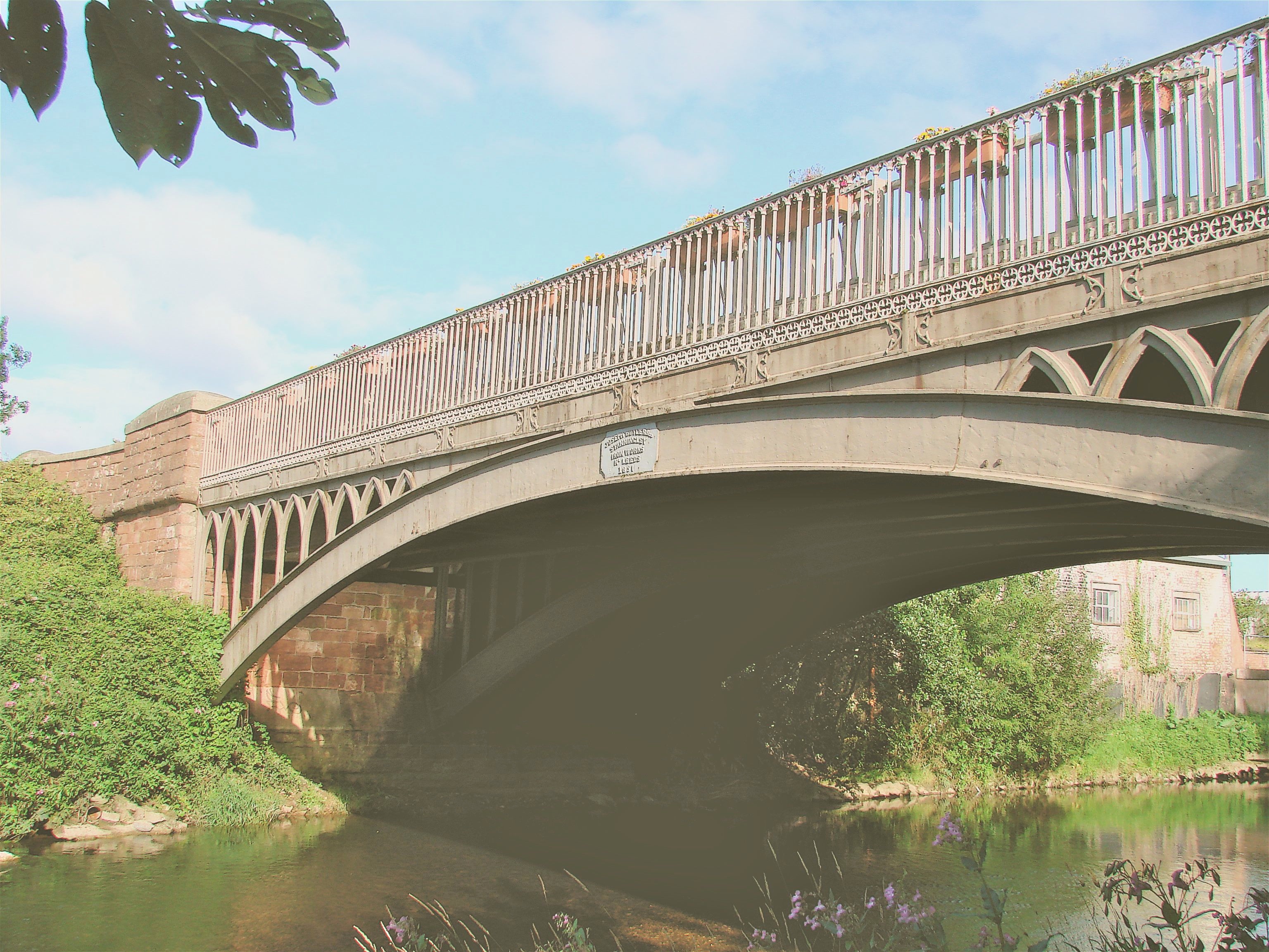
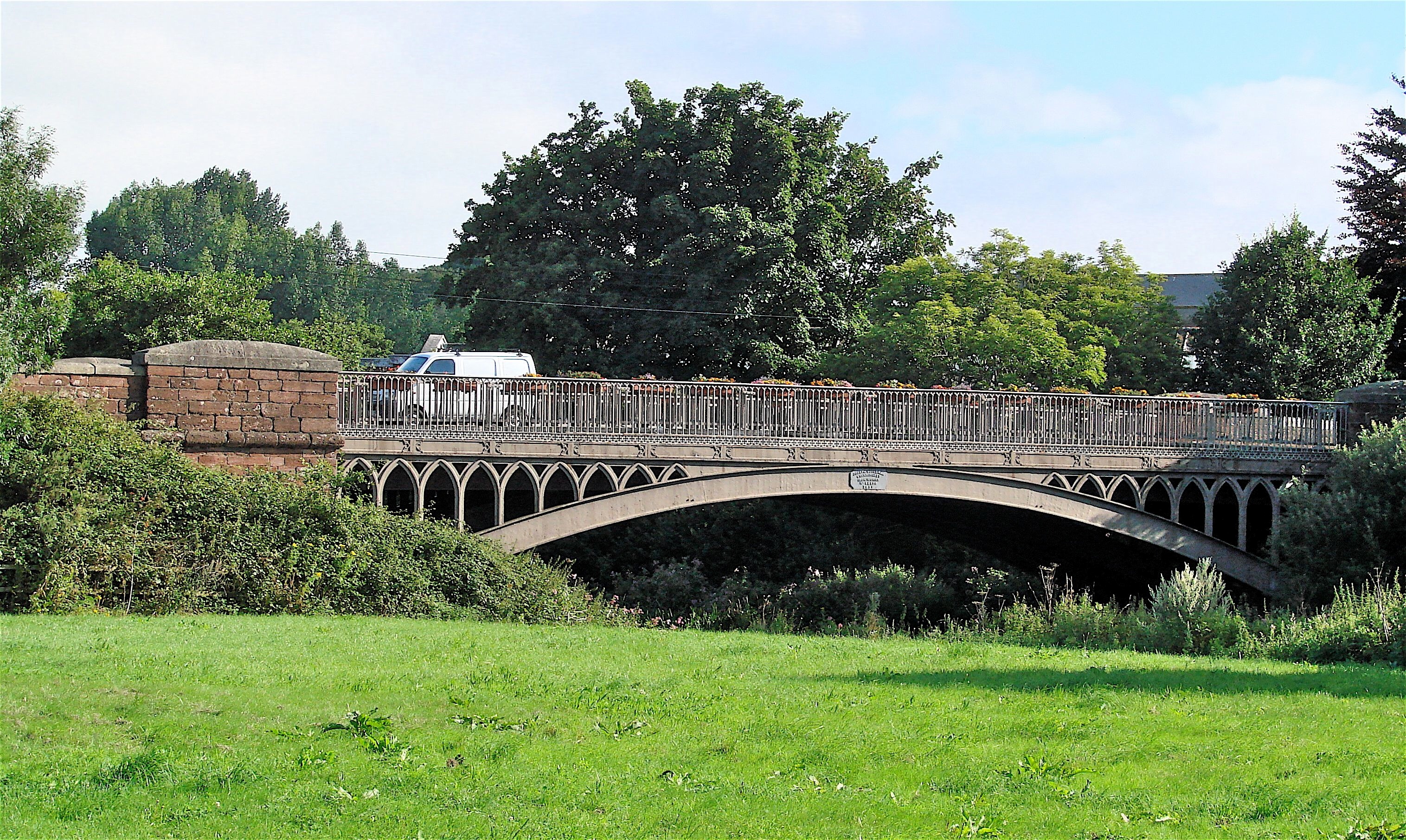
N50o 44' 56.9" W3o 17' 6.5" Over River Otter at Ottery St. Mary, Devon
- Details
- Written by: Administrator
- Category: Southern
BLAENAVON FORGE SIDE OR AARON BUTE'S BRIDGE 1812/1818 SO248 086 N51o 46’ 23.4” W3o 5’ 25.7”
This cast iron tram bridge is fenced off, overgrown, and crowned with a hideous modern parapet and railing. It bravely crosses a very precipitous creek and weir which makes it difficult to see or photograph. It is similar to the Rhyd y Car 1794 Merthyr Tydfil and Robertson Bridge 1811 at nearby Abedare which has continuously cast ribs and parapet. It appears to have cast iron plates as its roadbed for tram tracks. It is about 40’ in length and perhaps eight feet wide.
- Details
- Written by: Administrator
- Category: Southern
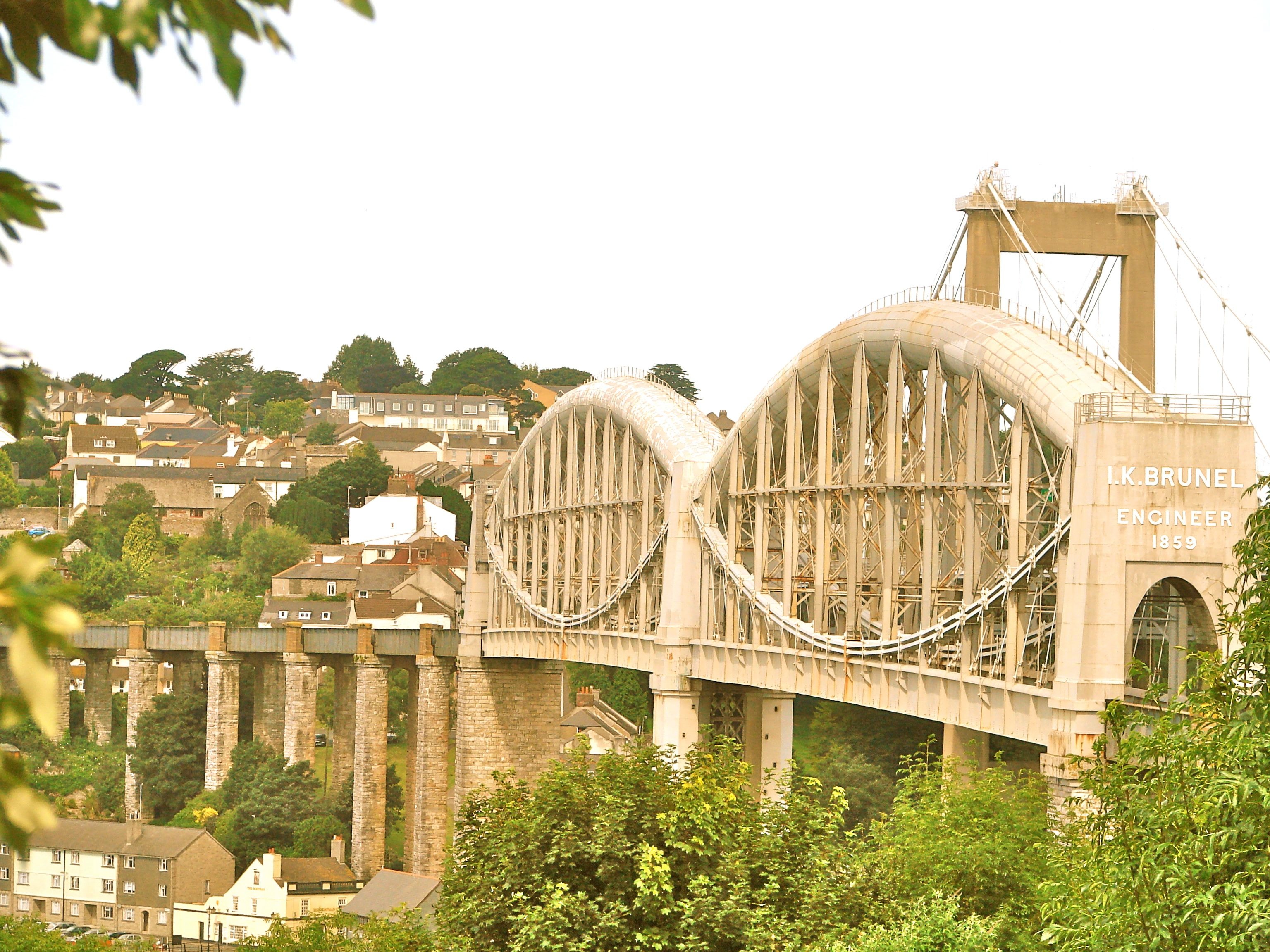
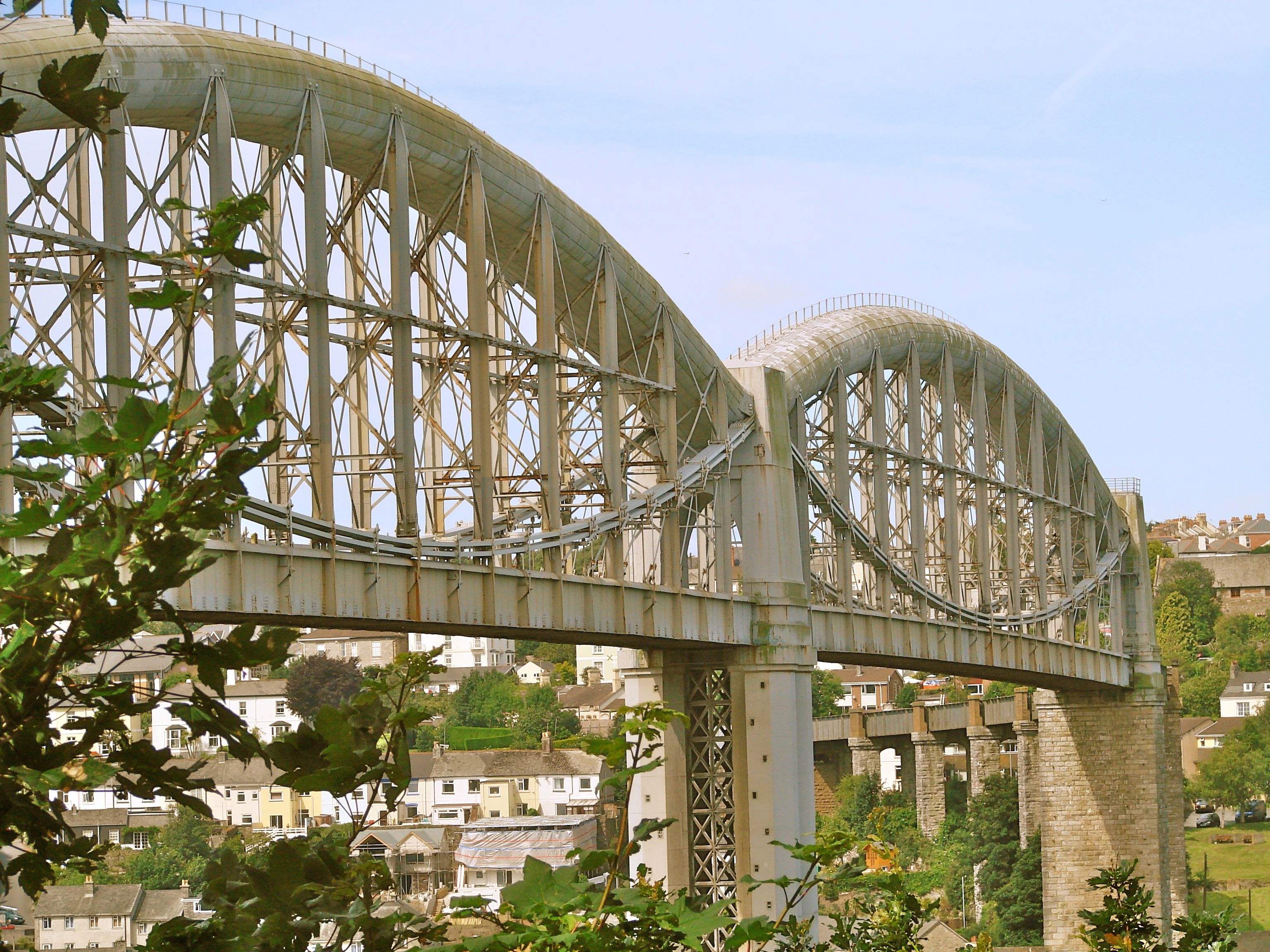
Brunel, N50o 24' 24.5" W4o 11' 51.8" at Saltash across River Tamar Devon/Cornwall
- Details
- Written by: Administrator
- Category: Devon
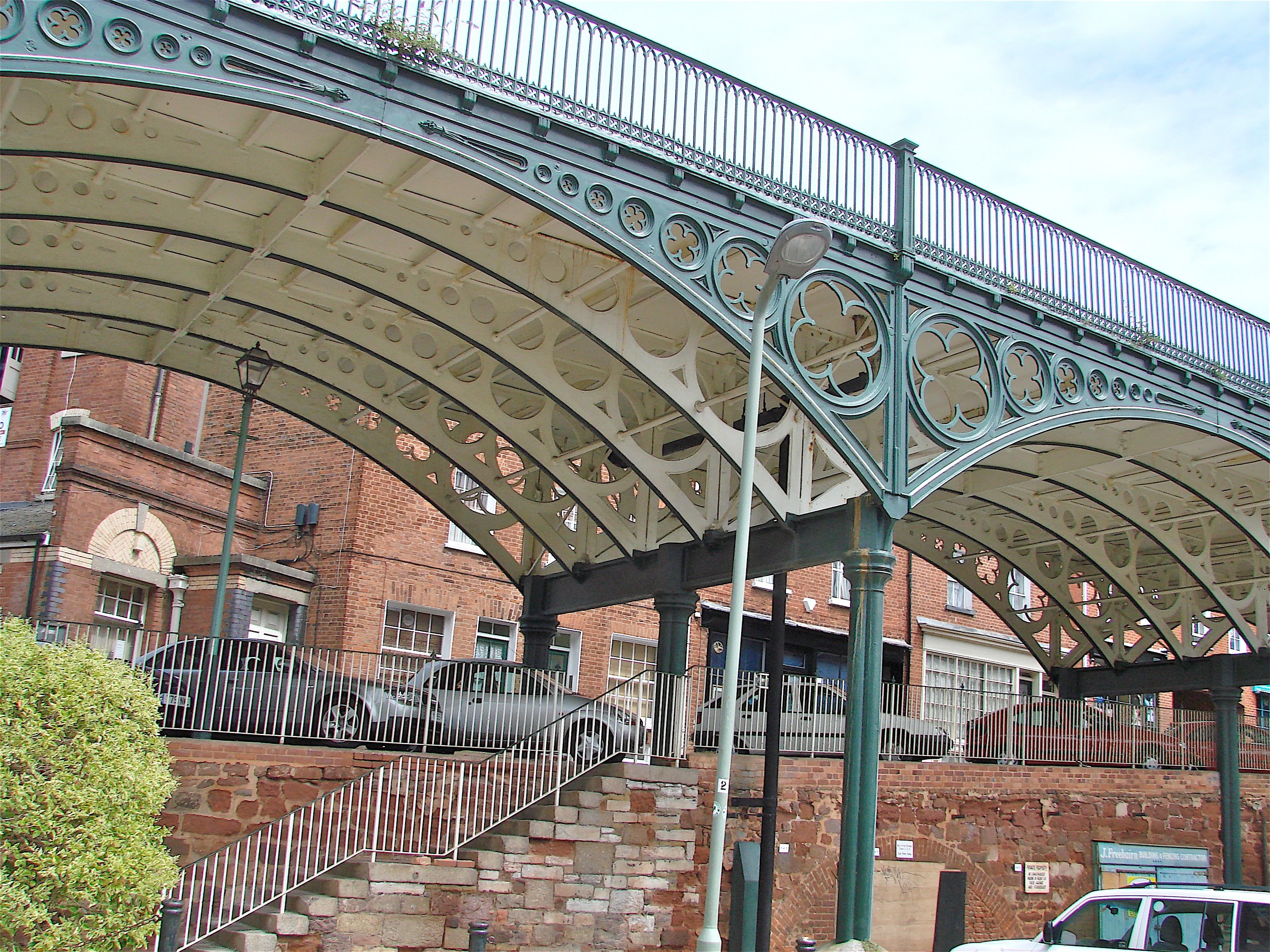
EXETER: NORTH STREET BRIDGE 1835 HEW 981 SX 917 927 N50o 43’ 26.8” W3o 32’ 8.1”
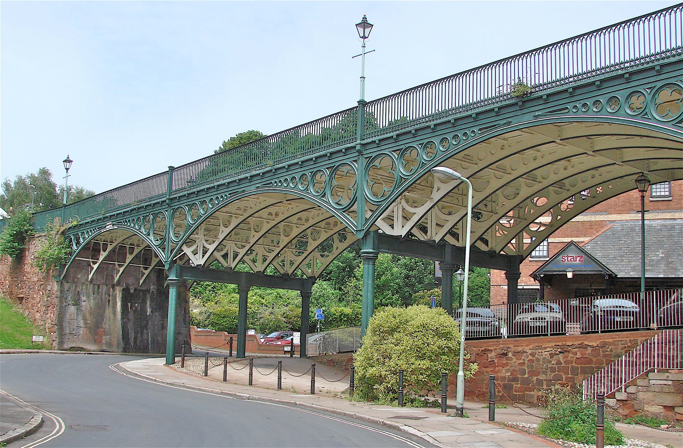
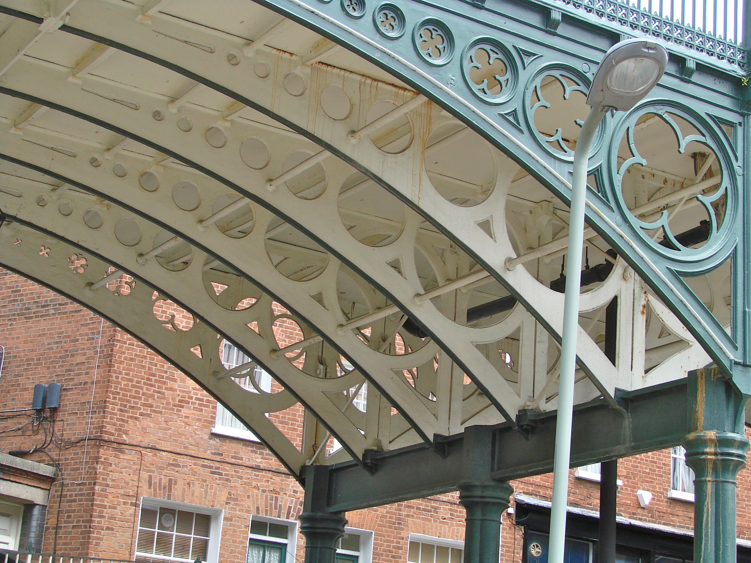
Commissioned by the Exeter Turnpike Trust I 1834, this cast iron bridge has six 40 foot arched spans resting on cast iron columns and carries North Street down to the site of the town’s North Gate and across Longbrook from St. David’s Hill at the beginning of the Barnstaple Road. Formerly, this was a very steep road up to the center of town. The iron was fabricated by Blaine Ironworks at Newport and arrived by boat at Exeter Basin. In 1984 a reinforced concrete deck was laid over the iron plates. The masonry approaches are in the distinctive Exeter red sandstone.
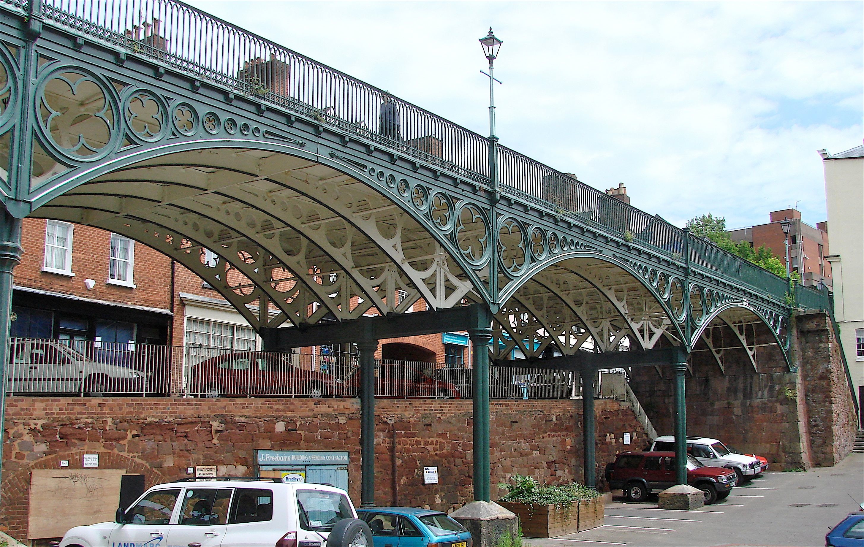
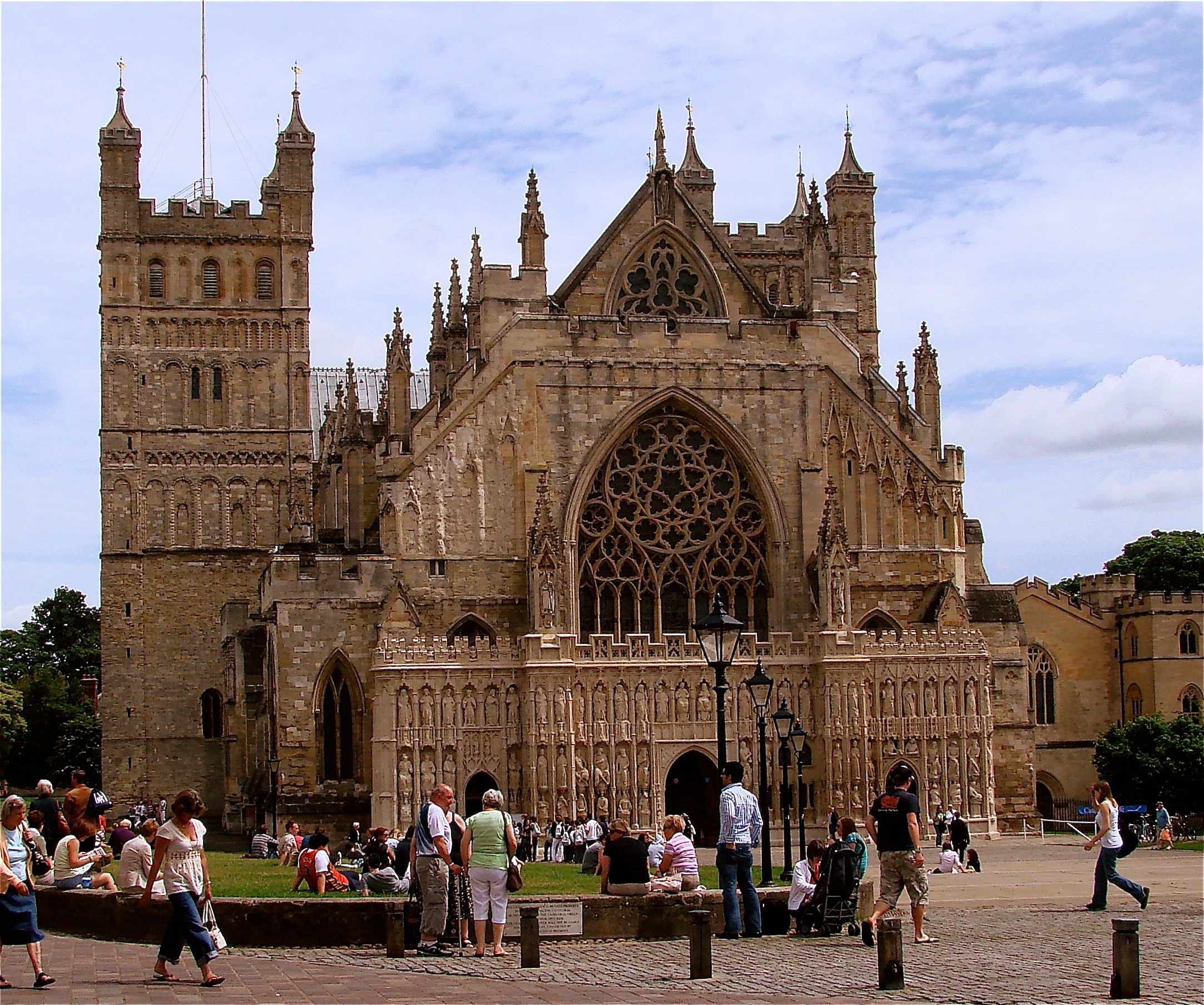
It is easy to see both these Exeter bridges in one visit. Park in the Mary Arches public garage and walk downhill on Upper North Street one block to the North Street Bridge. To see it from below, walk down the steps. The Cathedral is up hill on North Street one block to High Street, turn left and about 100 feet, you will glimpse the Cathedral through a pedestrian passage which is across High Street from the entrance to the modern shopping mall. The footbridge is to the left of the façade of the Cathedral, along the street with the medieval buildings.
- Details
- Written by: Administrator
- Category: Devon
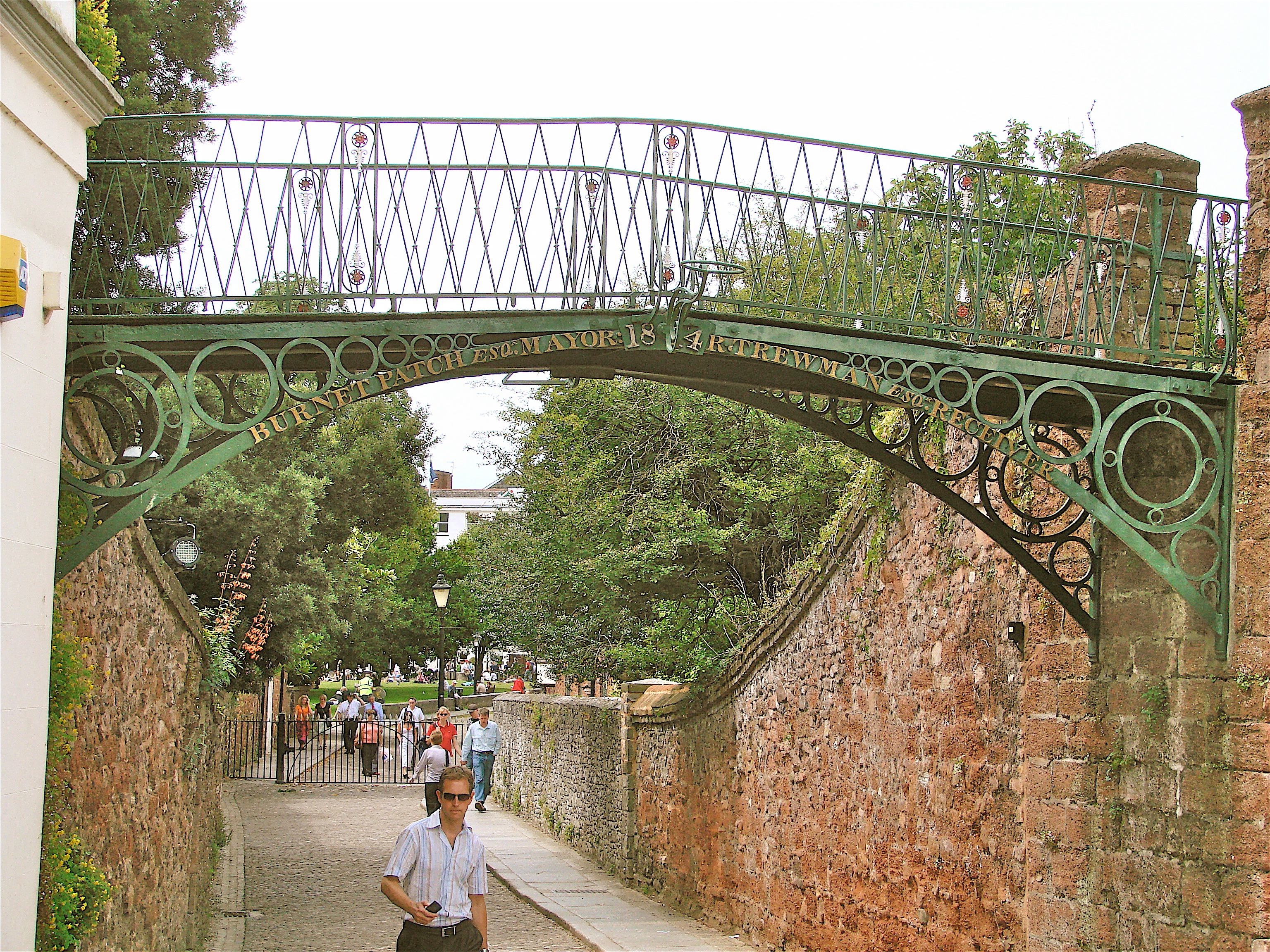
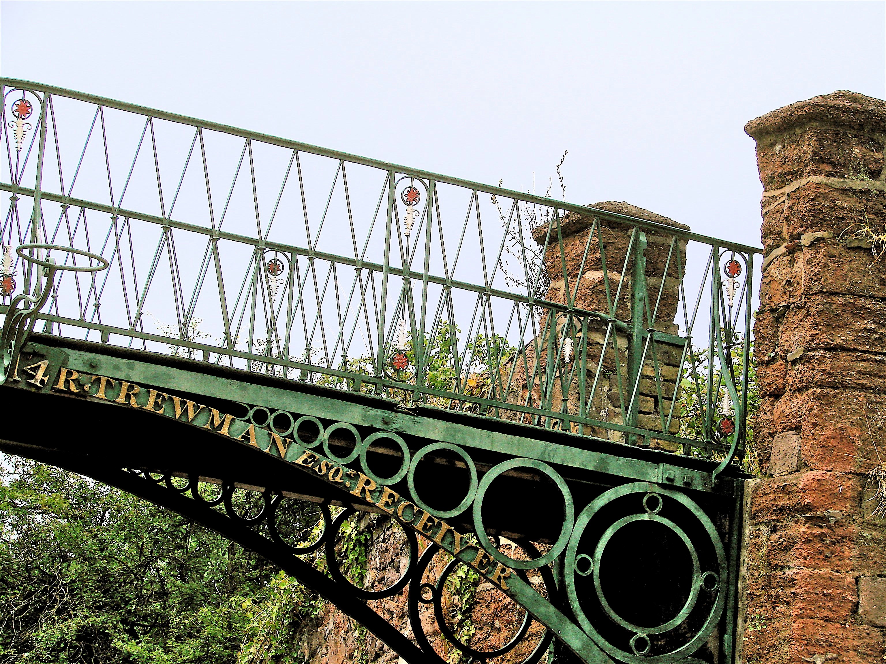
EXETER CATHEDRAL FOOT BRIDGE 1814 HEW 362 SX 922 925 N50o 43’ 20.5” W3o 31’ 40.2”
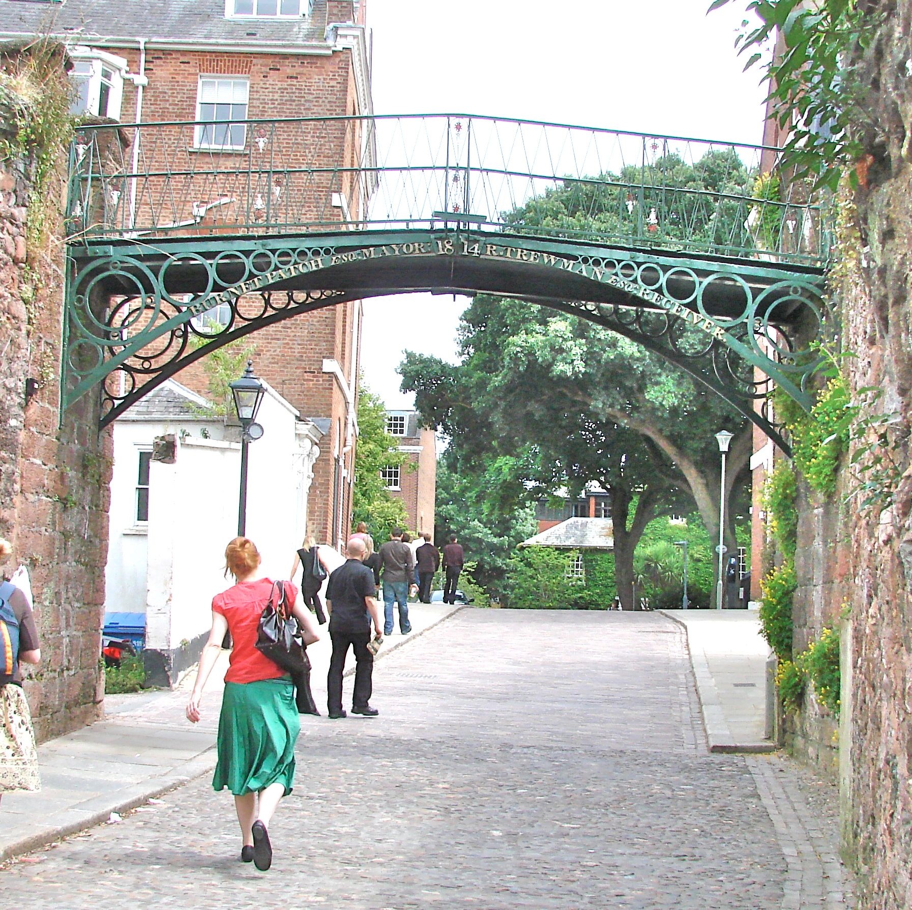
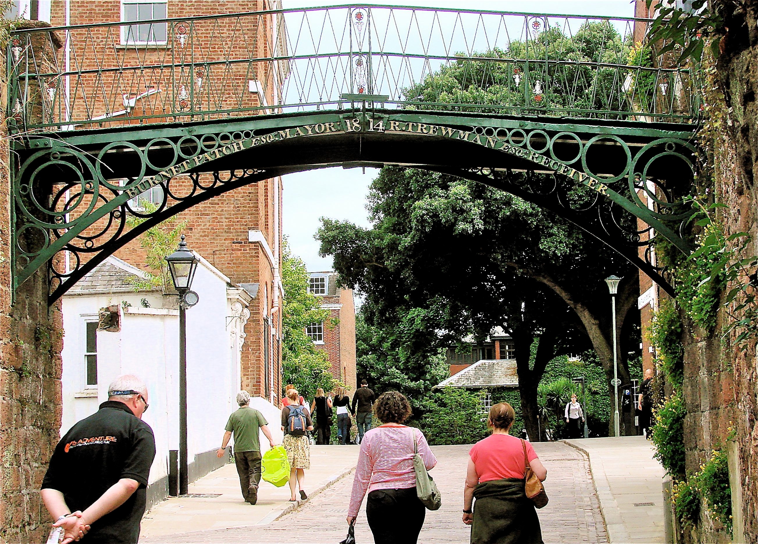
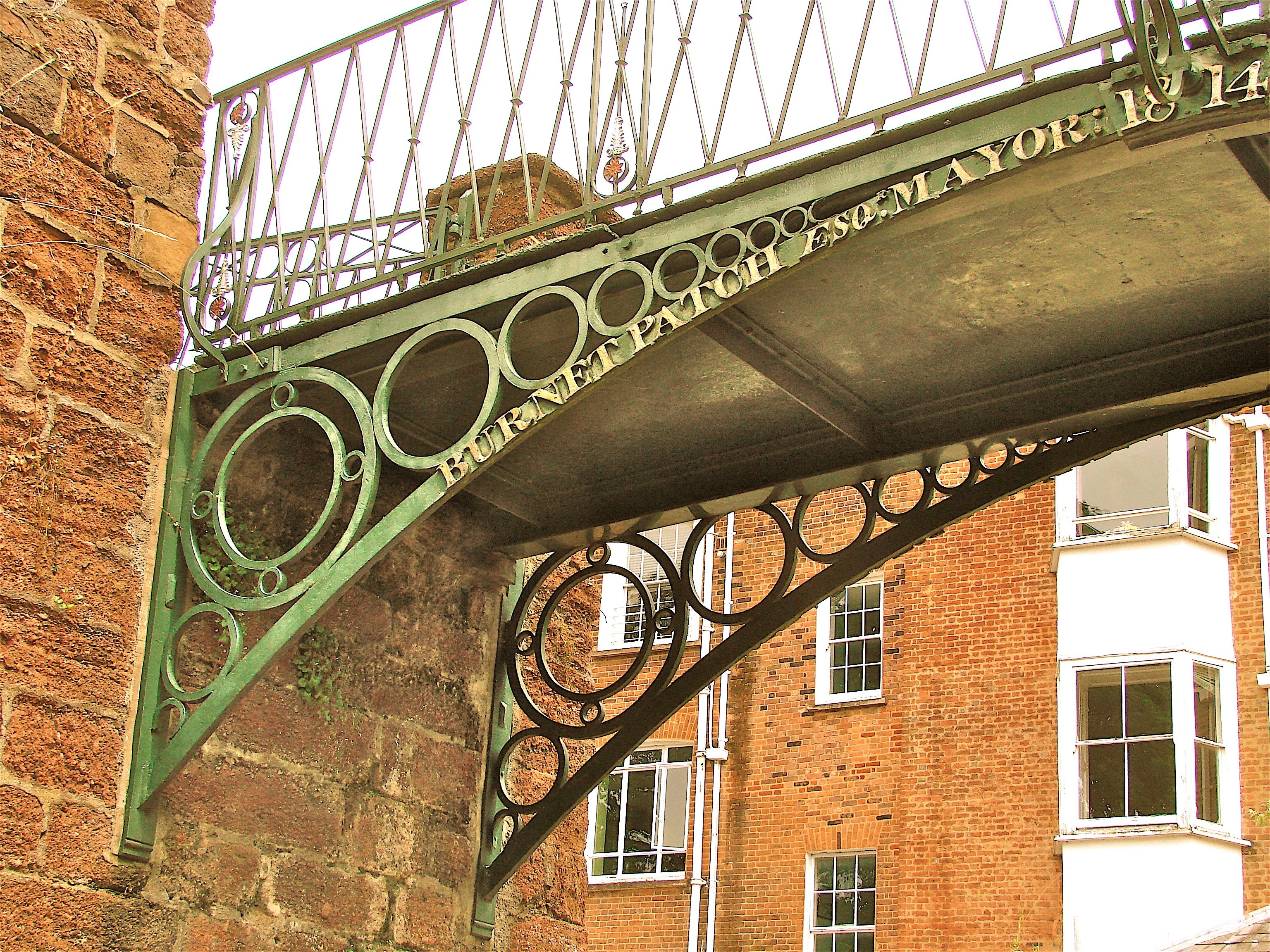
This delightful little foot bridge spans a 19 foot wide pedestrian way to the east of the Cathedral carrying a walkway that runs along the old City Wall which once joined the Bishop’s Palace to the Deanery gardens. It has two ribs of segmented cast iron with the familiar diminishing circle design in the spandrels. The names of those people responsible for its erection and the date are on the arch. It still retains its original light brackets but no longer the lights themselves.
- Details
- Written by: Administrator
- Category: Devon
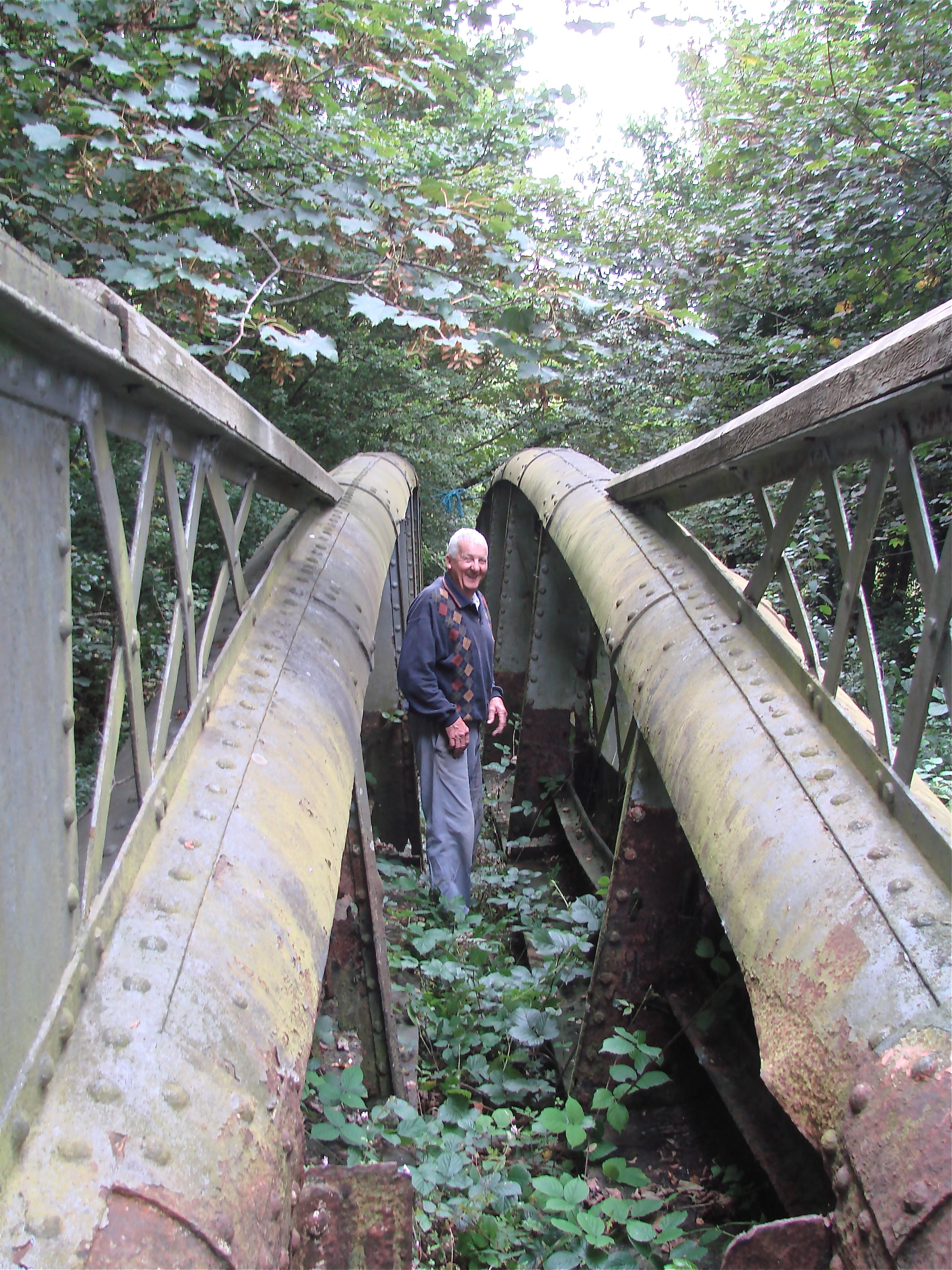
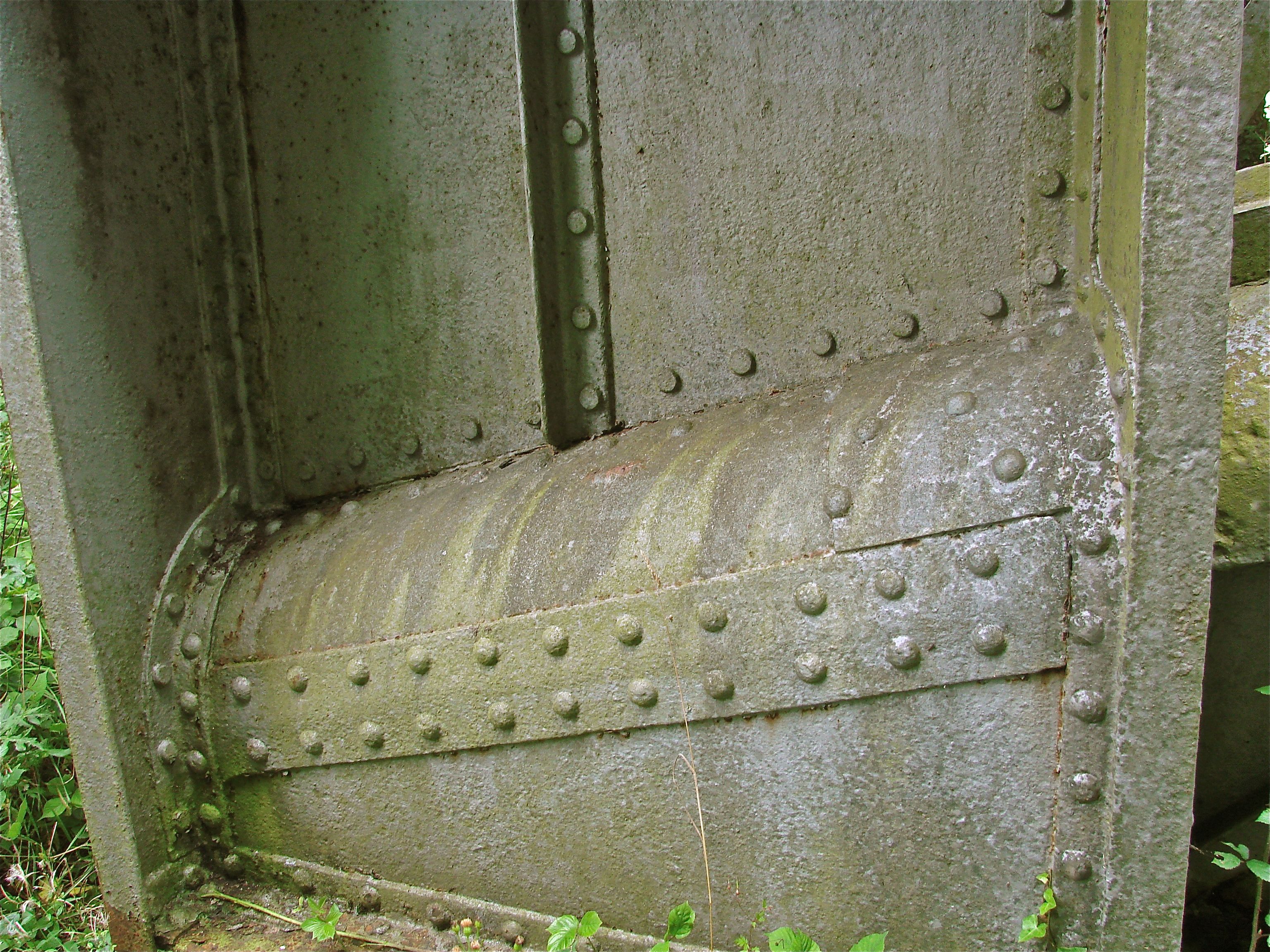
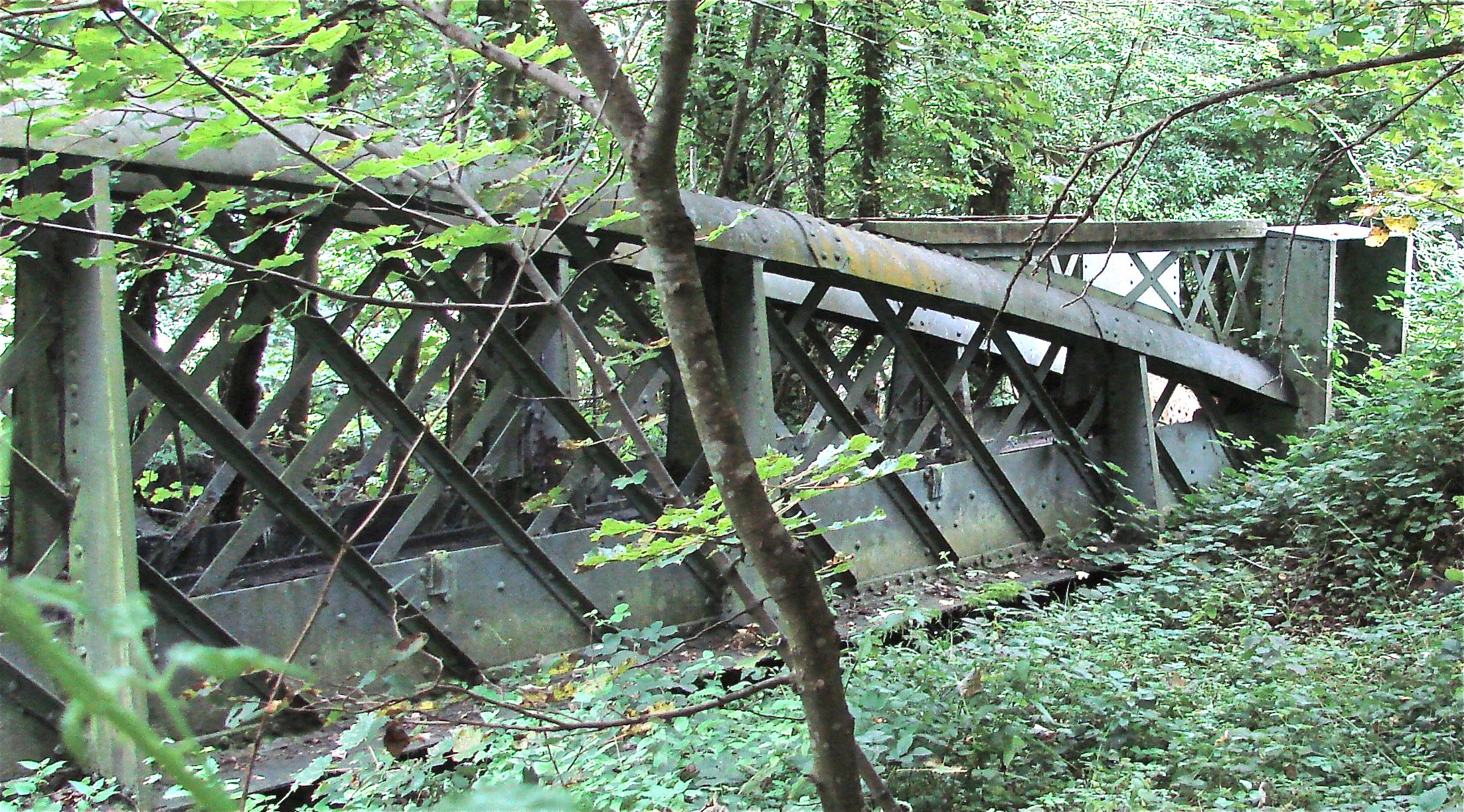
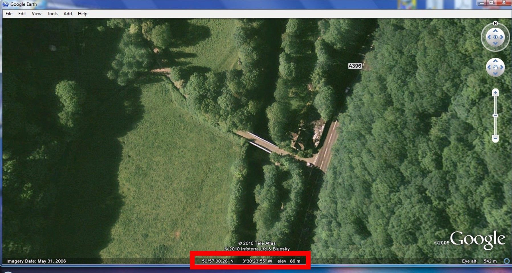
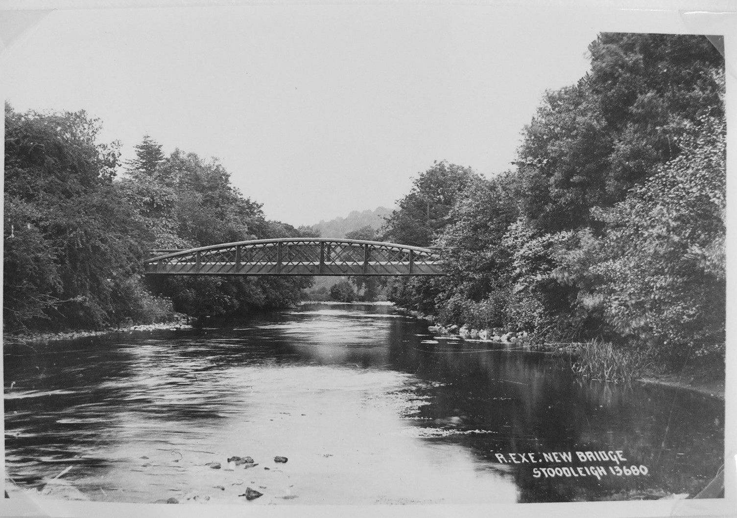
STOODLEIGH BRIDGE, Devon Replacement Br. 1998 site: N50o 57' 28" W30 30' 23.55 Pieces of original bridge: N50o 57' 08.99" W3o 31' 22.80" (numbers need checking)
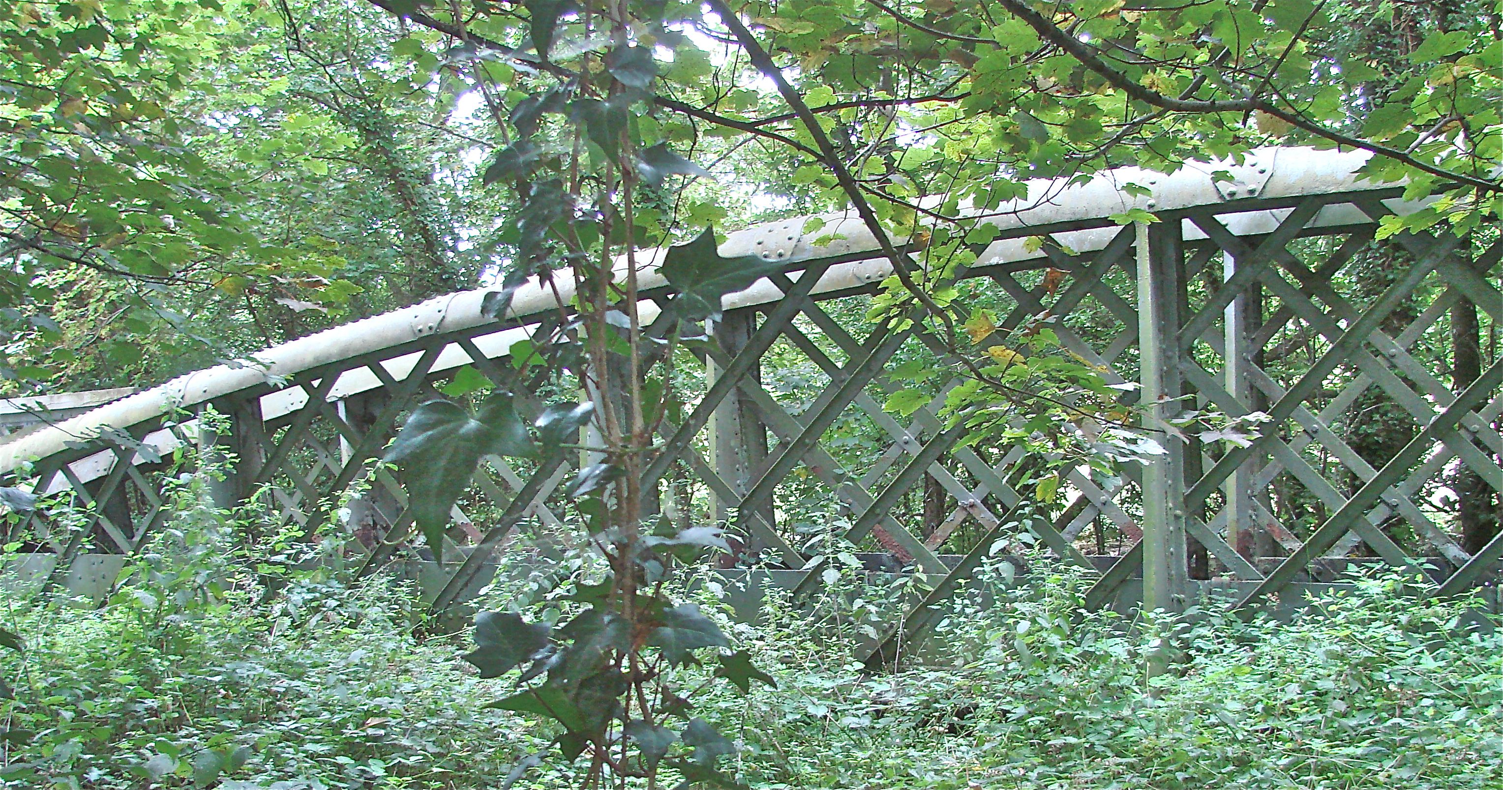
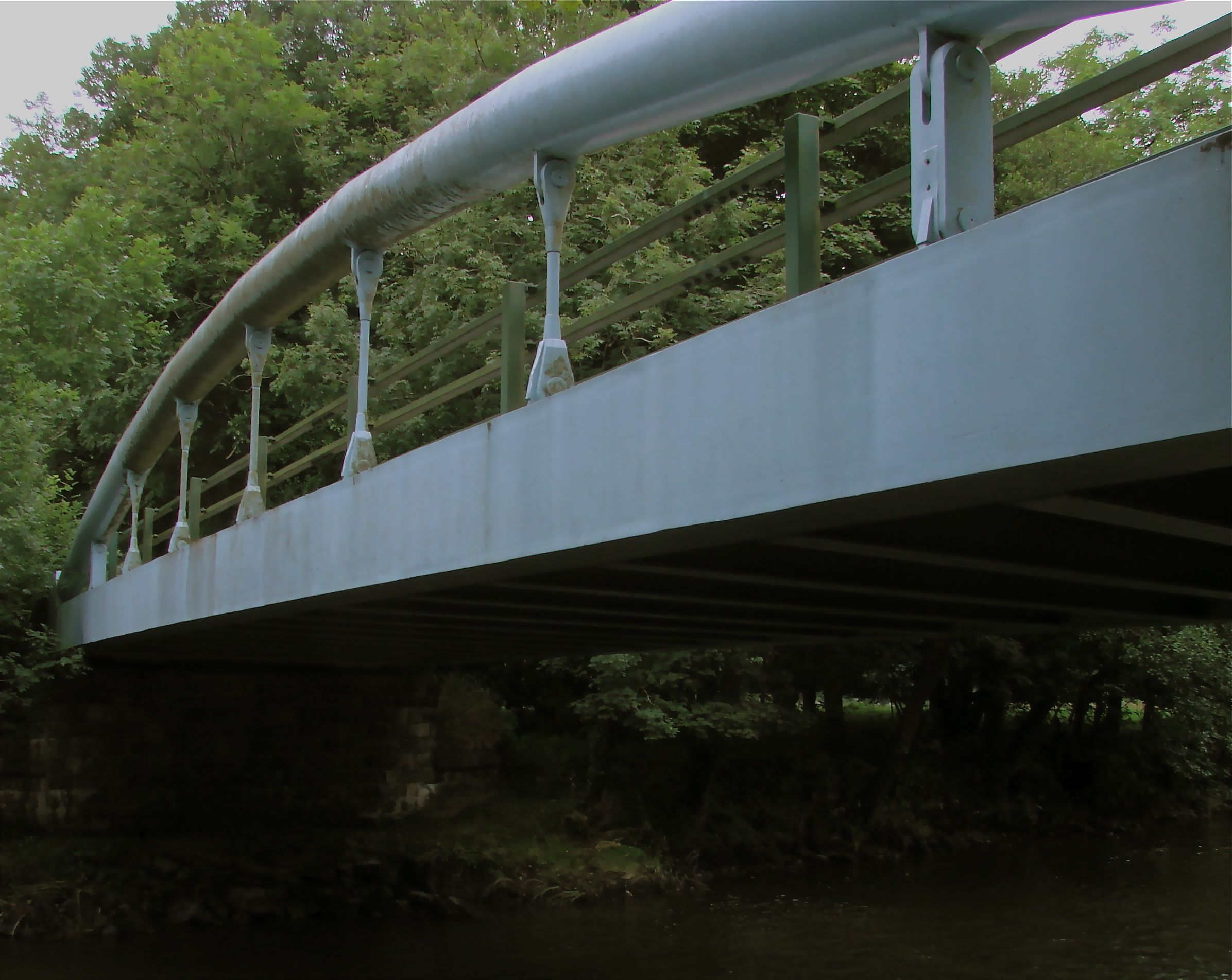
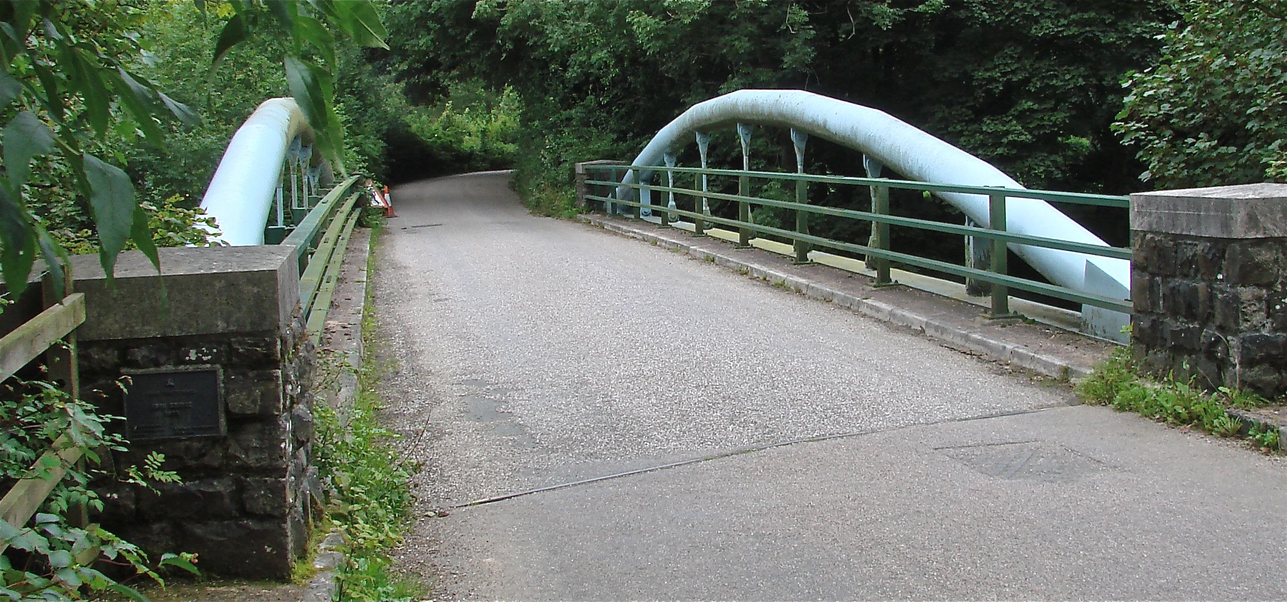
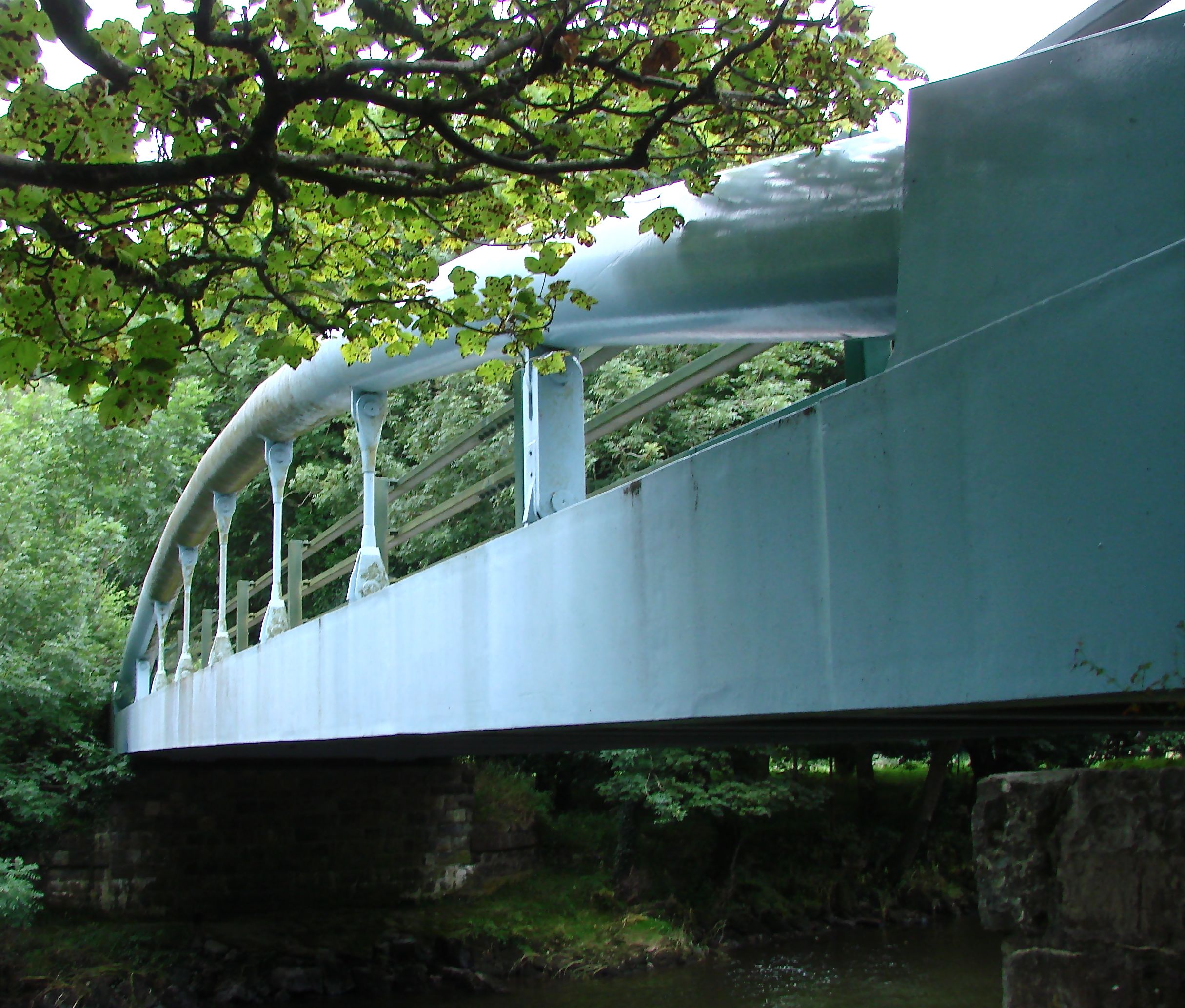
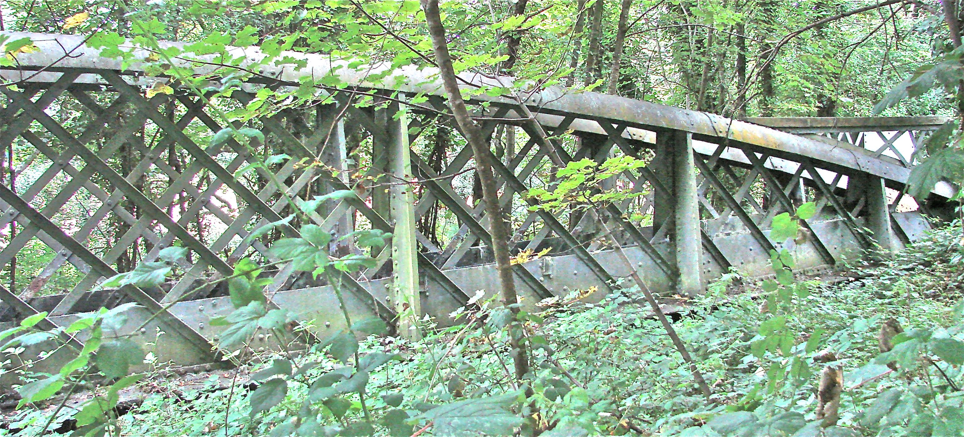
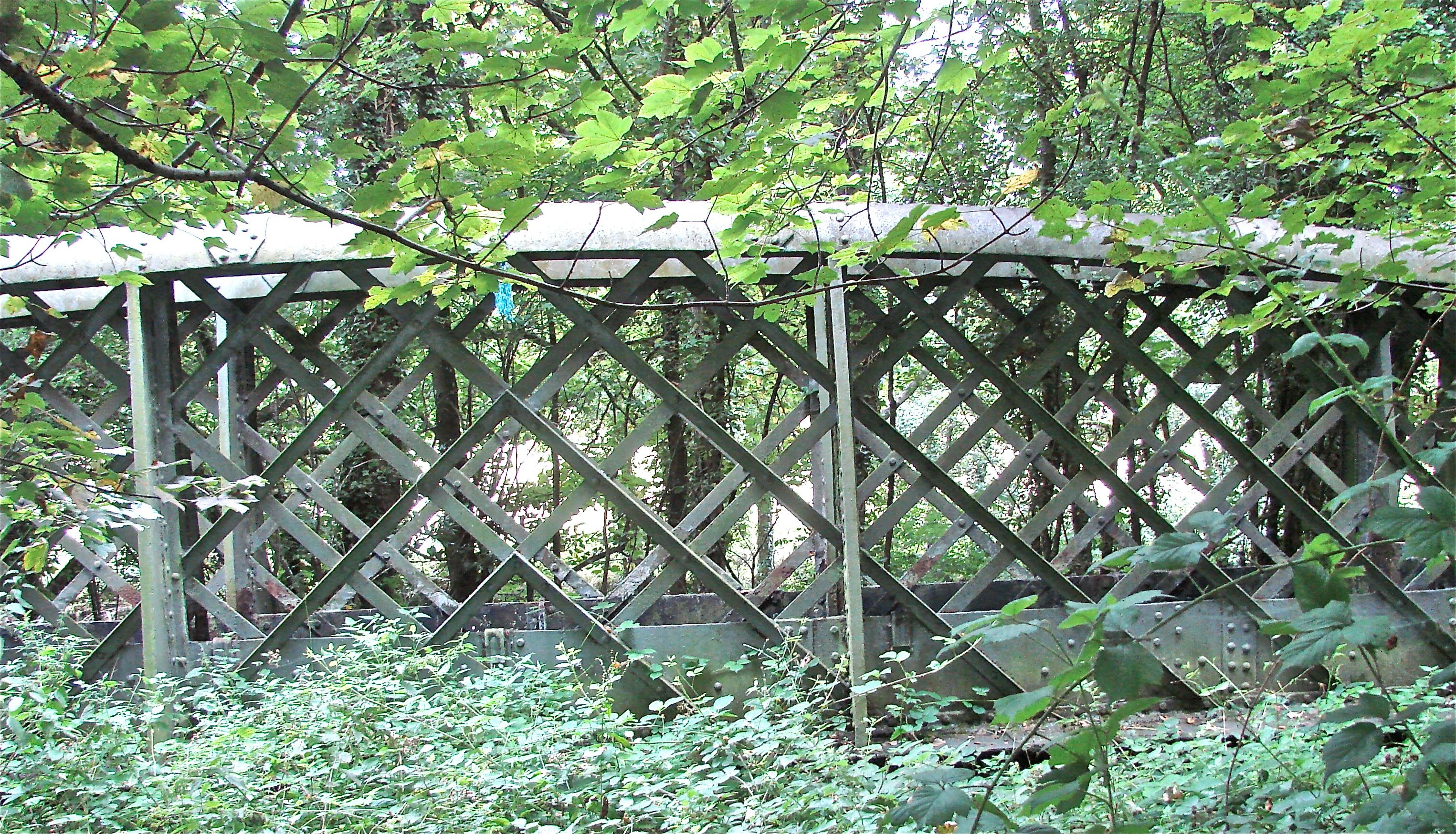
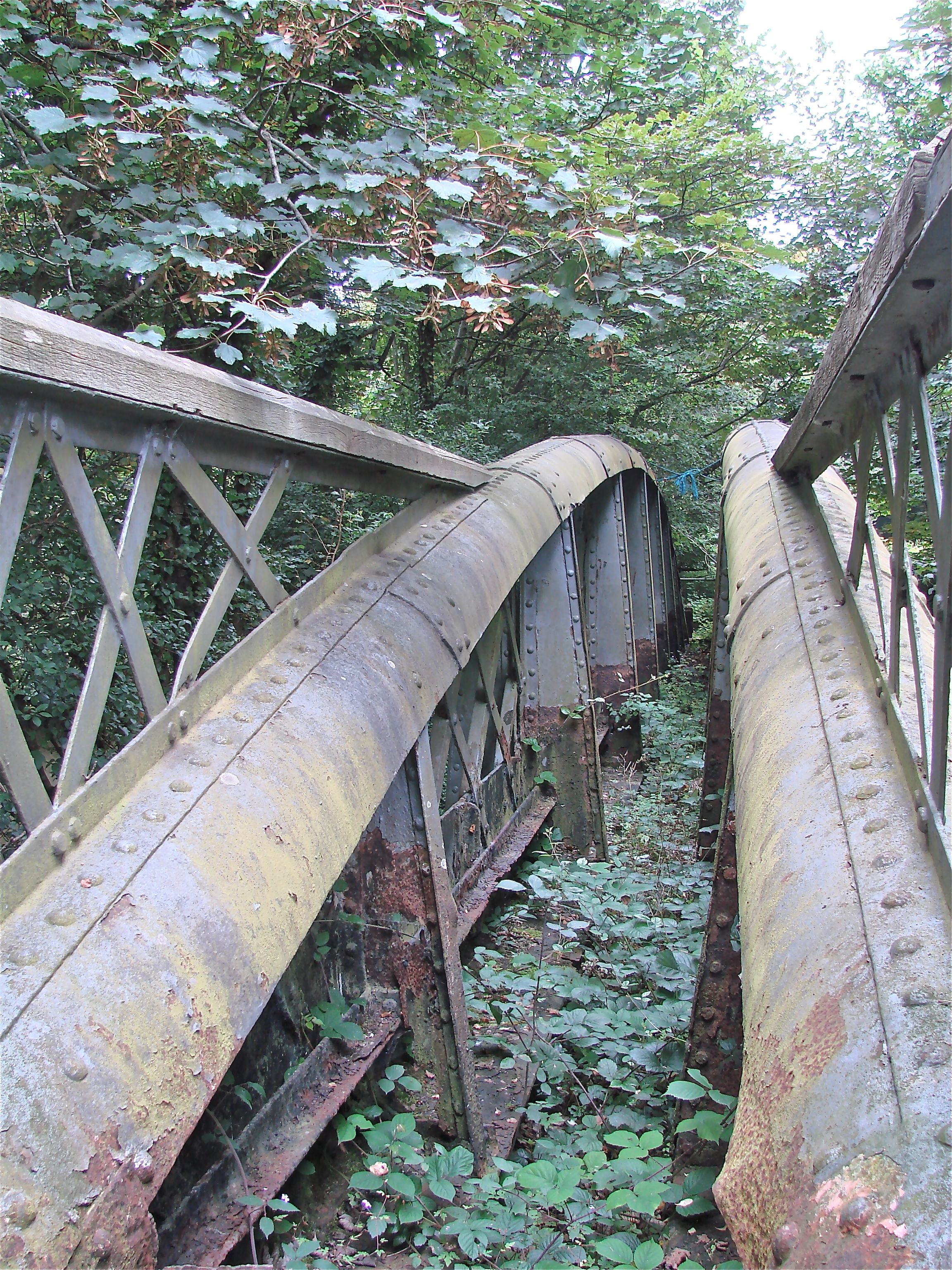
This unusual bridge was fortunately 'dumped' in the woods nearby when it was replaced in 1998. It is almost completely intact in two lengthwise halves. The road bed appears to have been supported by iron rods descending from two arches of iron formed by half tubes. Rivets hold the pieces together. The space between the arches and the road bed was filled with a lattice work of iron. The replacement bridge has attempted to give the same effect with full tubular arches with descending rods from which the road bed hangs. It is handsome, but not as wonderfully eclectic as the original.
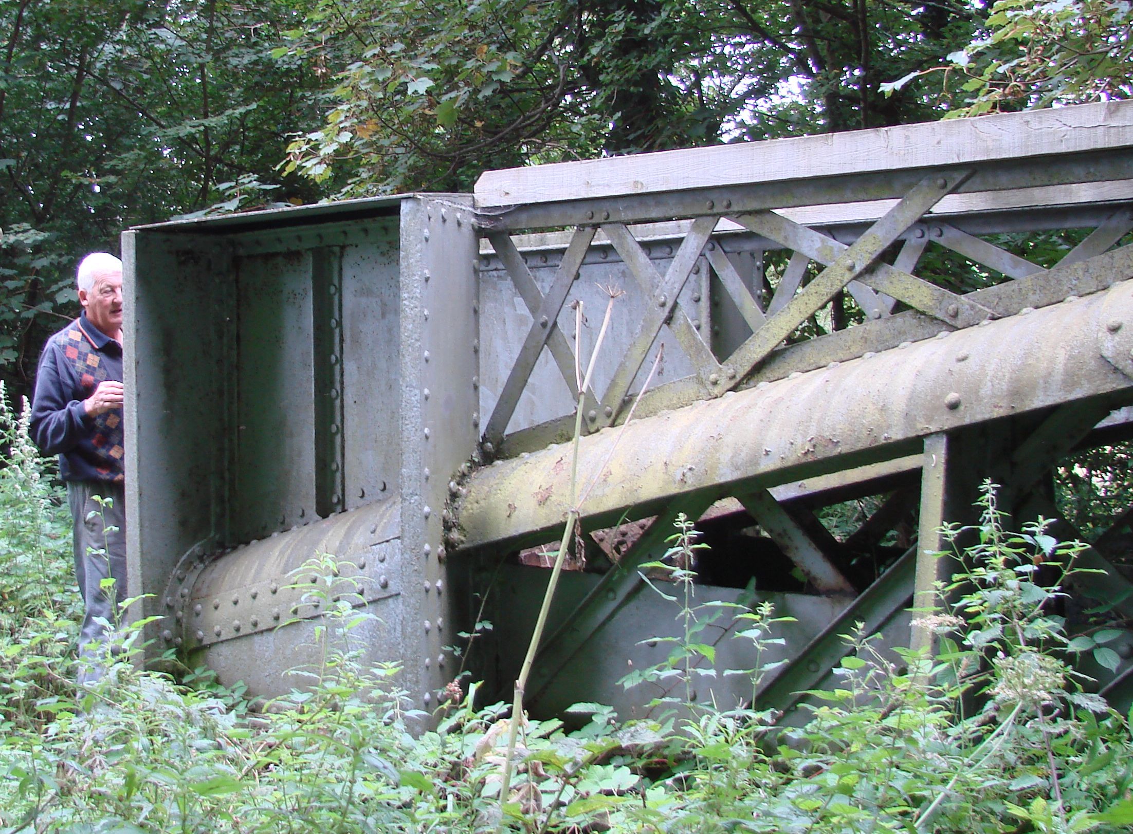
"At the time of its removal, the bridge was a public road bridge maintained by the Devon County Council. Before its removal, DCC commissioned an historical assessment and evaluation by Keystone Historical Building Consultants. This concluded inter alia that the bridge was originally constructed on the Stoodleigh estate as a private bridge carrying a private drive across the Exe into the estate from the Tiverton/Dulverton turnpike road. There was no bridge or drive there in 1842 (Tiverton tithe map). The earliest mention found by Keystone of 'an iron bridge leading to Stoodleigh' is in a newspaper item in 1863. The drive is first mentioned, in another newspaper item, in 1866. Hence, the provisional date range 1842-1866. The main purpose of the bridge seems to have been as a means of getting felled timber out of the estate and down towards Tiverton - hence the rather utilitarian form." (Summary of a report by David Greenfield 2009)
The site of the bridge is on the lane to Stoodleigh from the west side of the A396 between Tiverton and Dulford as it crosses the River Exe almost immediately. The turnoff is well marked 'Stoodleigh'. The old bridge is in the woods about a mile toward Tiverton from its former site a
- Details
- Written by: Administrator
- Category: Devon
SALTASH RR BRIDGE (AKA Royal Albert Bridge) 1854-9 Brunel Saltash, Cornwall/Devon N50o 24’ 24.5” W4o 11’ 51.8”
Brunel designed this bridge to carry The Great Western Railroad from Devon into Cornwall over the River Tamar. There are two spans of 465 feet resting on a single masonry pier resting within a cast iron coffer dam. Each of the 1000 ton sections of the bridge was lifted into position by hydraulic jacks before an awe-sruck crowd. Brunel directed the operation by means of flags and numbered plaquards.
It is interesting to note that the iron work commissioned for Brunel’s Clifton Suspension Bridge was sold to the South Devon Railway Company to be used for this bridge when the Clifton Bridge sponsors went bankrupt. The Saltash Bridge is an extremely original design and illustrates what the ‘new’ iron of our story was capable of achieving when used by a designer of genius.
The three very tall granite pylons support two elliptical balloon-like arched tubes (16’ high and 9’ wide) from which the bridge deck is suspended by tie rods. To further support the deck, there are suspension chains from the pylons to the decking. However, they cannot extend past the pylons to be anchored on shore in the usual manner (because of the long approach viaducts), so they terminate in the pylon. Their great inward pull on the pylons is counteracted by the great curved tubes.
One can view the bridge without crossing it: there is a western Bridge Business Office with a parking lot at the southern approach of A38 from Devon.
- Details
- Written by: Administrator
- Category: Devon
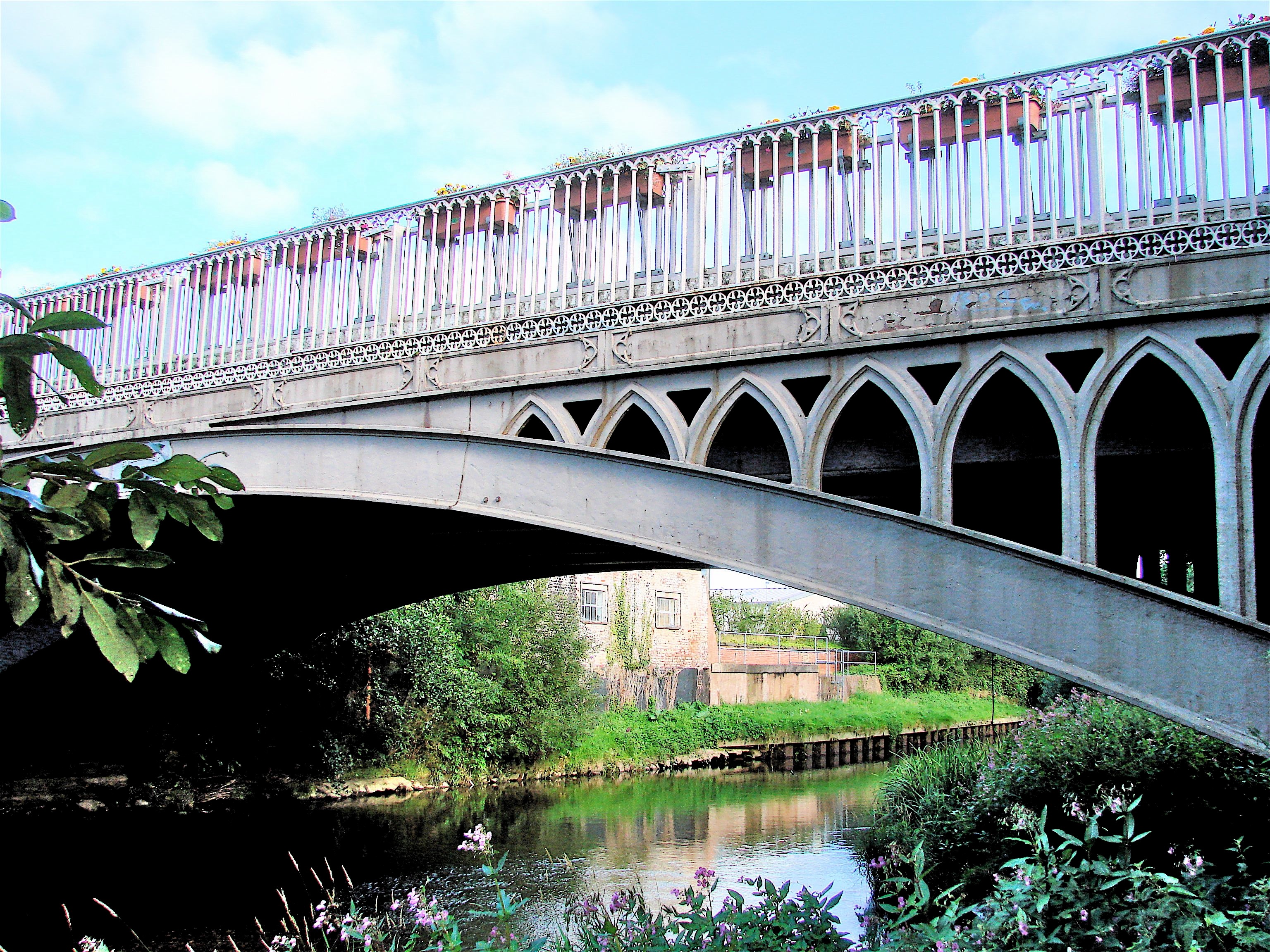
ST SAVIOUR’S BRIDGE 1851 Ottery St. Mary, Devon HEW 947 SY 094 951 {N50o 44' 56.9" W30 17' 6.5"}
This single arched span of 83 feet carries the road across the River Otter. There has been a bridge on this site since 1355 and this present one is the companion of six others in masonry and brick by James Green. The method of construction by Joseph Butler and Company is that of a cast iron tray supported by the arch which carries the roadbed. The bridge has a gothic theme, with open, bold gothic arches in the spandrels contrasting with the crispness of the closely spaced uprights of the railings. The bold masonry abutments anchor the open ironwork visually. The bridge was sensitively widened and strengthened with a reinforced concrete deck in 1992.
- Details
- Written by: Administrator
- Category: Devon
POST BRIDGE Clapper Bridge nr Moretonhampstead, Devon HEW 637 SX648 788 N50o 35’ 39.1” W3o 54’ 41.0”
This ancient bridge of huge boulders and stones (‘clapper’ means piled stones in Old Anglo Saxon) crosses the River Dart on the south side of B3212 on Dartmoor. Its age may be as old as the Bronze Age but it is more likely to date from the 1300’s it is thought today. It has no mortar: the piers are piled stones and the decking is large slabs of roughly dressed stones about one foot thick and about 8 feet wide.
- Details
- Written by: Administrator
- Category: Devon

