Southern
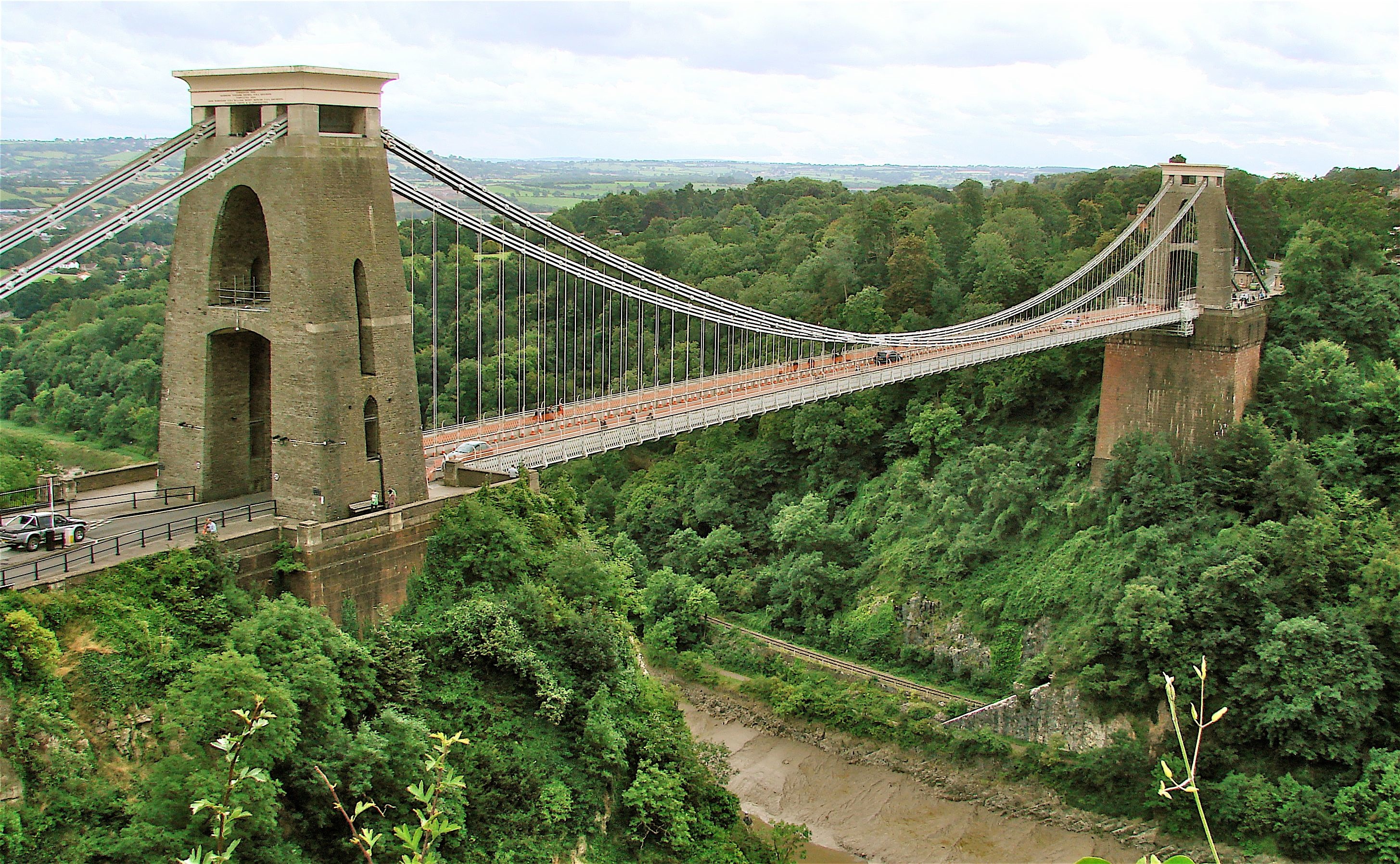
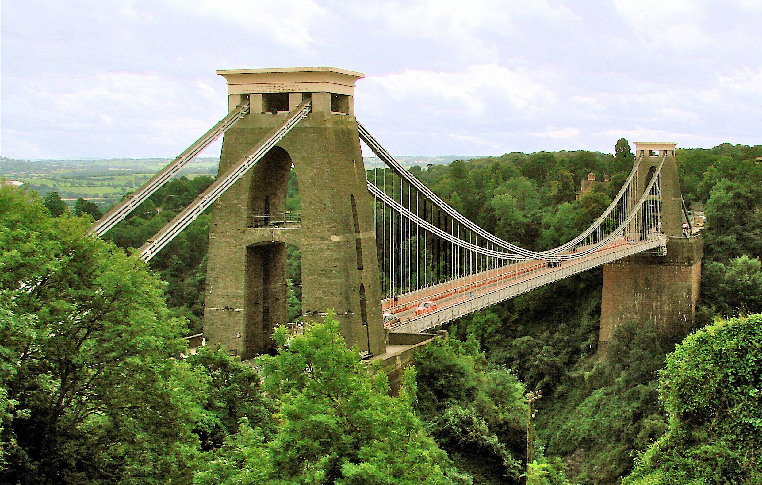
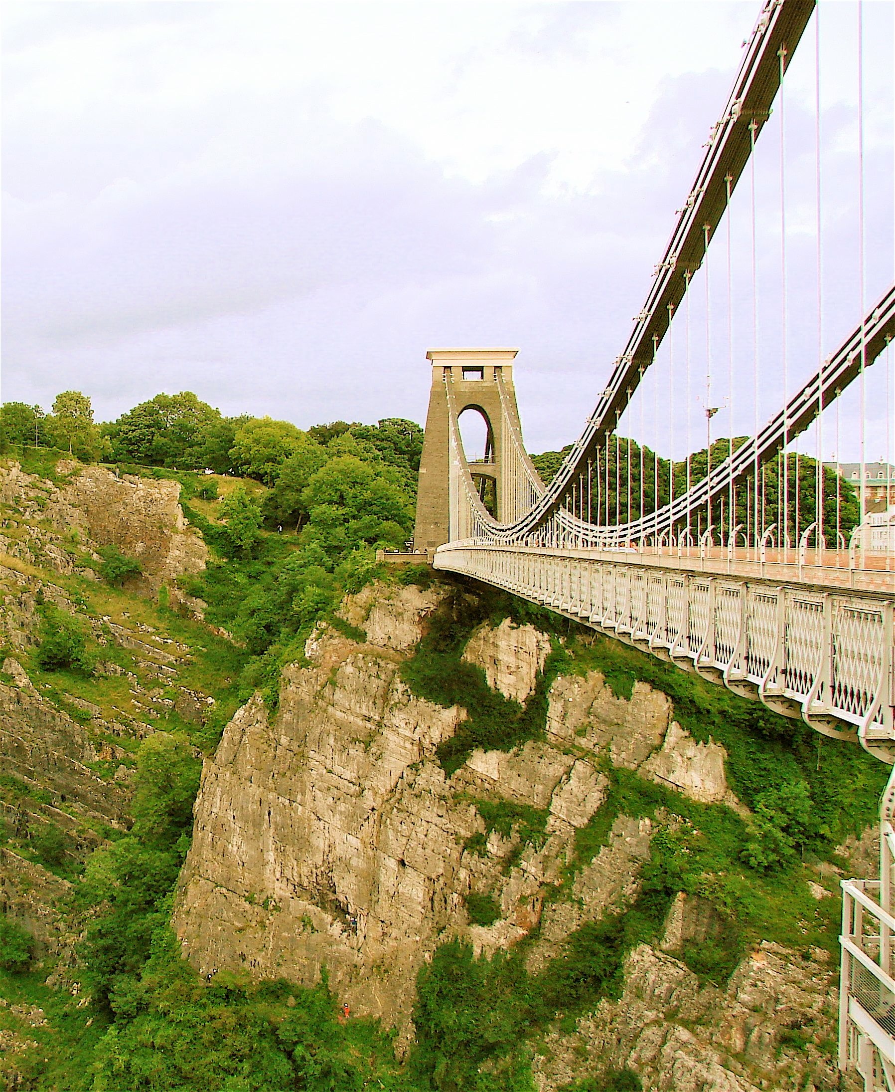
CLIFTON SUSPENSION BRIDGE Clifton Gorge, Somerset 1836>1864 Brunel HEW129 ST565 731 N52o 47' 30.2" W2o 1' 45.3"
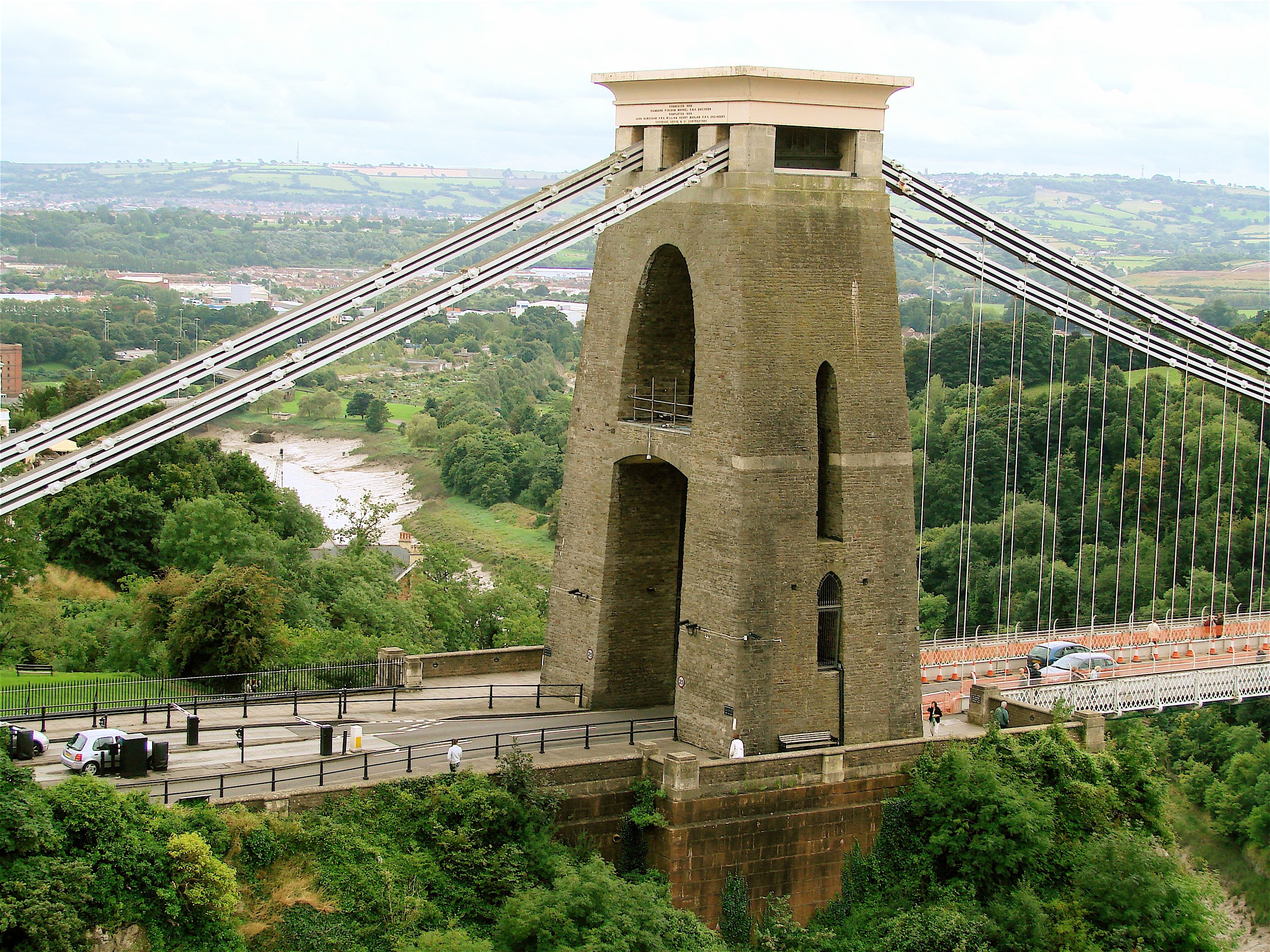
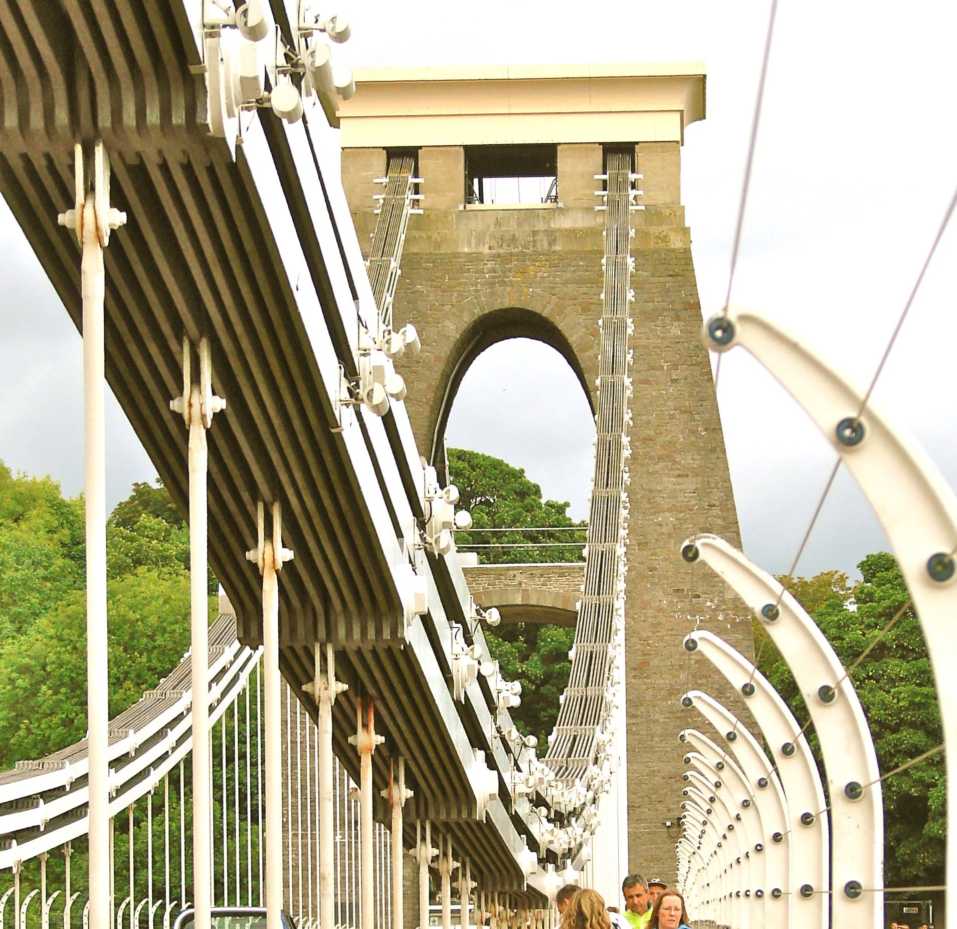 William Vick left 1000 pounds in 1753 to be invested until ten thousand pounds had accumulated which was to be spent on his dream of a bridge across the Clifton Gorge of the Avon River. In 1829, the 25 year old I.K. Brunel won a design competition set by the Trustees. Construction began in 1836, but was suspended when the money ran out six years later. The stone towers were in place, but still in rustic condition. The iron chains were sold to be used for Brunel’s Royal Albert Bridge at Saltash. After Brunel’s death in 1859 the Institution of Civil Engineers finished construction of the bridge as Brunel's memorial. John Hawkshaw and W.H. Barlow amended the original design making the bridge deck a little wider and with triple suspension chains and brought it to completion in 1864. Brunel’s 1845 Hungerford suspension foot bridge in London was being torn down and its iron chains were bought to use at Clifton.
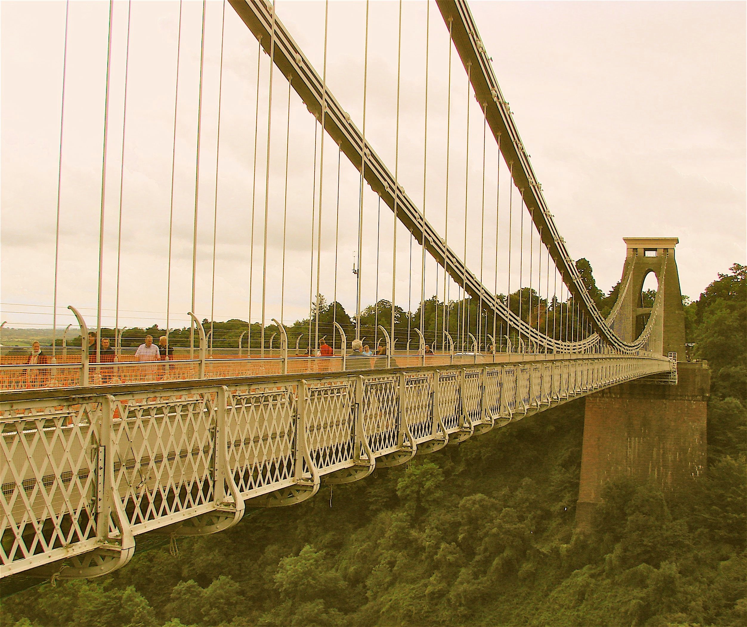
The suspension chains are 7 by 1 inch wrought iron links each of which is 24 feet long. Roller mounted ‘saddles’ at the top of the towers allow movement so the three independent wrought iron chains on each side can adjust to the bridge load. The deck is suspended from 81 matching vertical wrought iron rods.
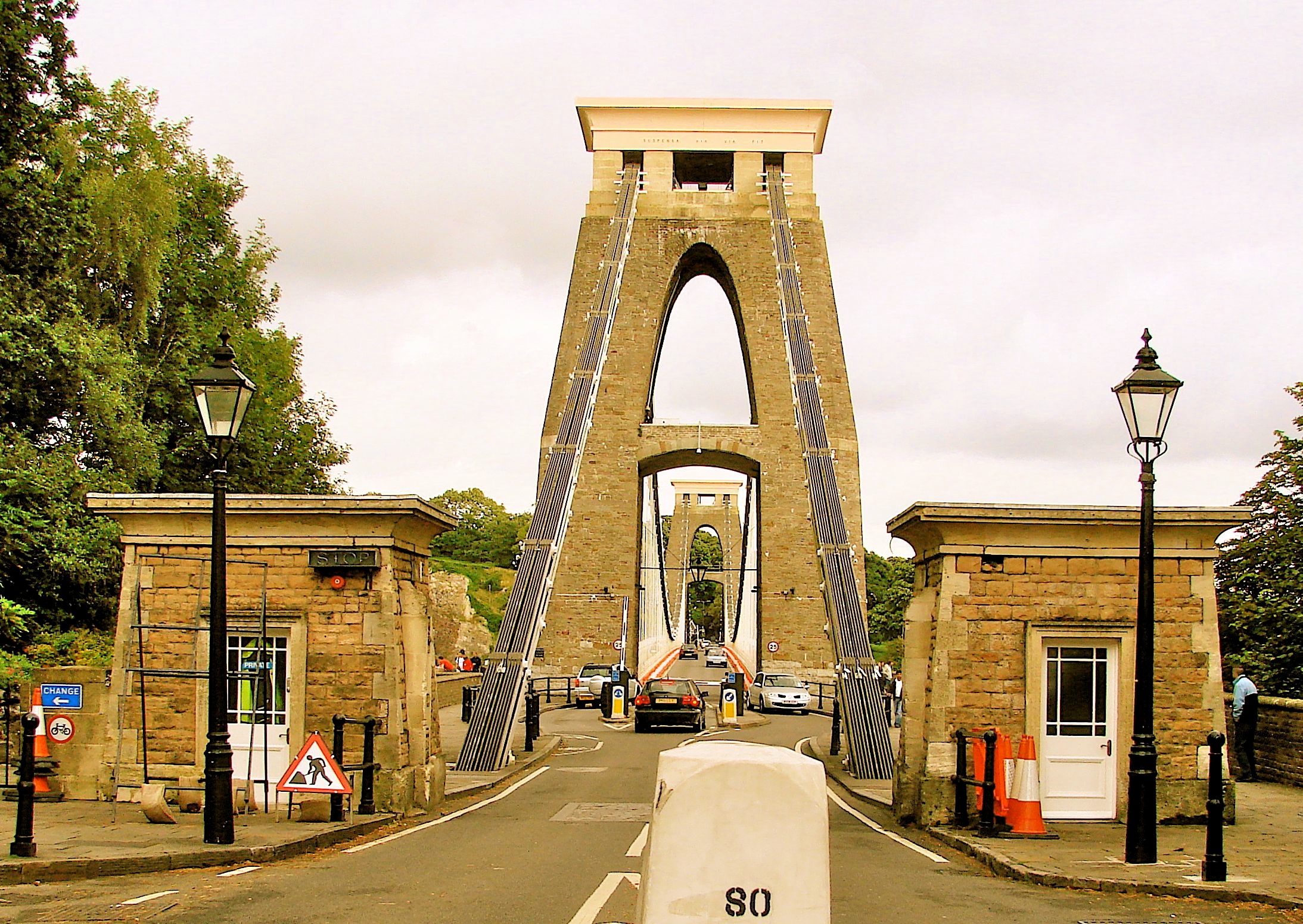
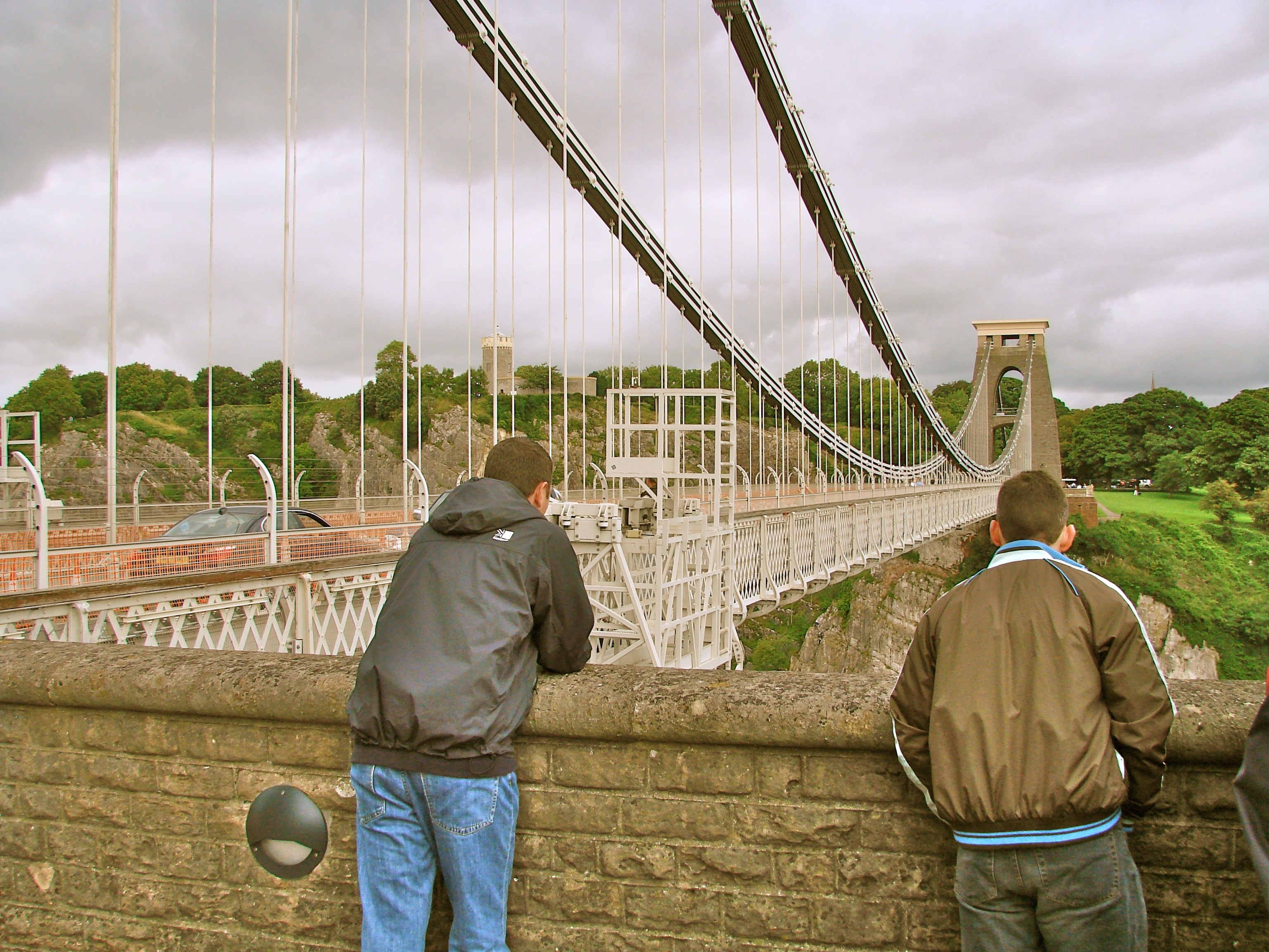
The bridge has a span of 702’3” which was at the time the longest free span in the world. The most spectacular aspect of this thrilling bridge, however, is it’s 240’ height above the river.
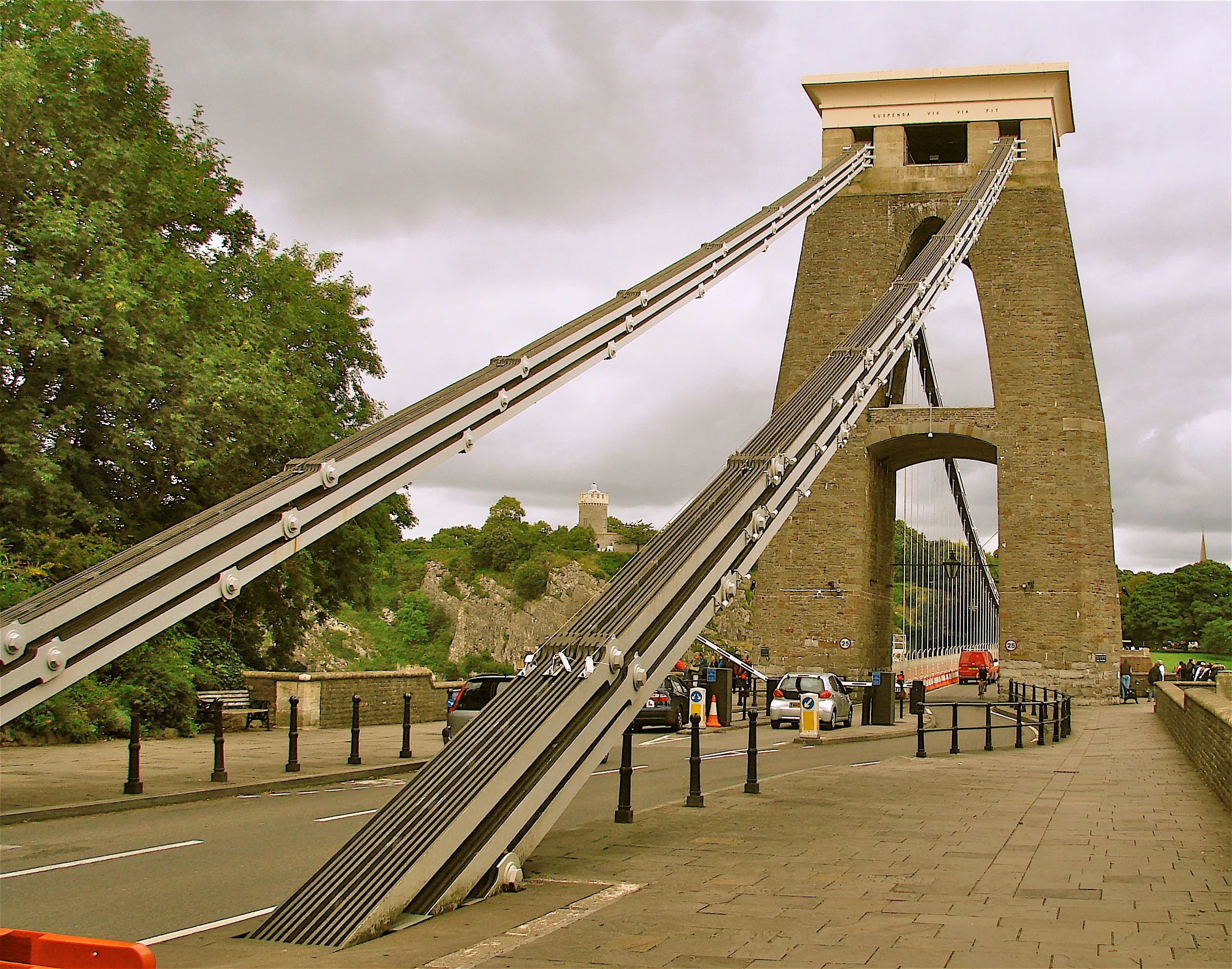
To reach the bridge and go across it, take the Service exit #19 on the M 5 heading southwest immediately after crossing the Avon. At the roundabout, take the second exit (after the one for services) A369 the sign for which will mention the Clifton Bridge. In about four miles, in Abbot's Leigh, you will take a left turn onto B 3129 at a traffic light which is signed to the Clifton Toll Bridge.

- Details
- Written by: Administrator
- Category: Somerset/Avon/Wiltshire
CLEVELAND BRIDGE Bath, Somerset 1826 SO 753 657 N52o 47' 30.2" W2o 1' 45.3"
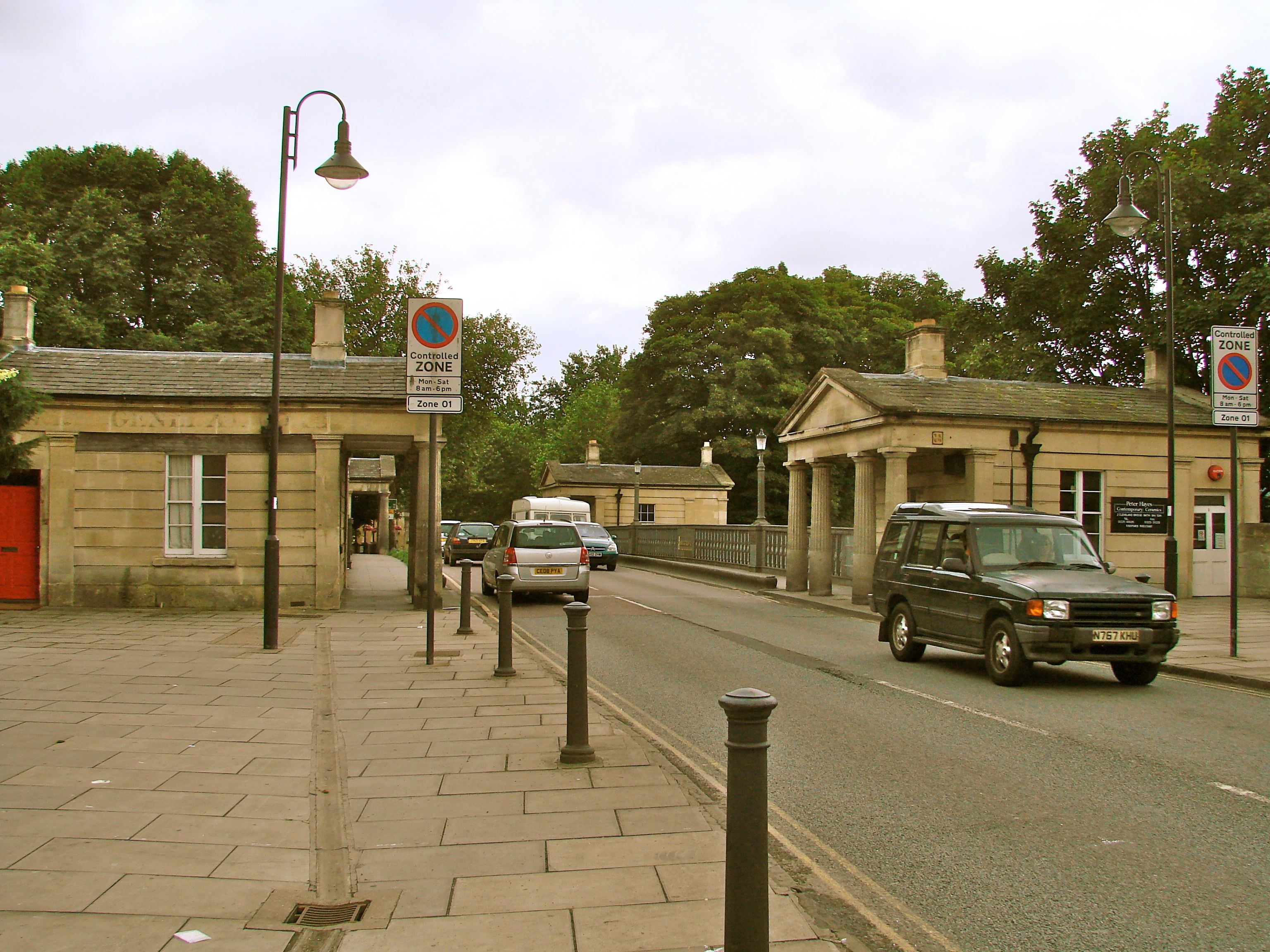
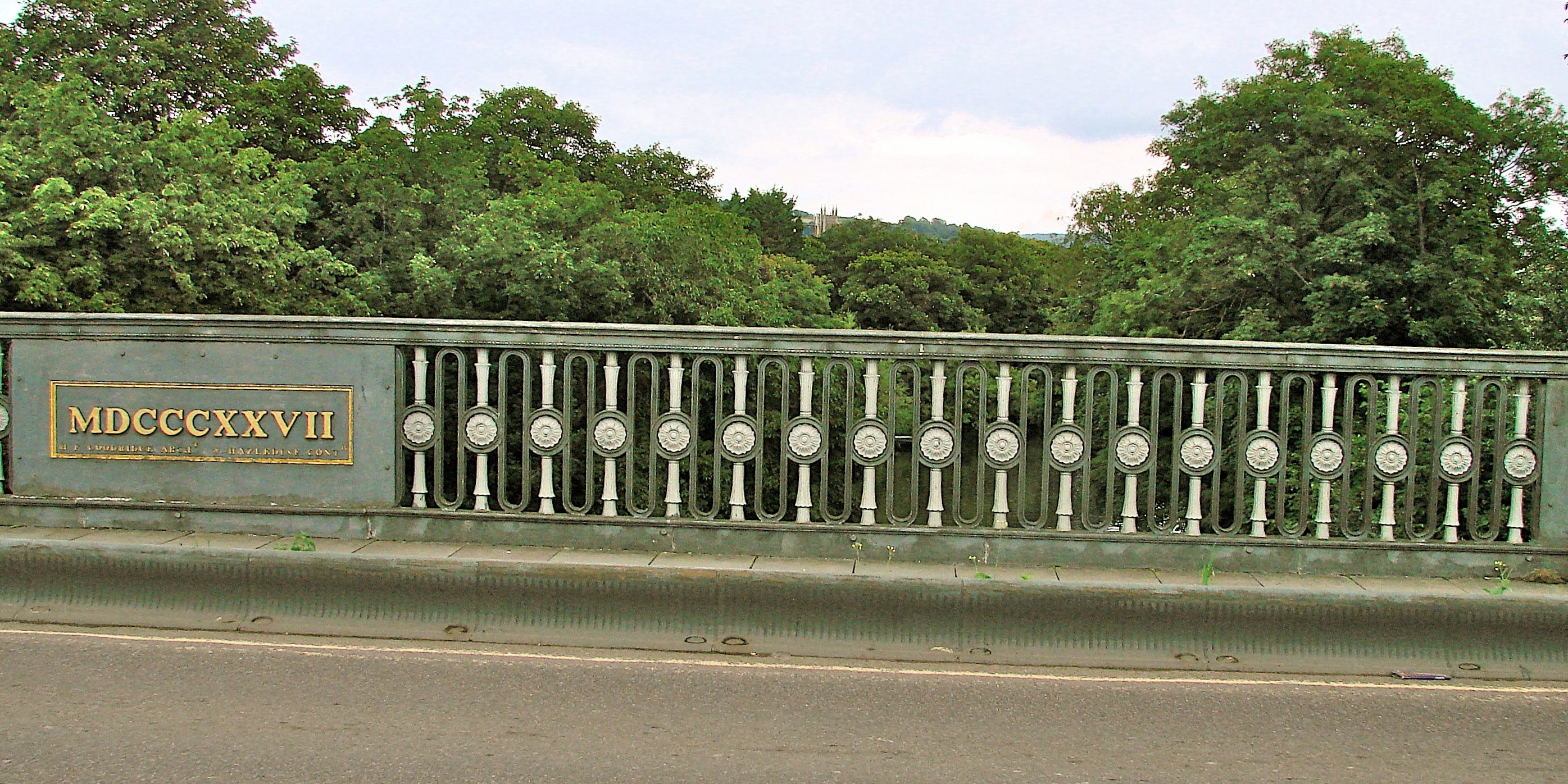
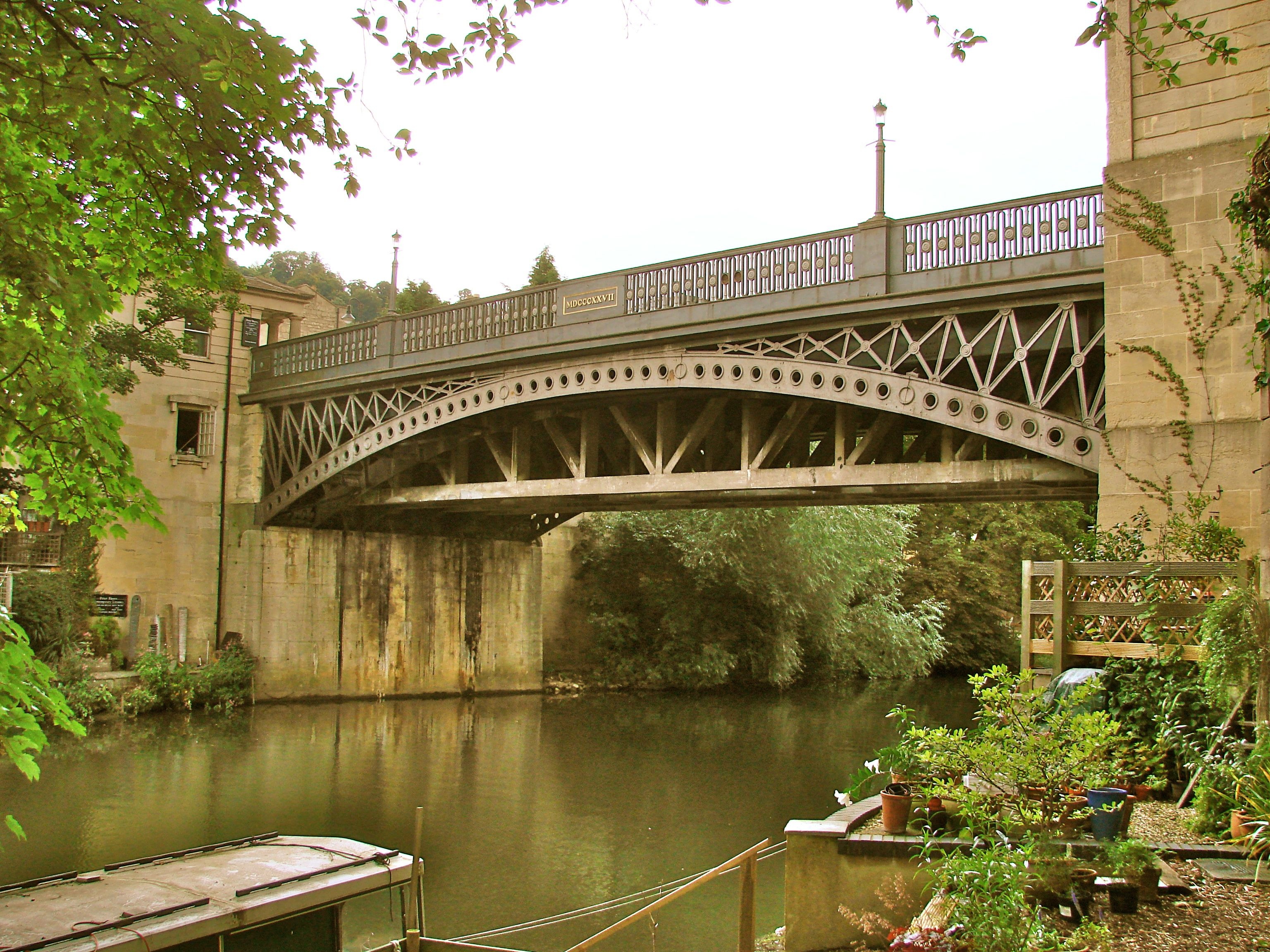
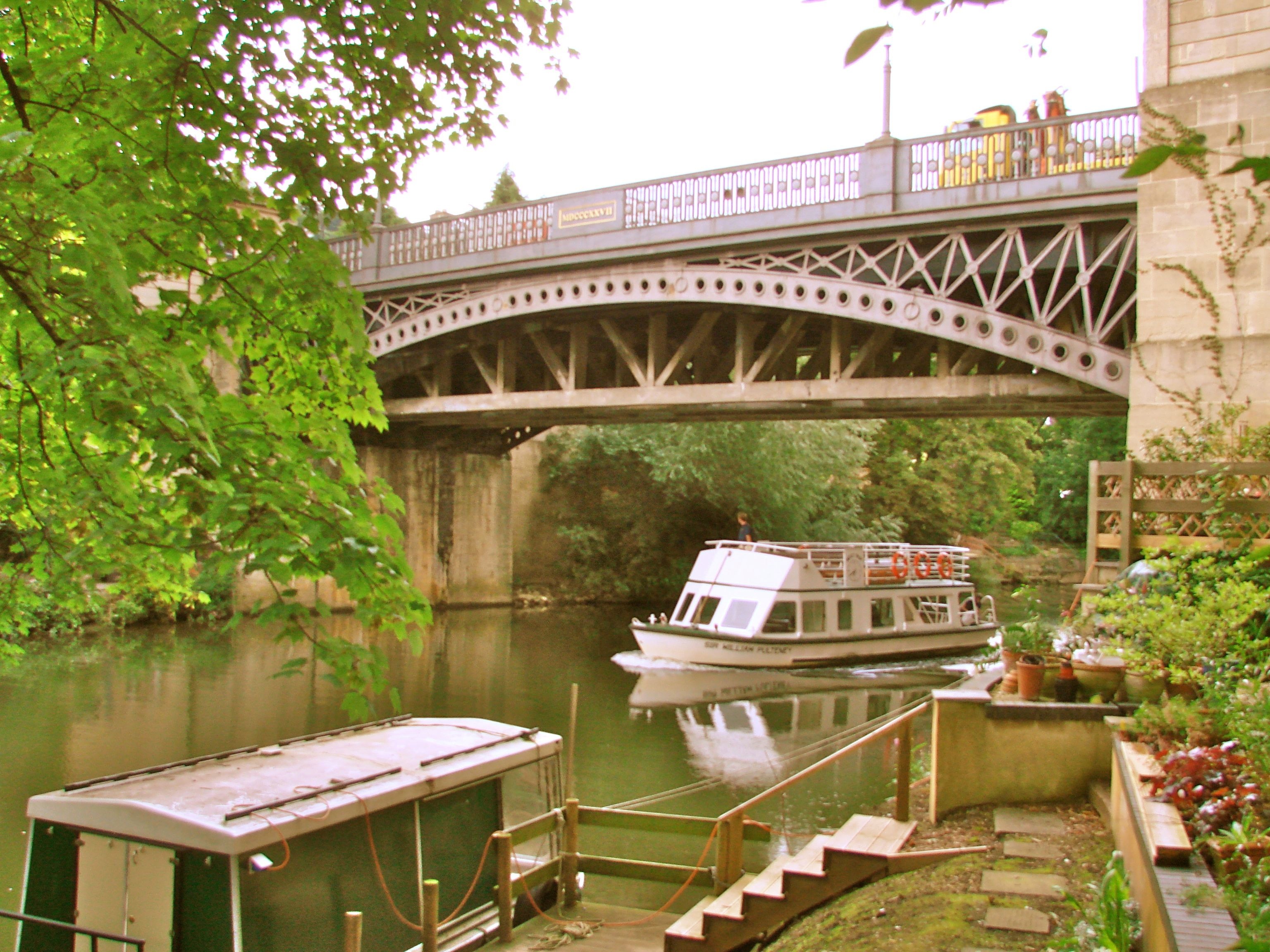
This arched cast iron bridge - designed by Henry Goodridge and built by William Hazledine of the Coalbrookdale Iron Works - crosses the Avon River at Cleveland Place in the heart of Bath. Small Georgian pavilions mark the four corners of the bridge – one of which was the toll house - echoing those around Cleveland Place. An Its incorporation and construction by the Bathwick Bridge Company was authorized by Act of Parliament. Unfortunately, the founding directors set the toll in perpetuity at one pence and by 1925, the City Council had to take over the bridge from the bankrupt company. In 1928-9 the bridge was re-enforced considerably to accommodate the weight of modern traffic.
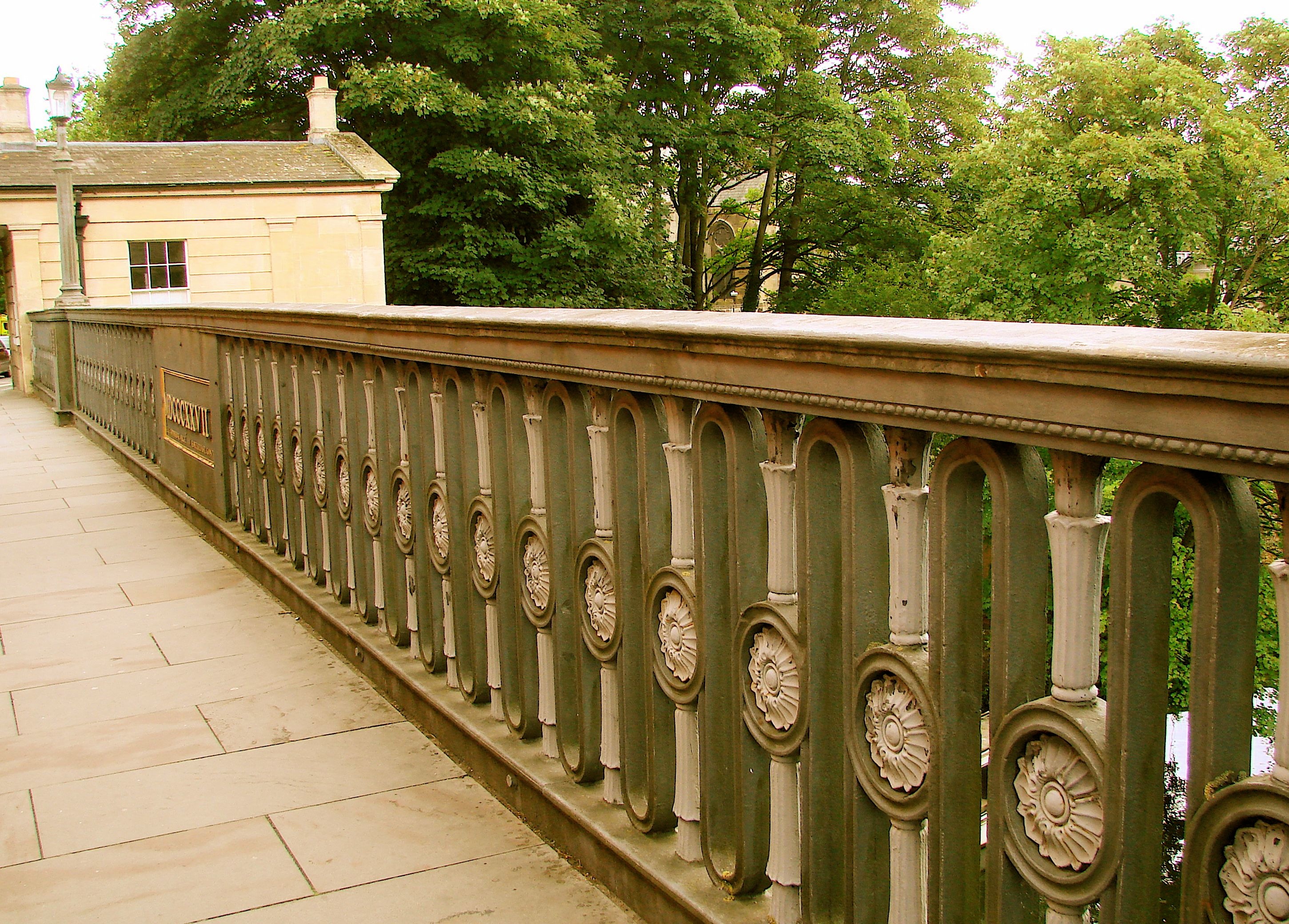
The road crossing the bridge is the A36 which joins the A4 or the London Road on the Cleveland Place side.
- Details
- Written by: Administrator
- Category: Somerset/Avon/Wiltshire
BATH: SYDNEY GARDENS BRIDGES Wiltshire 1800 HEW 808 ST758 653 N51o 23’ 11.9” W2o 20’ 54.0”
Ft Br over Kennet & Avon Canal N51o 23' 11.9 W2o 20' 54.0"

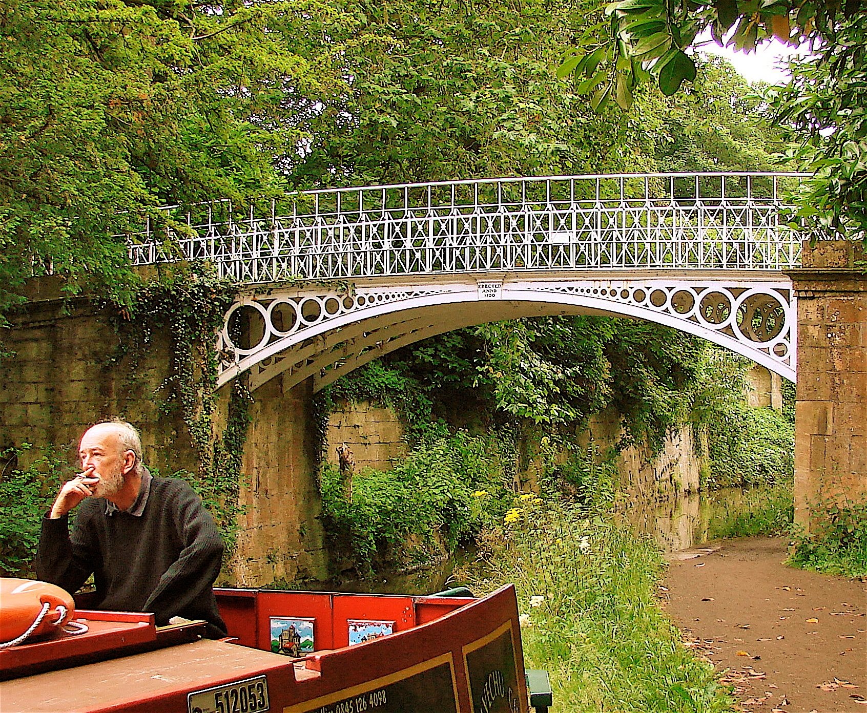
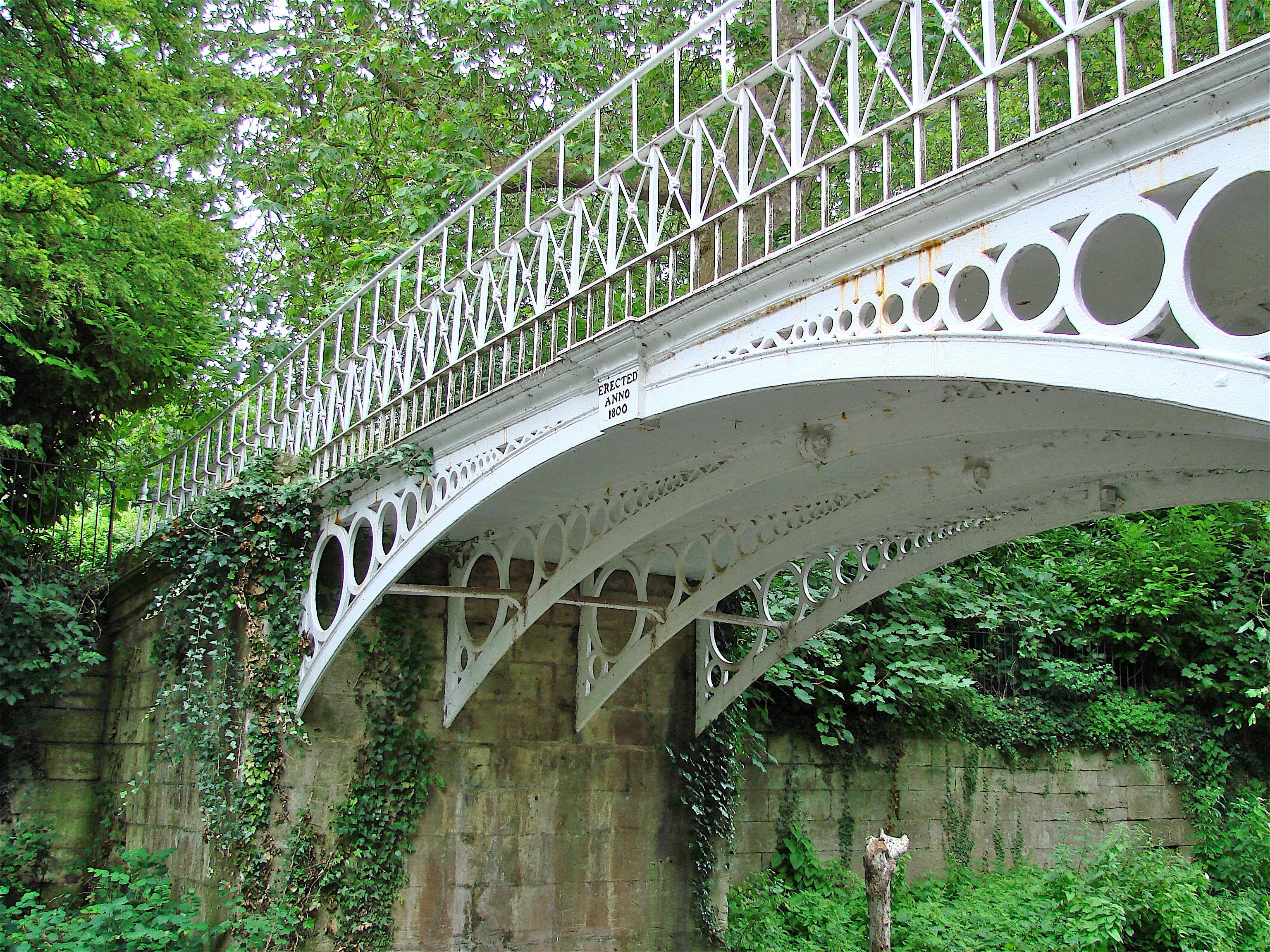
John Rennie was chief engineer for the Kennet and Avon Canal when these three bridge were built over the canal, but he did not design them. They were cast at the Coalbrookdale Co.
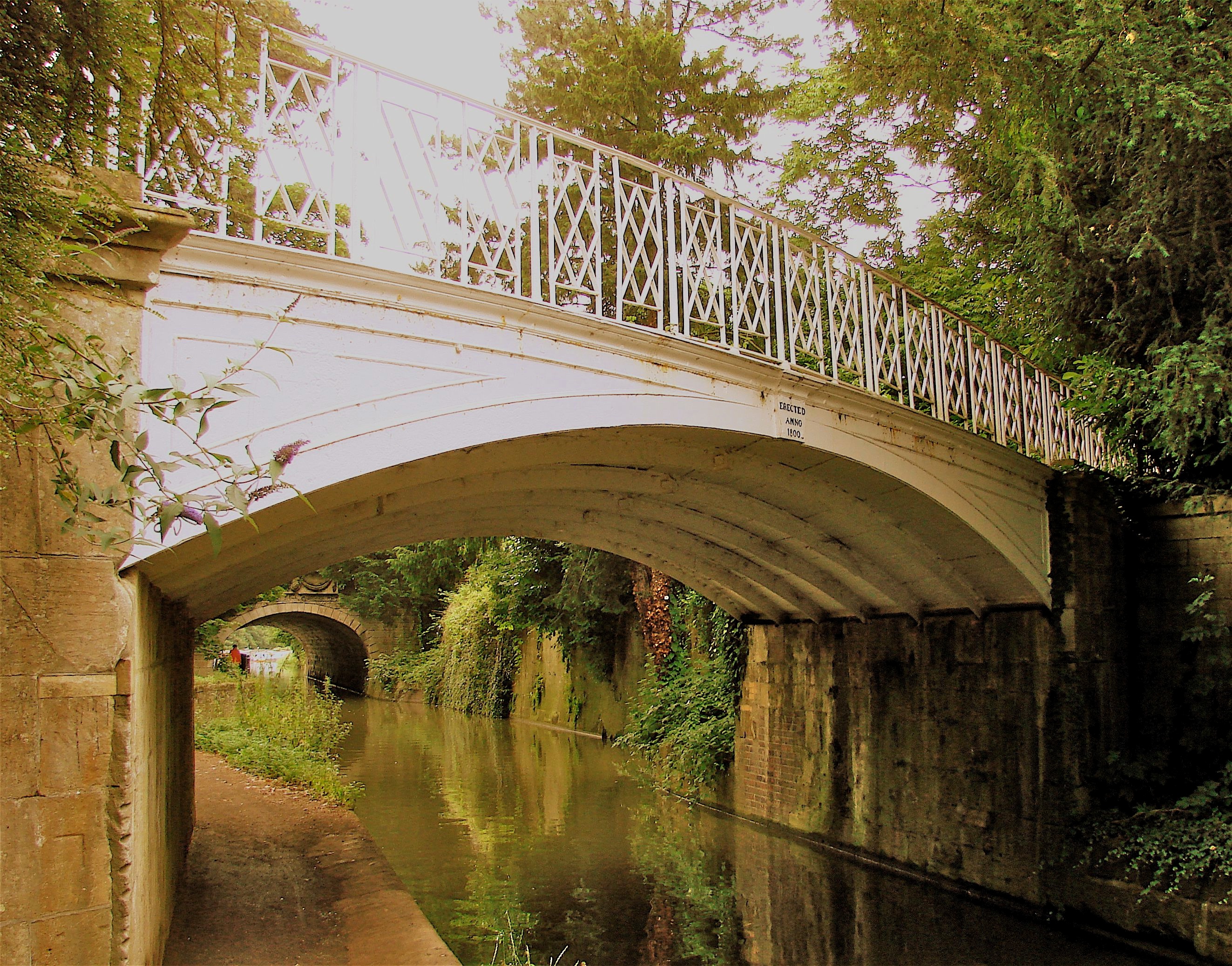
One is a 23’ foot bridge ten feet in width with four arched cast iron ribs whose spandrels are filled with Coalbrookdale’s familiar diminishing open circle design. The parapet is simple open diamond pattern between uprights. This bridge was upgraded in 1978.
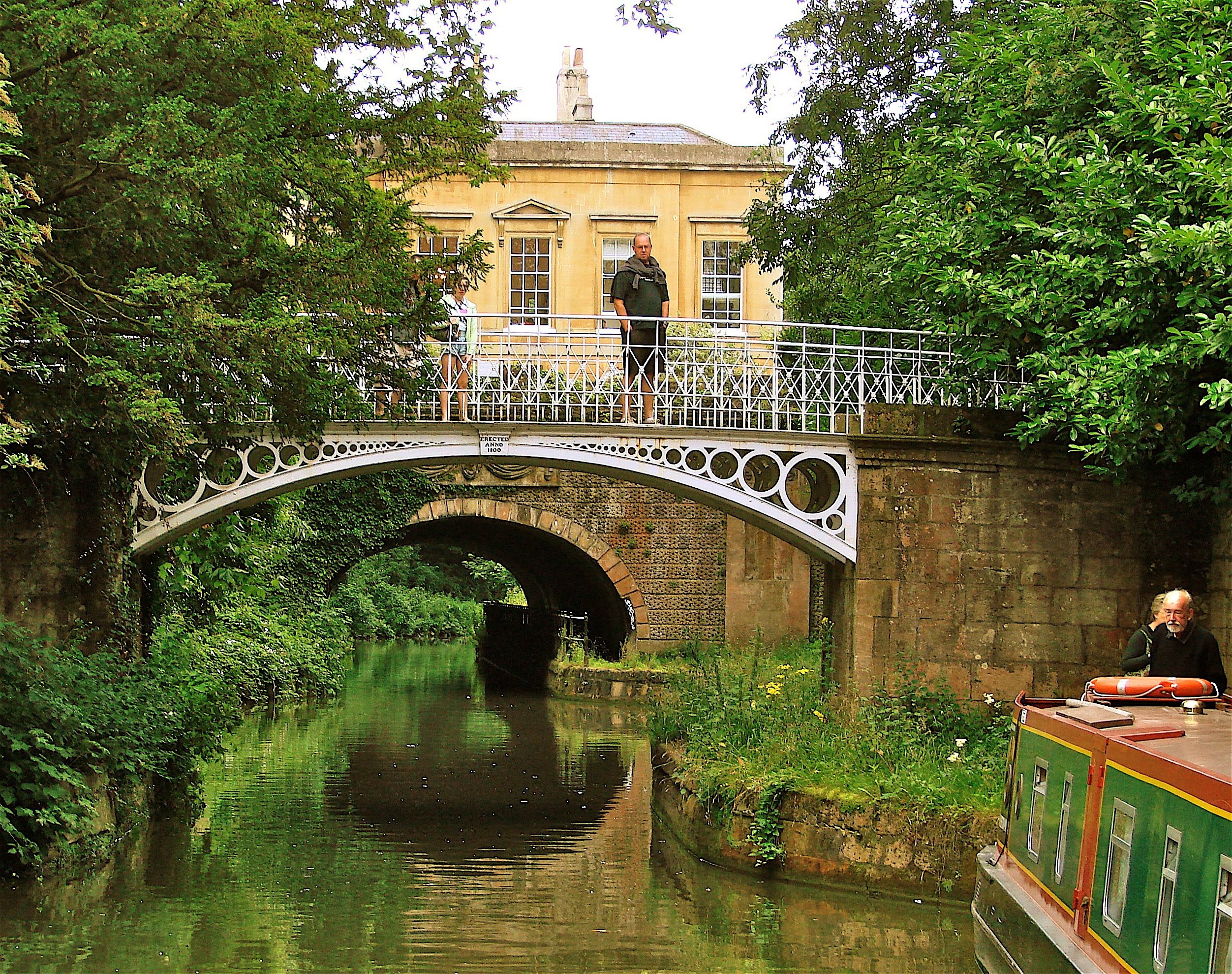
The second bridge is 30 feet spanning the canal at an oblique angle with a width of 19 feet. The face ribs are solid and there are five interior ribs of cruciform section with solid cast iron deck plates set parallel to the canal, not the skew. The parapets have an unusual design: a diamond superimposed on a cross.
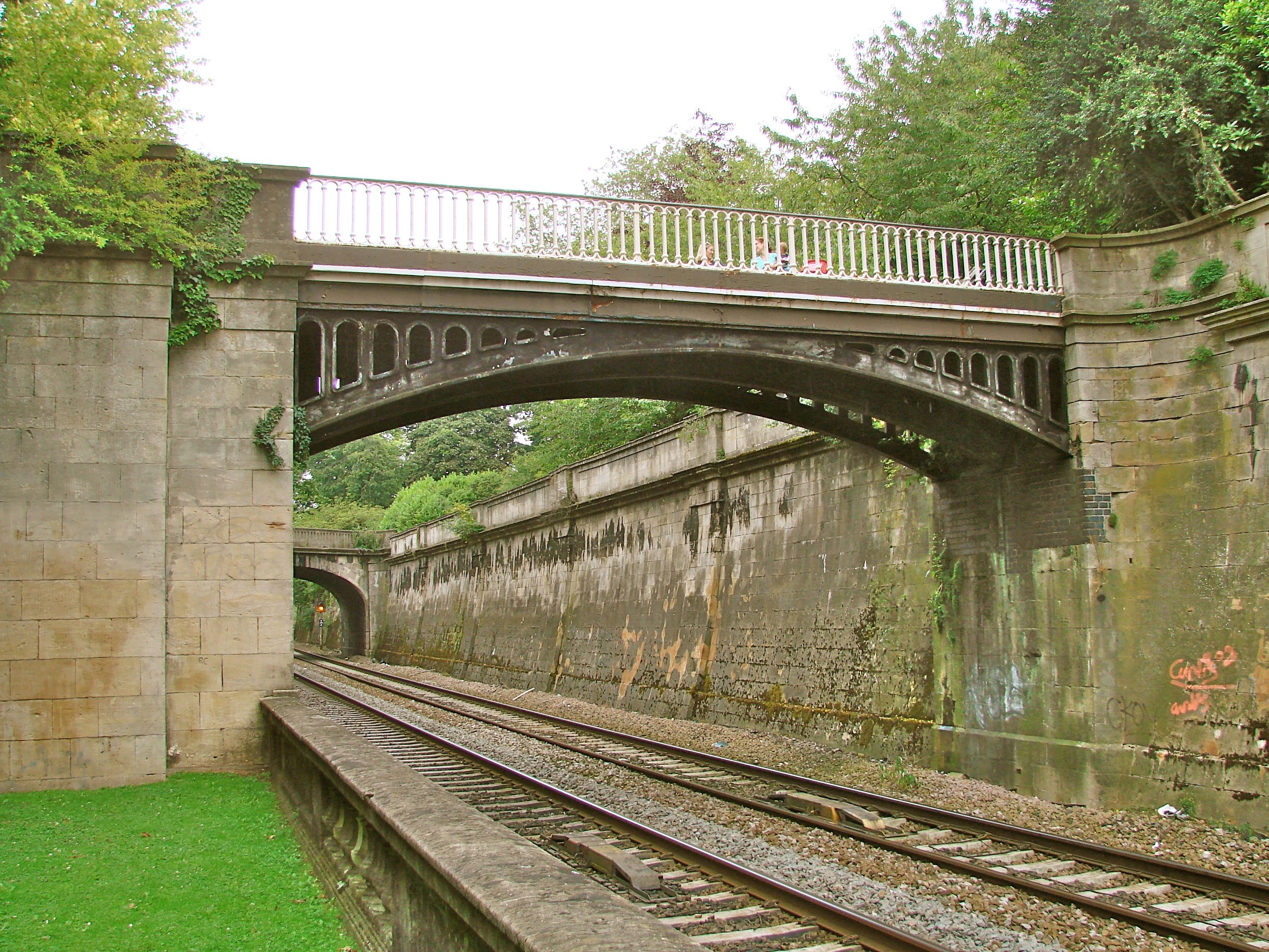
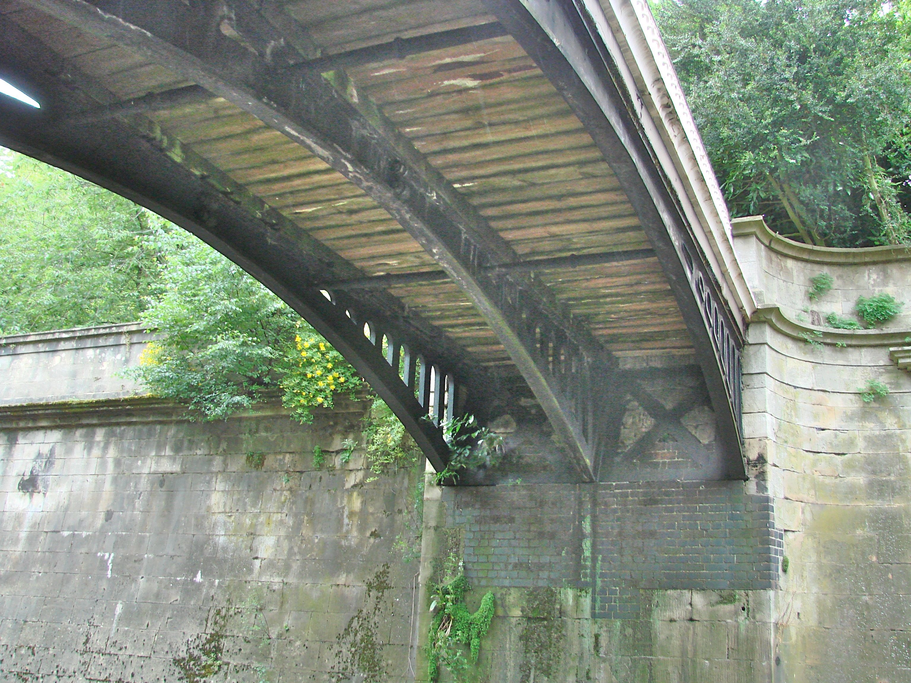
The third foot bridge (N51o 23’ 9.9” W2o 20’ 56.6”) is of later date but of a design used at the time of the previous bridges. It was cast at Coalbrookdale too about 1865 to span the Great Western RR tracks.
1865 Sydney Gardens Foot Bridge, Bath. Over Great Western RR line N51o 23' 9.1" W2o 20' 56.6"
- Details
- Written by: Administrator
- Category: Somerset/Avon/Wiltshire
VICTORIA SUSPENSION/CANTILEVER BRIDGE 1836 Bath HEW811 ST741 650 N51o 23' 0.9" W2o 22' 23.5"
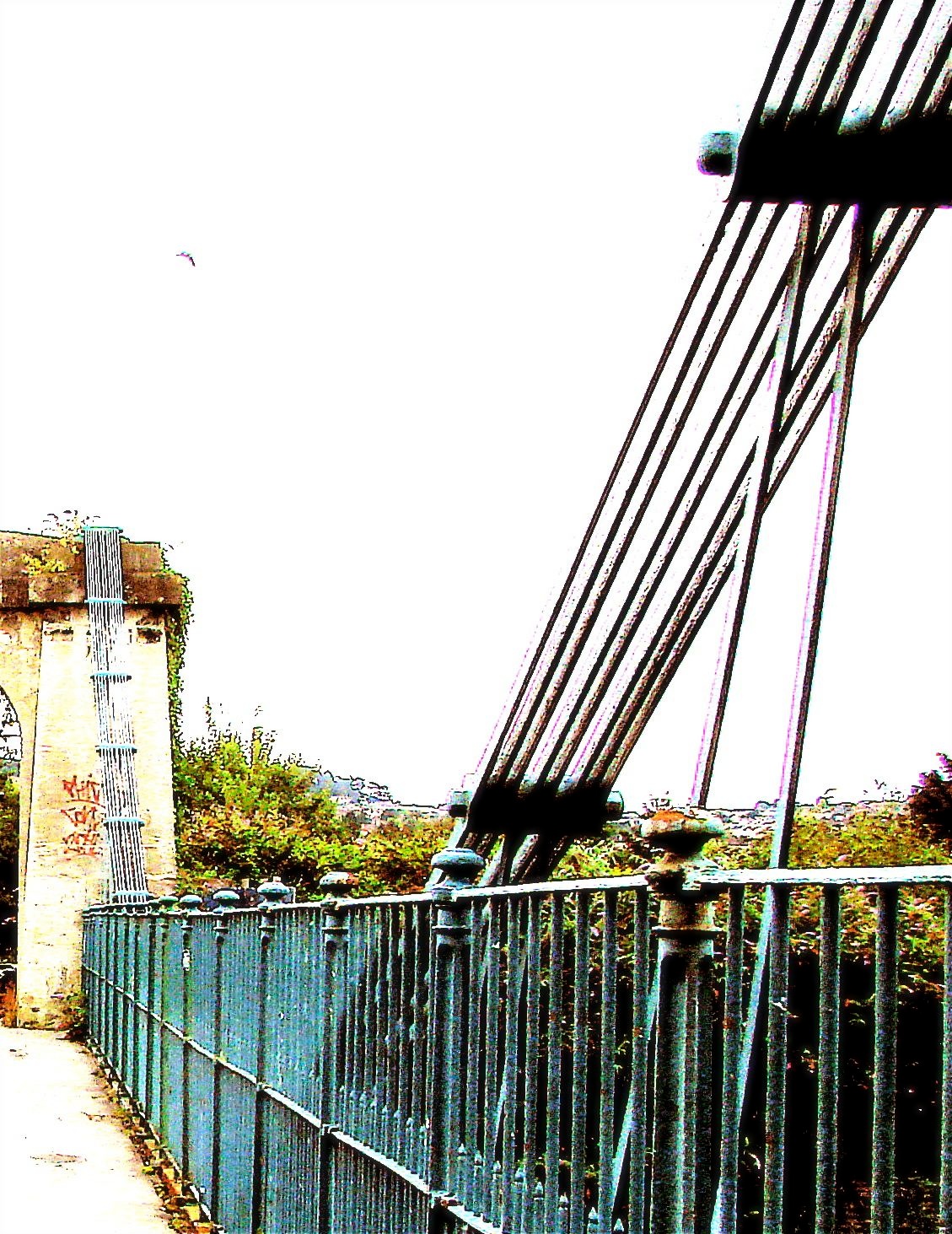
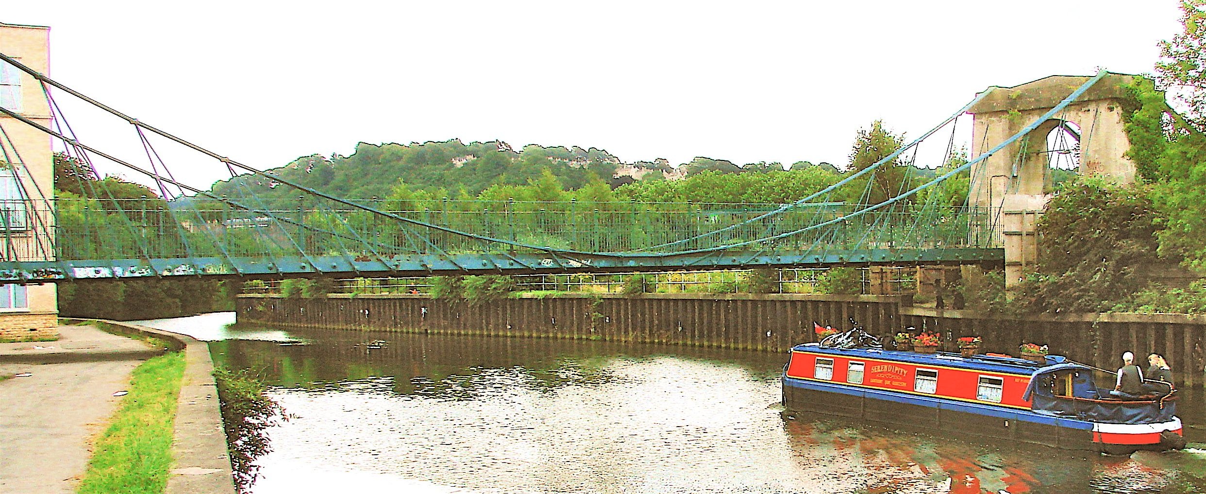
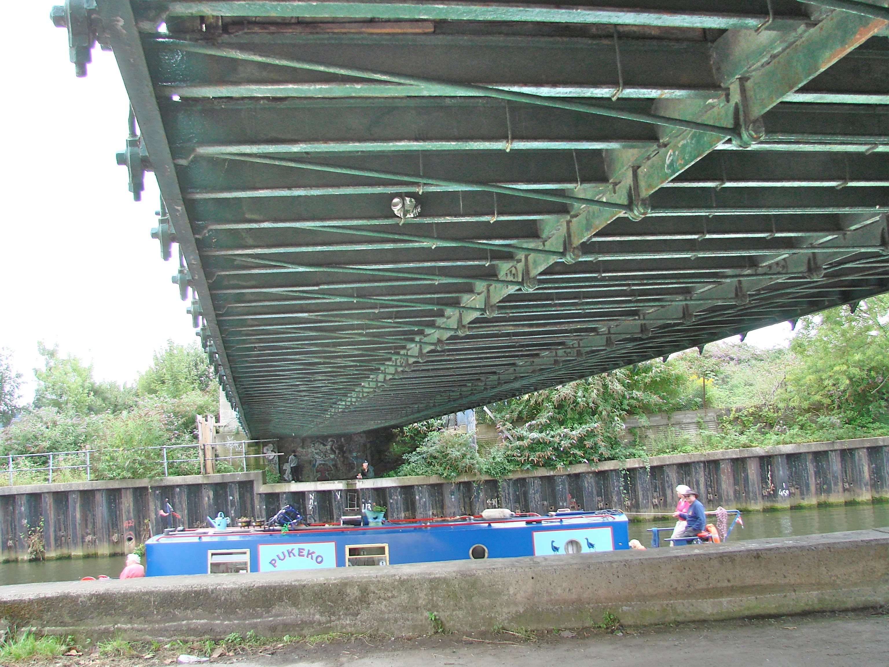
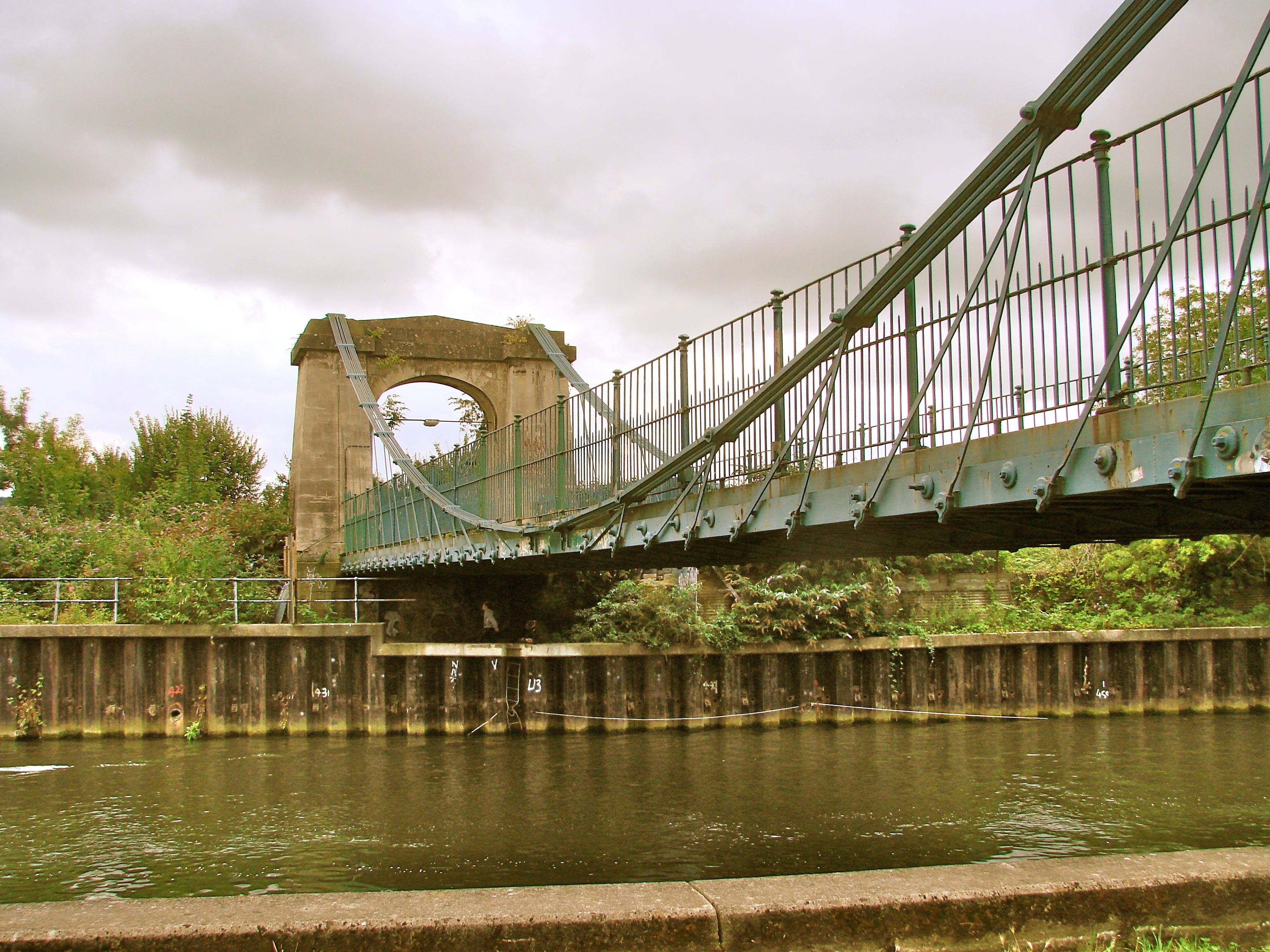
This was the first bridge built by James Dredge (1794-1863), a brewer in Bath who became a successful self-taught engineer. He developed and patented a very distinctive type of bridge which combined the principles of suspension and cantilever. Each half of the bridge works as a right angle triangle, the hypotenuse of which is formed by the wrought iron rods extending along the deck at oblique angles up to the top of the pylons. The bottom tips of these two triangles meet at the center of the bridge. If you cut a Dredge bridge in two at the center, both halves would still stand, whereas if you did that with a conventional suspension bridge, it would collapse.
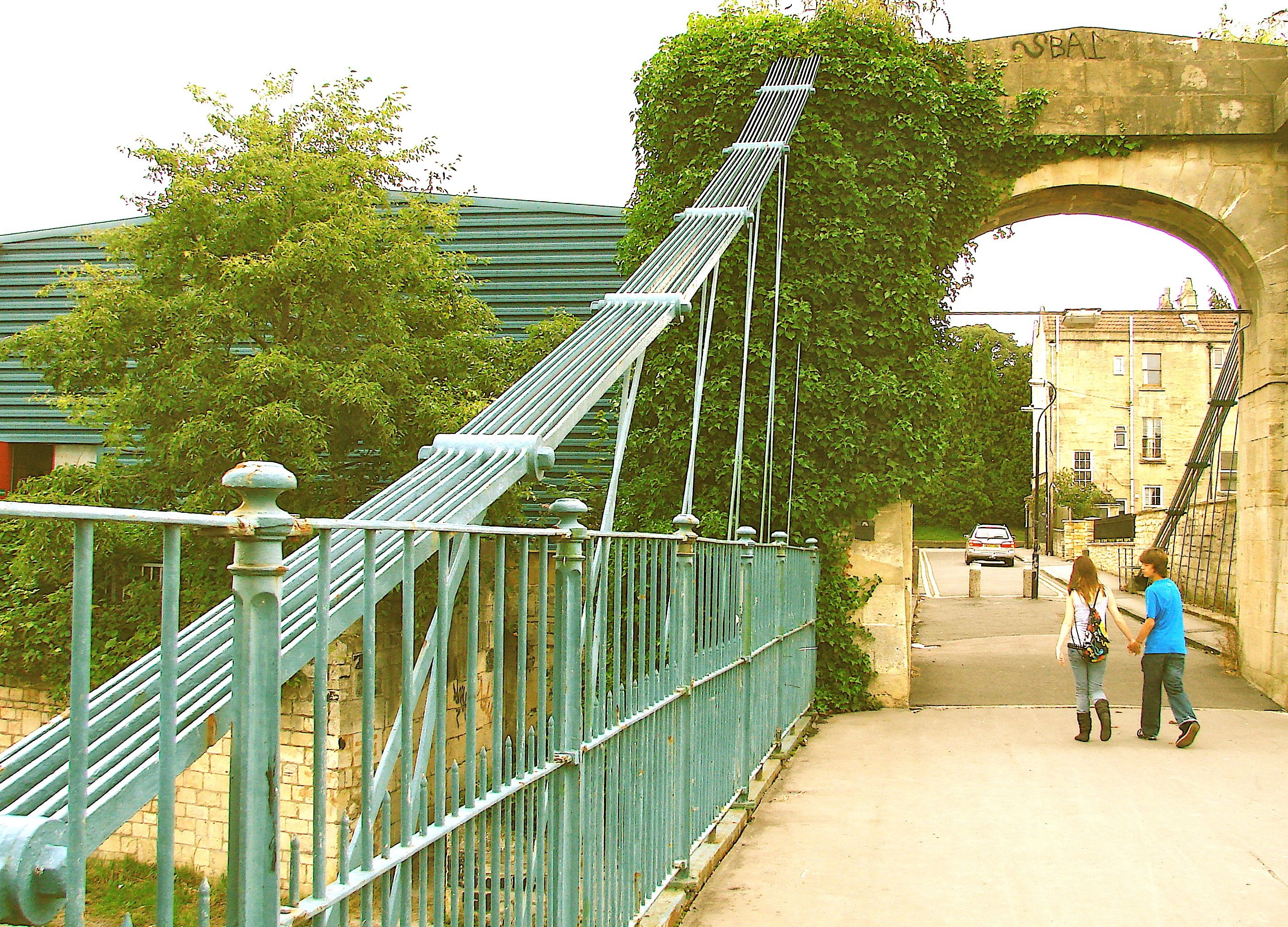
The chain of rods that loop from the top of each tower down to touch the outer edges of the deck at the center are simply positioning the rods which are actually supporting the bridge rather than having the chain itself provide its support as in a conventional suspension bridge. "Each chain (in a Dredge bridge) increased from a single wrought iron rod at the center of the bridge (deck) to the requisite number over the … (towers) by progressively adding an extra rod at each link position. This resulted in a significant reduction in the quantity of iron and in the self-weight of the suspension system. … Connected to each joint in the main chains was a pair of inclined bars which gave support to the deck. These 'oblique' rods … were all set at different angles to the horizontal. … This introduced compression into the deck: a fact which Dredge argued in his favour, since the conventional suspension bridge decks of his era were greatly affected by wind-induced oscillatory motion". (Don McQuillan "Dredge Suspension Bridges in Northern Ireland", THE STRUCTUAL ENGINEER Vol. 70., NO7 April 1992)

Of the fifty or so bridges that Dredge subsequently built in the British Isles, only seven others survive today: the Doldowlod Bridge in Wales, the Stowell Park Bridge in Wiltshire, two in Scotland at Aberchalder and at Inverness and three in Northern Ireland. This first one was built as a toll bridge across the Avon River to connect Upper Bristol Road with Twerton. It was built in six months and survived a severe storm during its construction. It has a length of 150 feet and a width of 18 feet six inches with a total iron content of 21 tons.
To find this bridge, look for a very inconspicuous street called Victoria Bridge Road on the south side of Upper Bristol Road (the A4). You will catch a glimpse of the bridge between buildings as you pass.
- Details
- Written by: Administrator
- Category: Somerset/Avon/Wiltshire
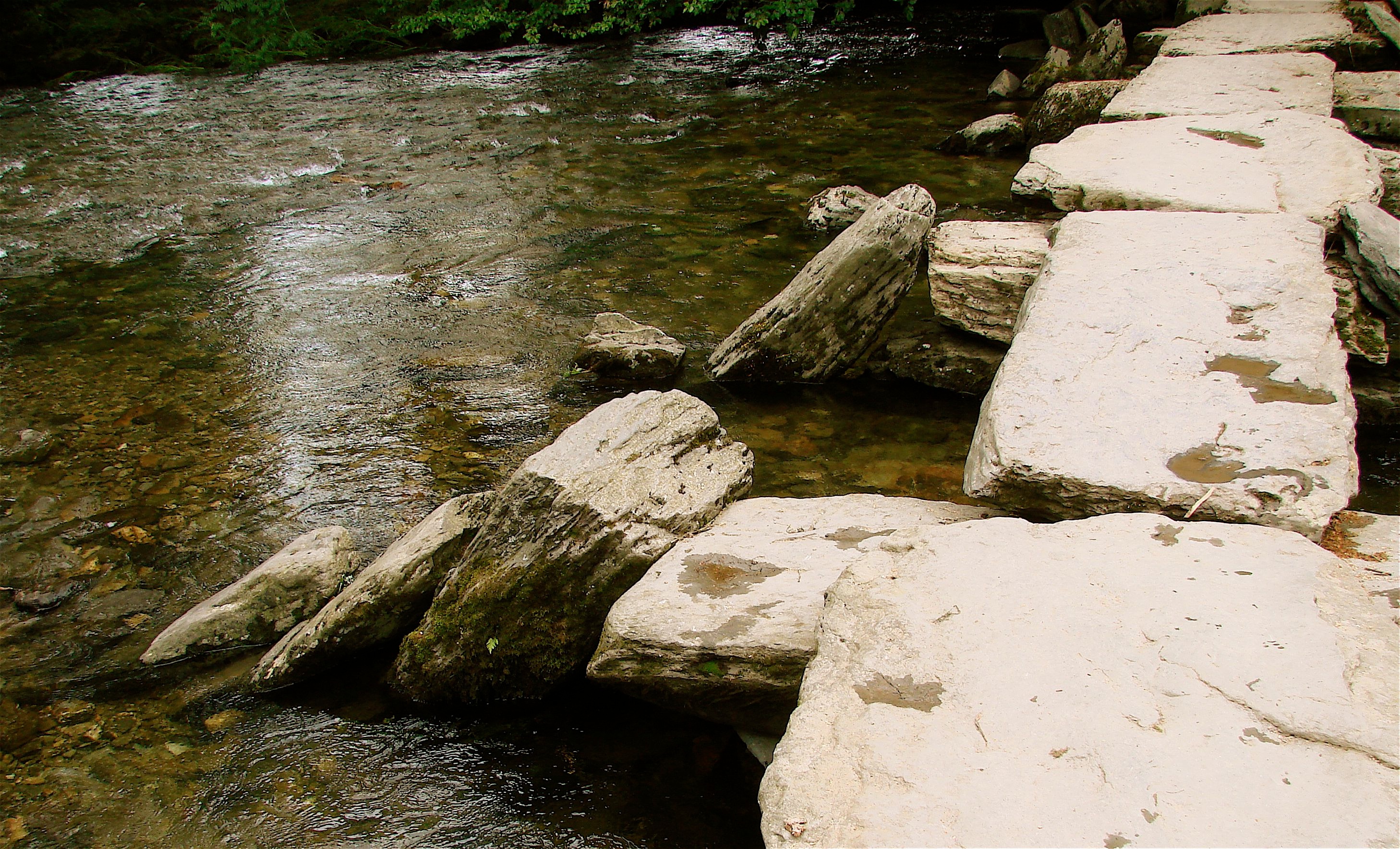
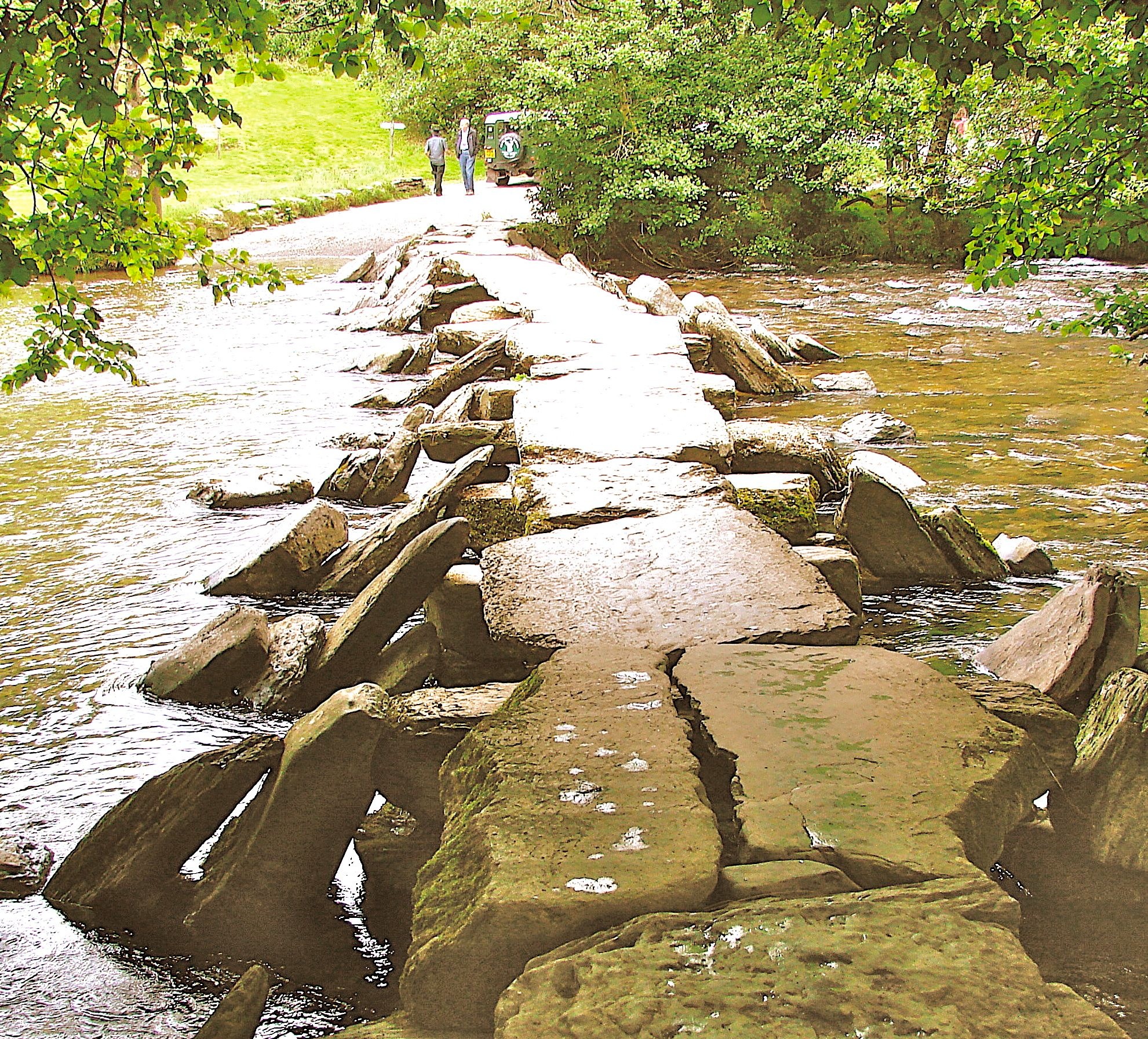
TARR STEPS CLAPPER BRIDGE Exmoor nr Dulverton, Somerset HEW 863 SS868 321 N53o 5’ 37.7” W3o 48’ 28.1”
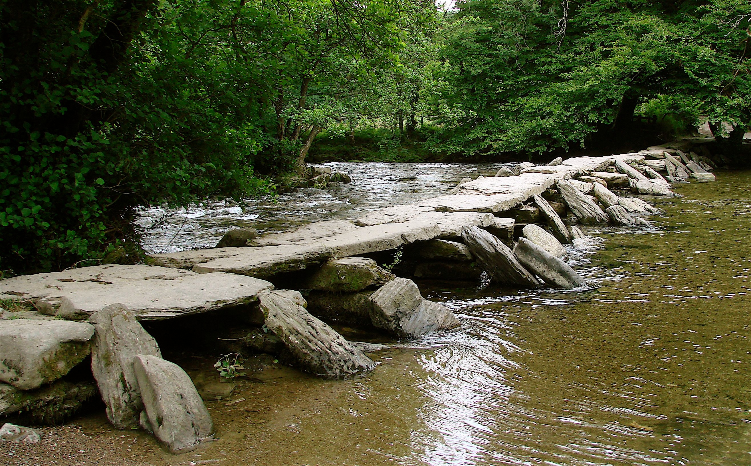
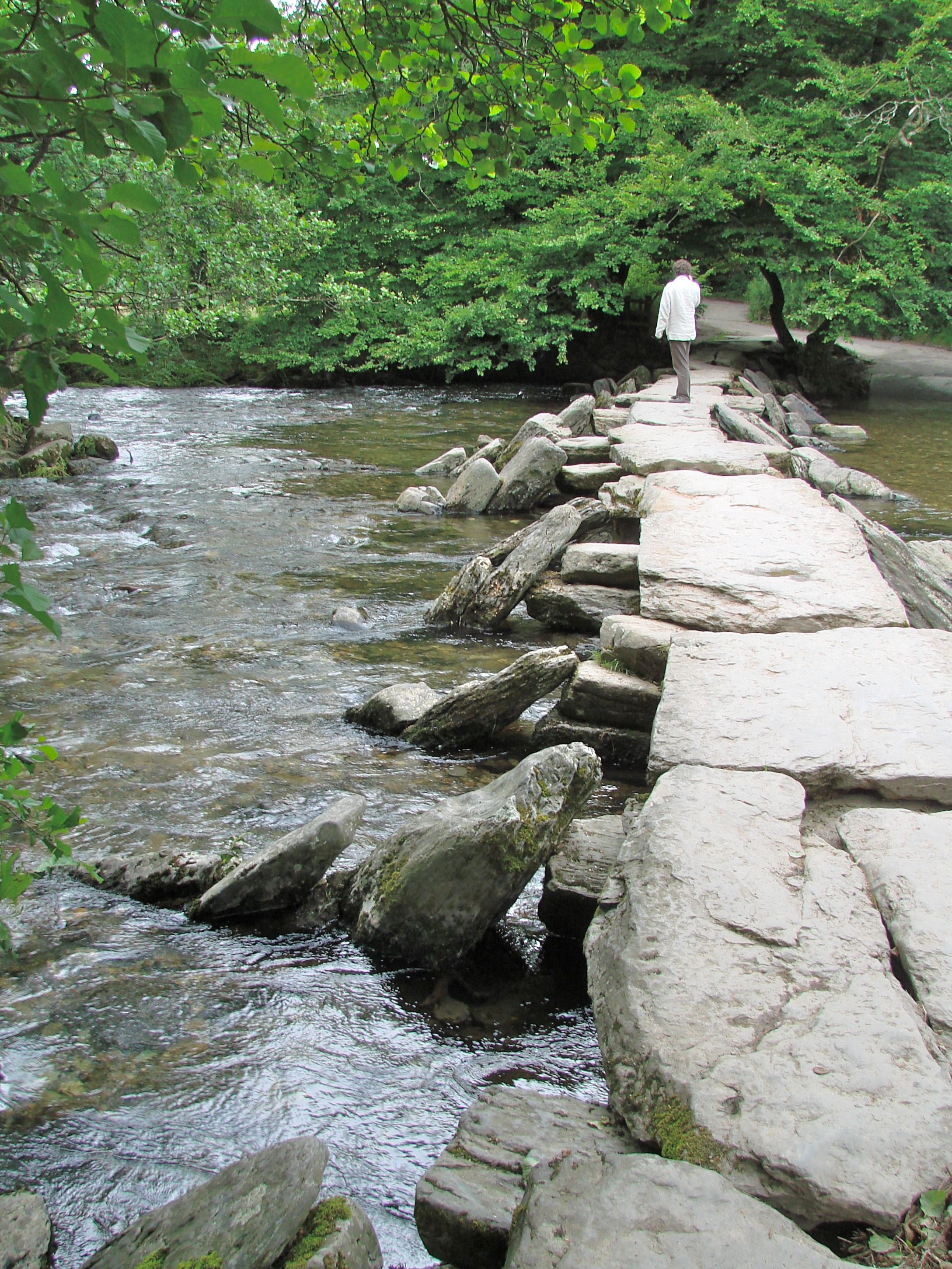
(“Clapper” in Old Anglo Saxon means “heap of stones”) This bridge is of Bronze Age origin. The raking slabs upstream and downstream act as shear-waters and serve also to deflect debris up and over the stones during floods. It might well be part of the ancient pathways on the uplands as there is a pack horse track leading down to it from the tops from which you can hike in.
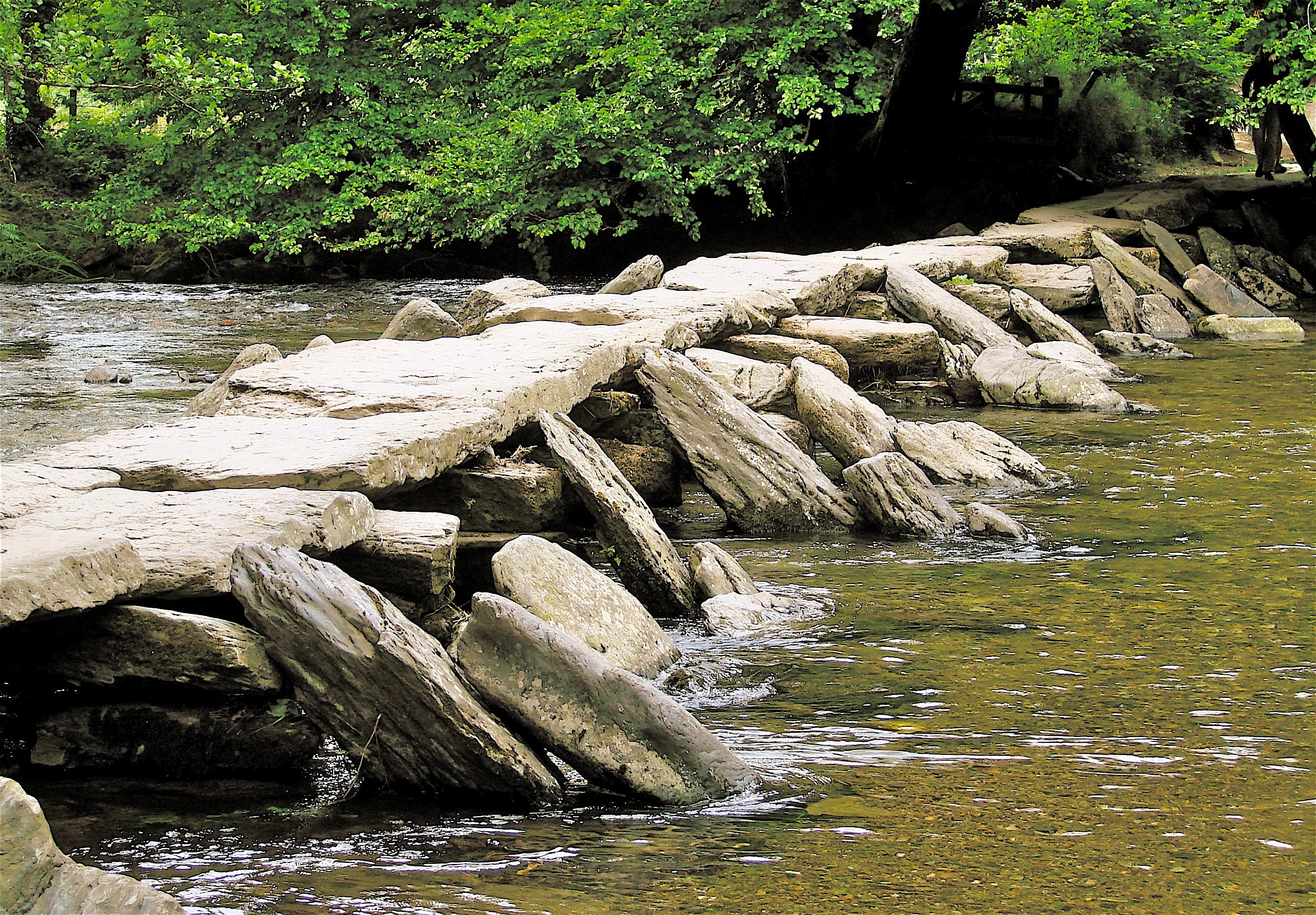
In this case “near Dulverton” means about six miles to the northwest and it isn’t easy to find the extremely narrow road out of Dulverton which turns off Fore Street, one street to the north of and parallel to High Street. From the entrance/exit of the mid-town car park, take the street between them and ahead you will see the tiny sign saying Tarr Steps on the side of a house. When you turn off the country road to the Tarr Steps and cross the first cattle grid, you can park and walk over the hills to the bridge – about a mile or so. Or you can drive in a mile or so and park close by.

- Details
- Written by: Administrator
- Category: Somerset/Avon/Wiltshire
STOWELL PARK BRIDGE 1845 HEW 378 N51o 21’ 7.8” W1o 47’ 32.4”
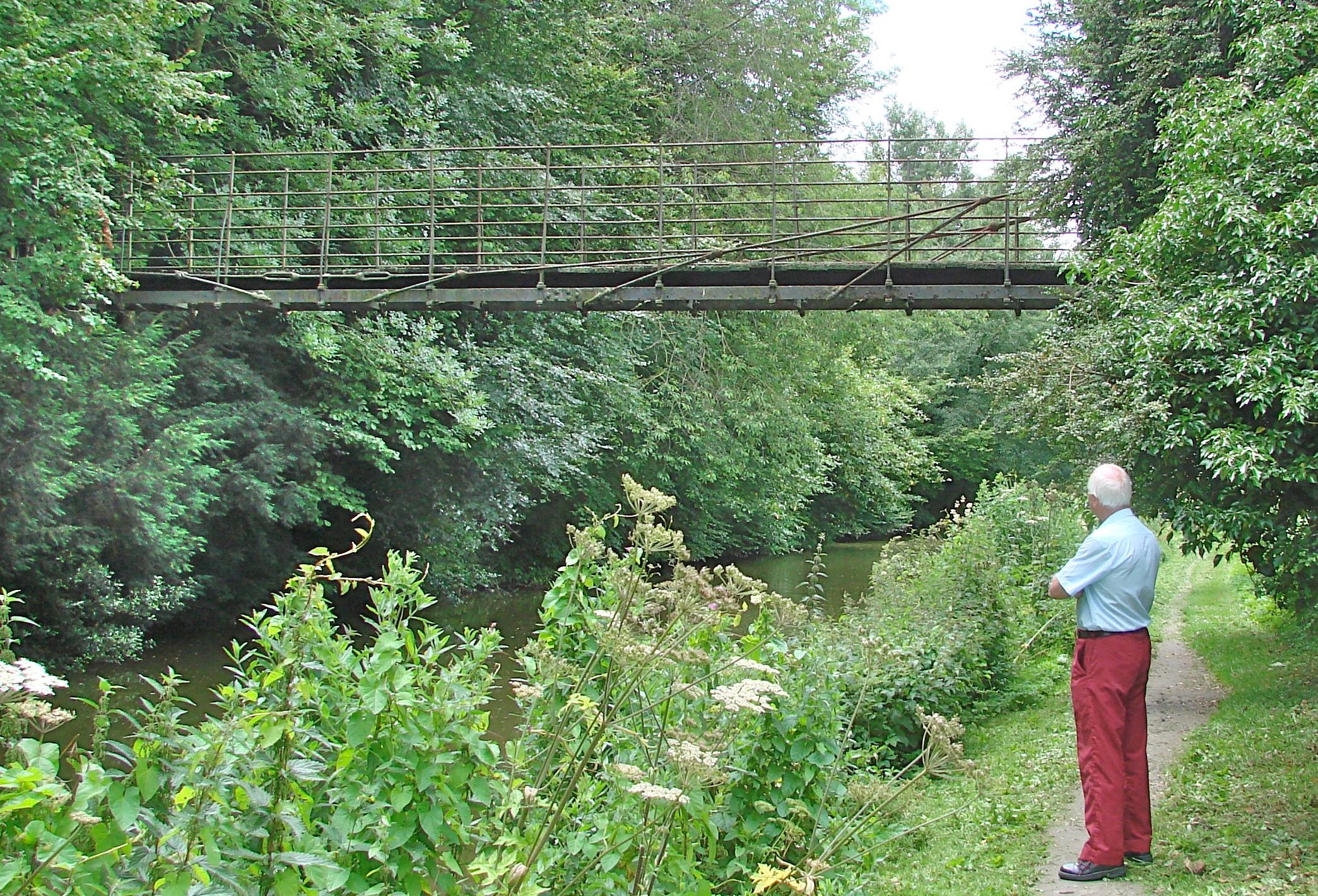
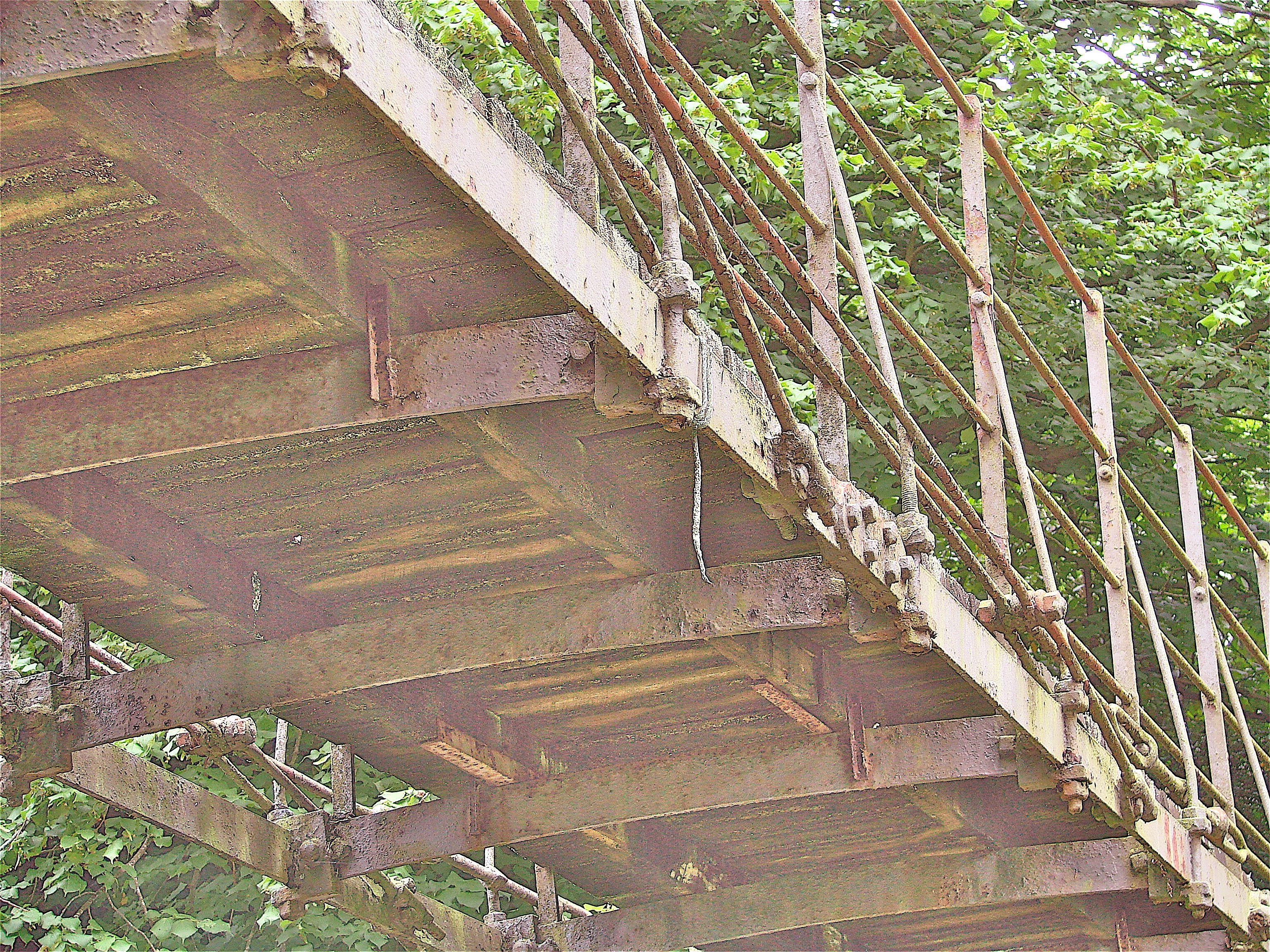
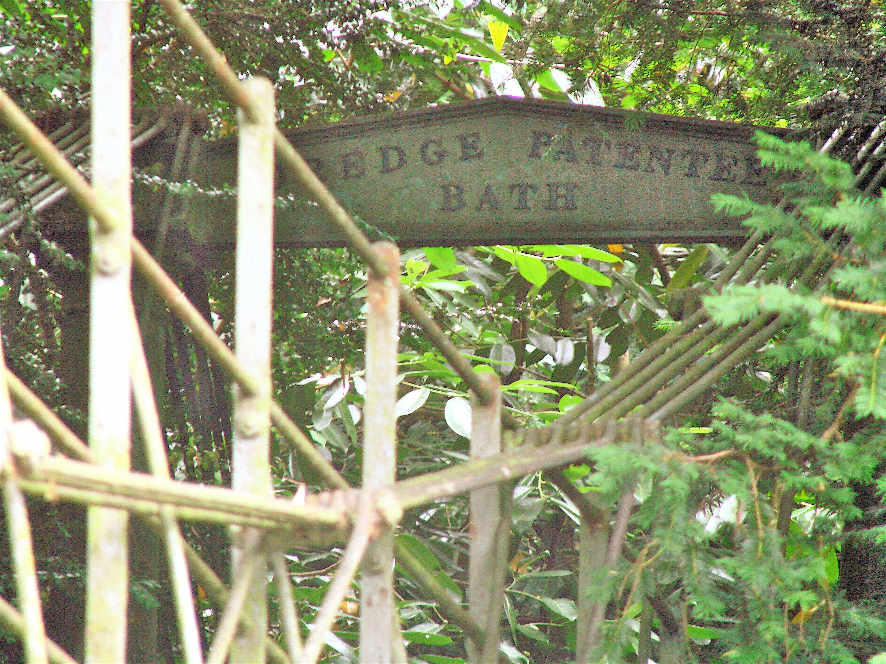
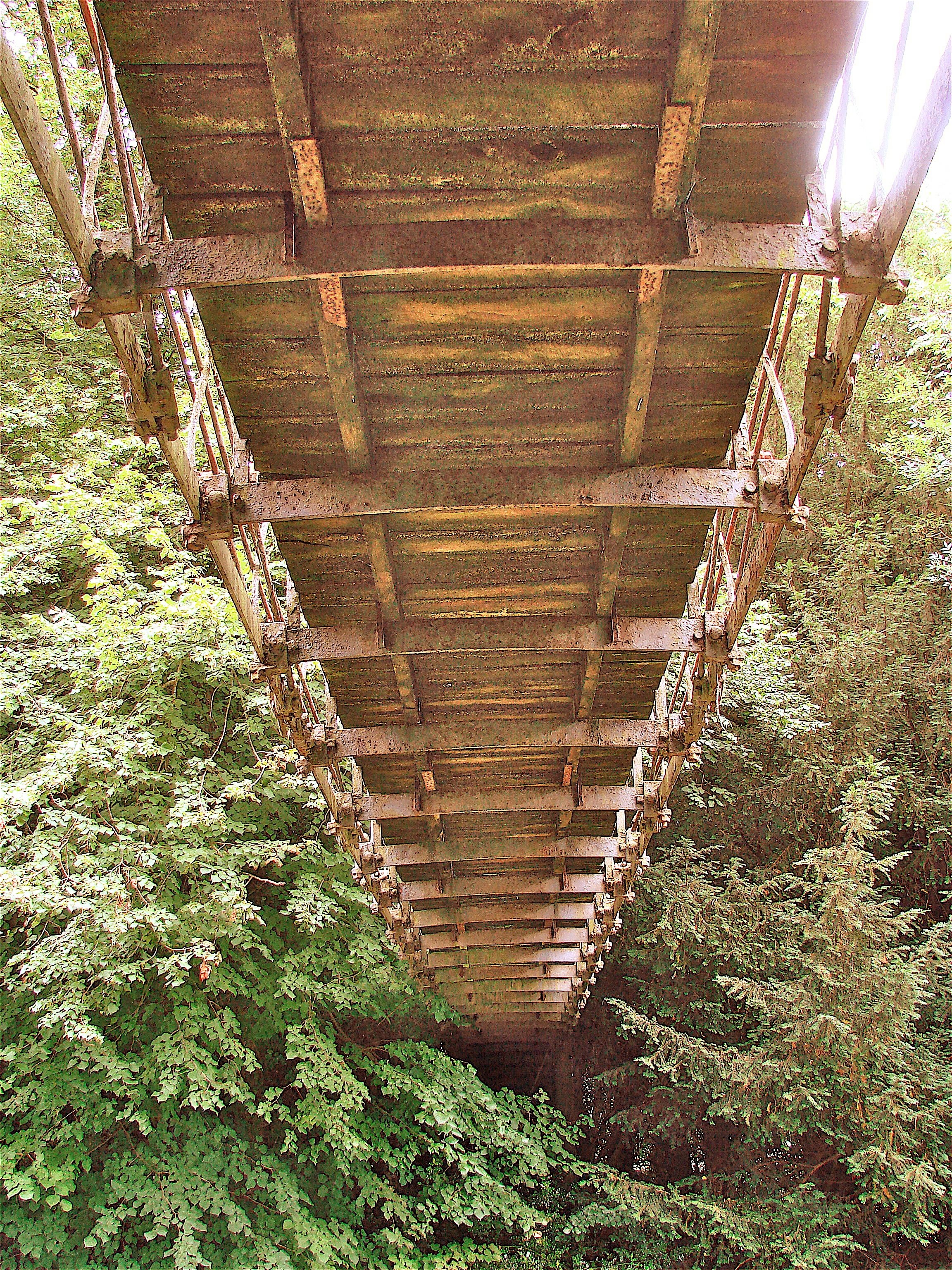
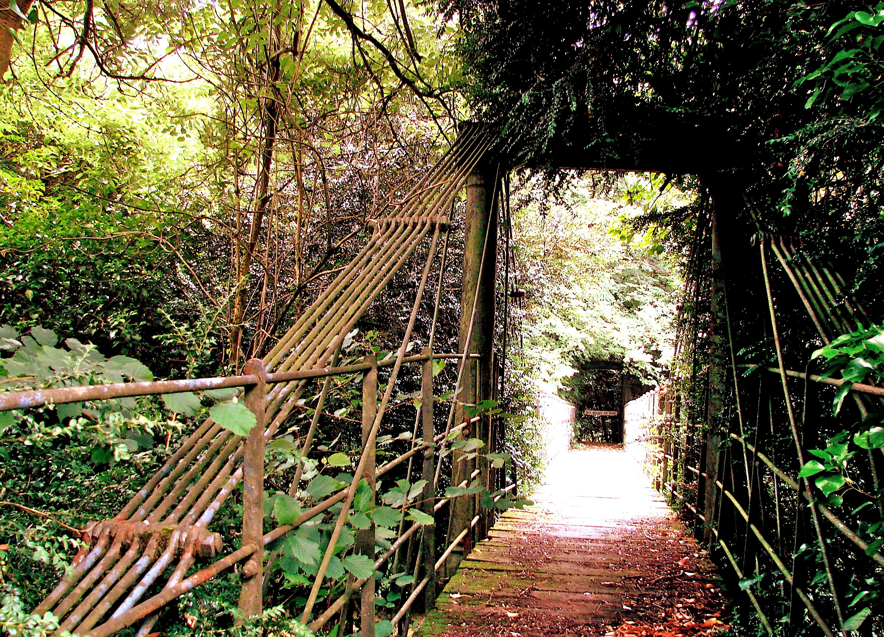
This is Bridge #116 on the Kennet & Avon Canal. Comissioned by Colonel Wroughton of Wilcot, son of Admiral George Montague, as a footbridge to connect his residence Stowell Lodge with his lands, it was designed by James Dredge (1794-1863. This is one of only eight surviving bridges in the British Isles of the fifty-odd designed by Dredge, a successful self-educated engineer. He developed a very distinctive type of bridge which combined the principles of suspension and cantilever. Each half of the bridge works as a right angle triangle, the hypotenuse of which is formed by the wrought iron rods extending along the deck at oblique angles up to the top of the pylons. The bottom tips of these two triangles meet at the center of the bridge. If you cut a Dredge in two at the center, both halves would still stand, where as if you were to do so to a conventional suspension bridge it would collapse.
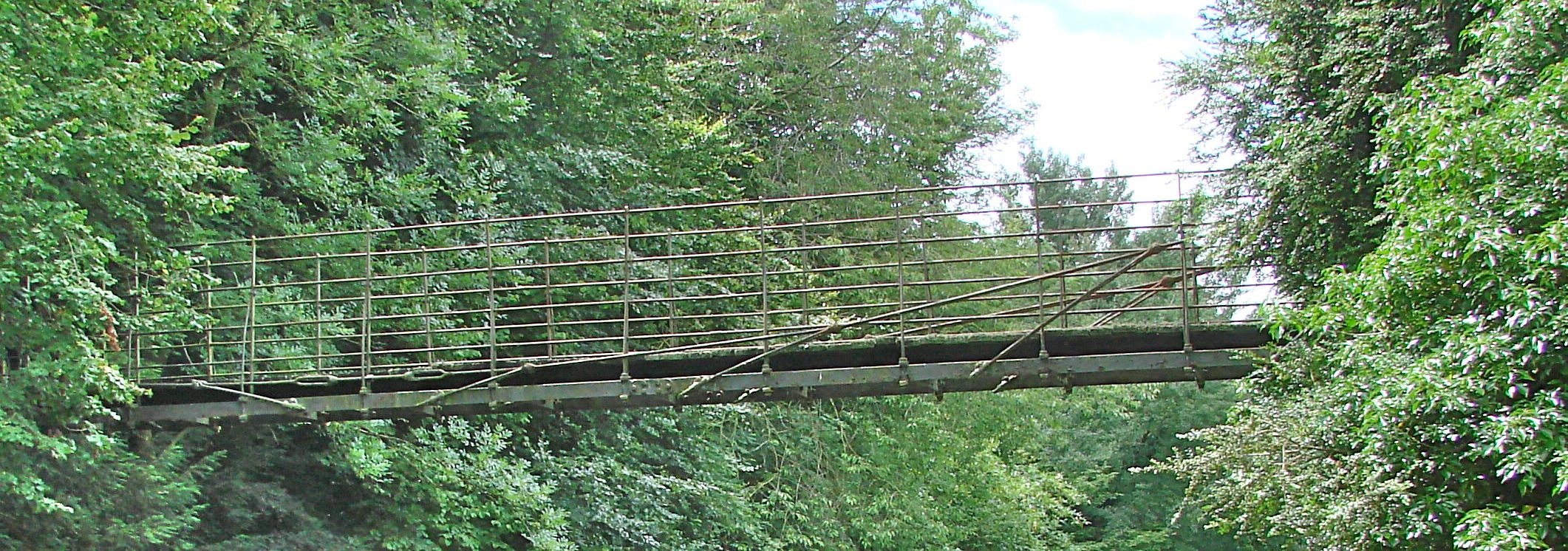
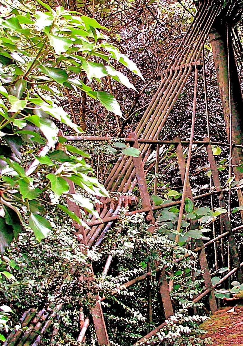
The chain of rods that loop from the top of each pylon down to touch the outer edges of the deck at the center are simply positioning the rods which are actually supporting the bridge rather than having the chain itself provide its support as in a conventional suspension bridge. You will notice that each chain starts as a single rod at the center edge of the deck and adds the requisite number of additional rods at each chain link position up to the top of the pylon. Also at this link a pair of inclined bars descend to the deck edge for its support, each set at its own inclined angle to the deck. Dredge claimed that this gave compression to the deck which overcame the tendency of pure suspension bridges to oscillate dangerously under certain conditions such as severe storm winds or troops marching in cadence.
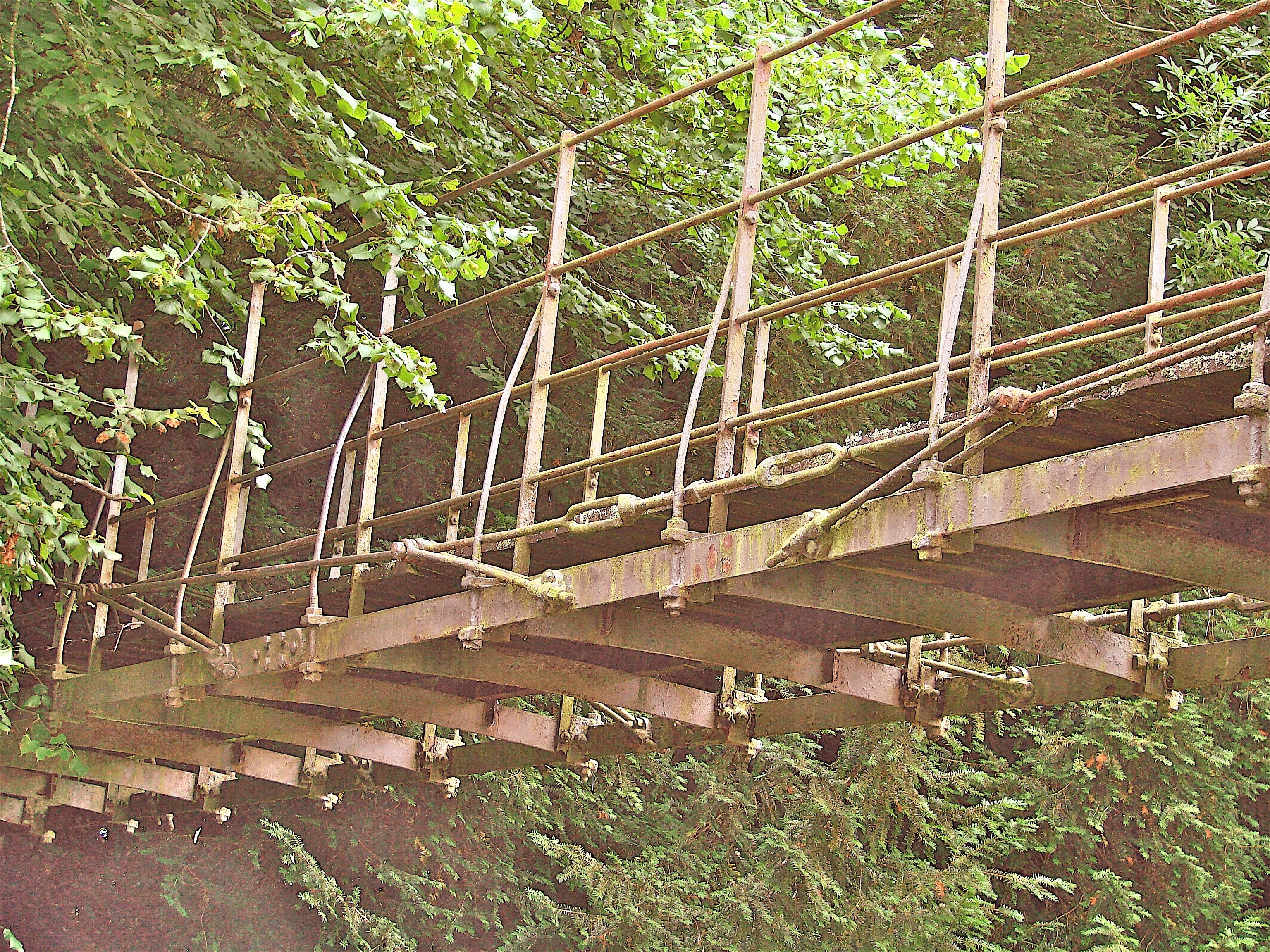
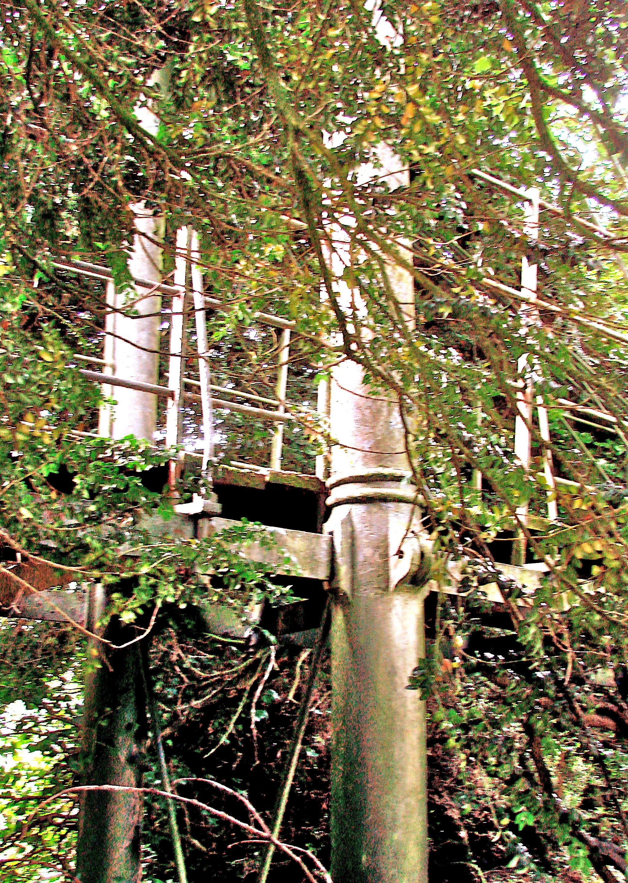
The four foot wide deck is of timber and the length of the bridge is seventy six feet, three inches. It is raised well above the canal providing generous clearance for the canal traffic and stone steps at either end are provided. All in all it is a marvelously bold and unusual bridge with cast iron pylons of great size crowned by arch tops that define their height, one of which advertises the Dredge patent.
It is not easy to find: take the Wilcot road out of Pewsey, Wiltshire and turn right at the Swan Pub to the stone bridge #117 over the canal. Immediately take a right onto the little road on the far side parallel to the canal. The iron bridge spans both the tow path and the canal. It is so buried in shrubbery and trees that only the part of the bridge spanning the canal is visible.

- Details
- Written by: Administrator
- Category: Somerset/Avon/Wiltshire
AVINGTON HALL PARK BRIDGE Hampshire N51o 5' 16.1" W1o 14' 16.1"
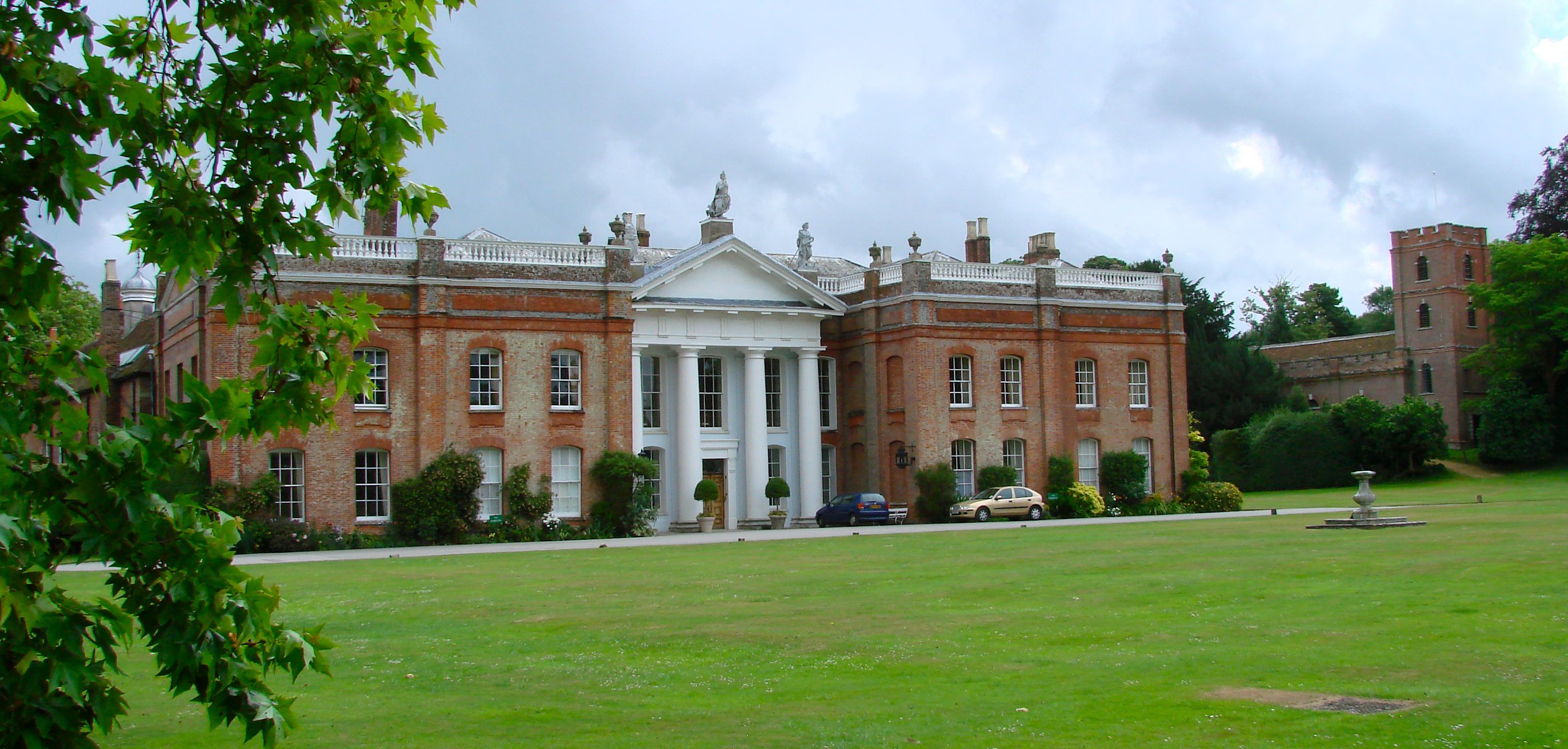
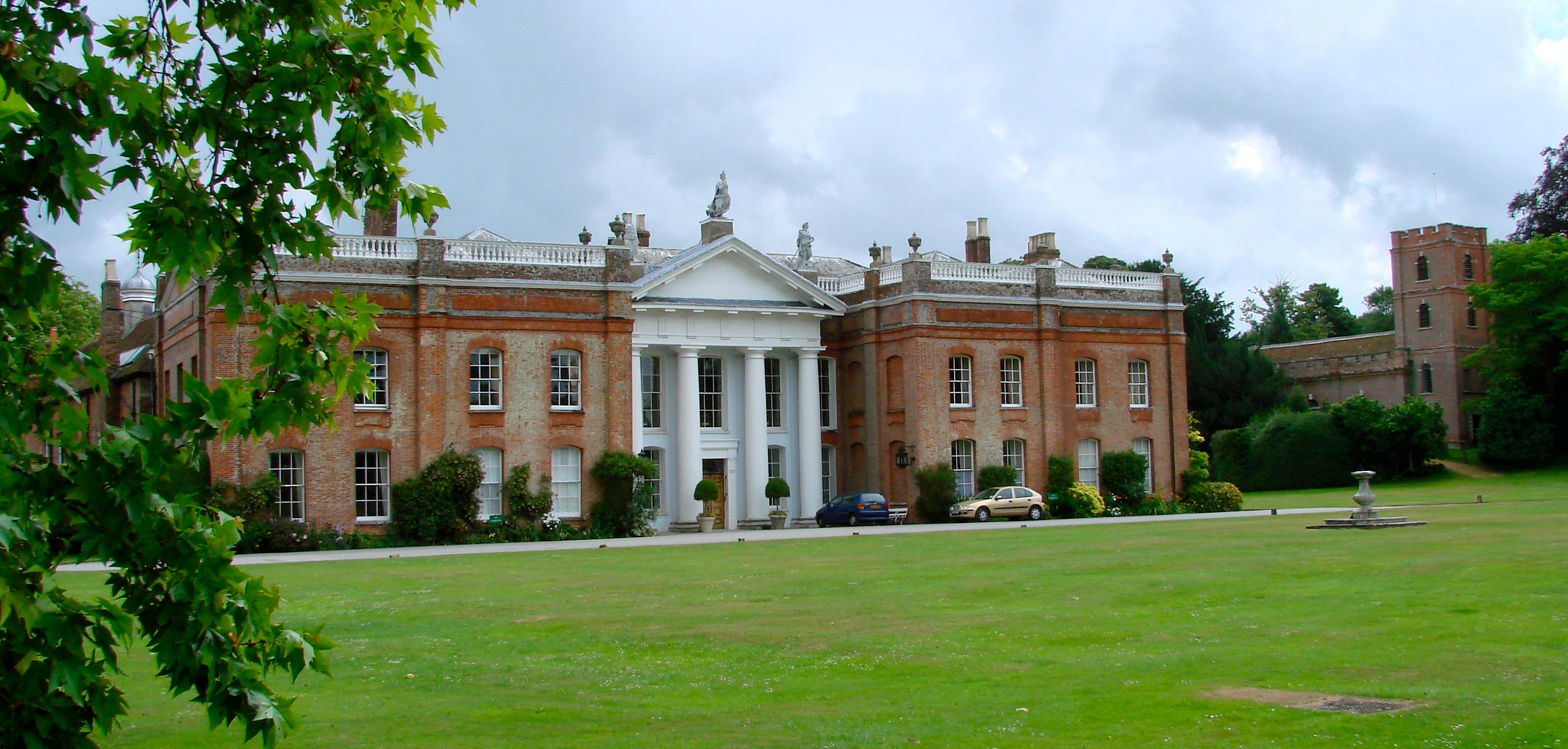
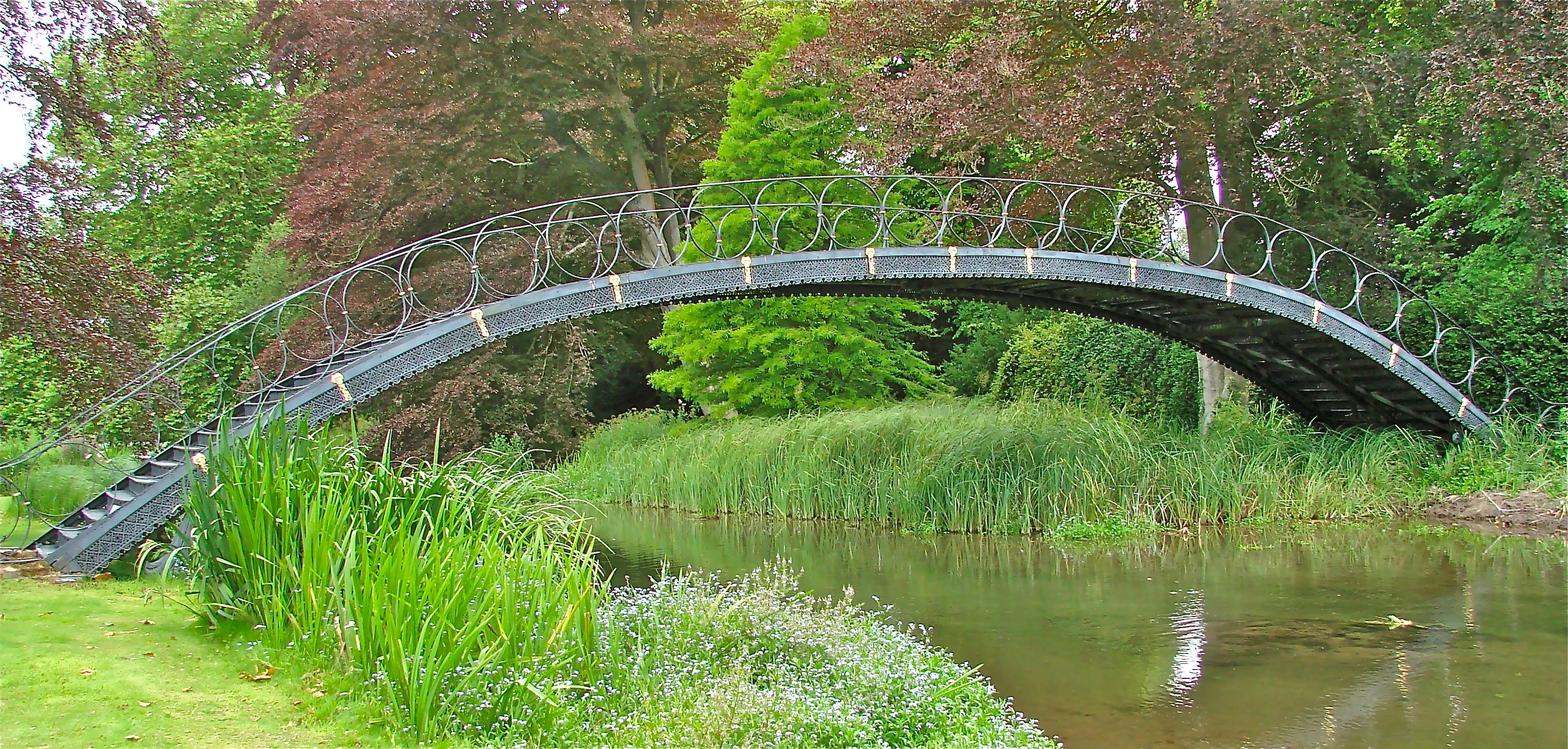
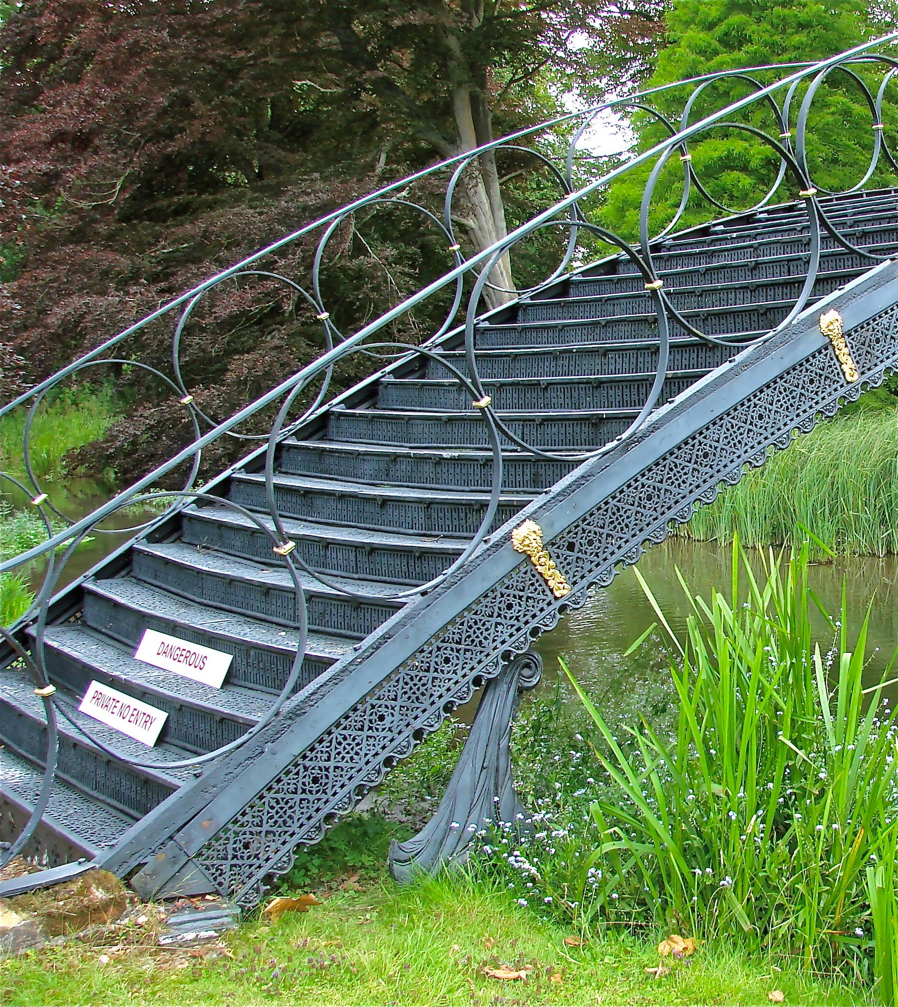
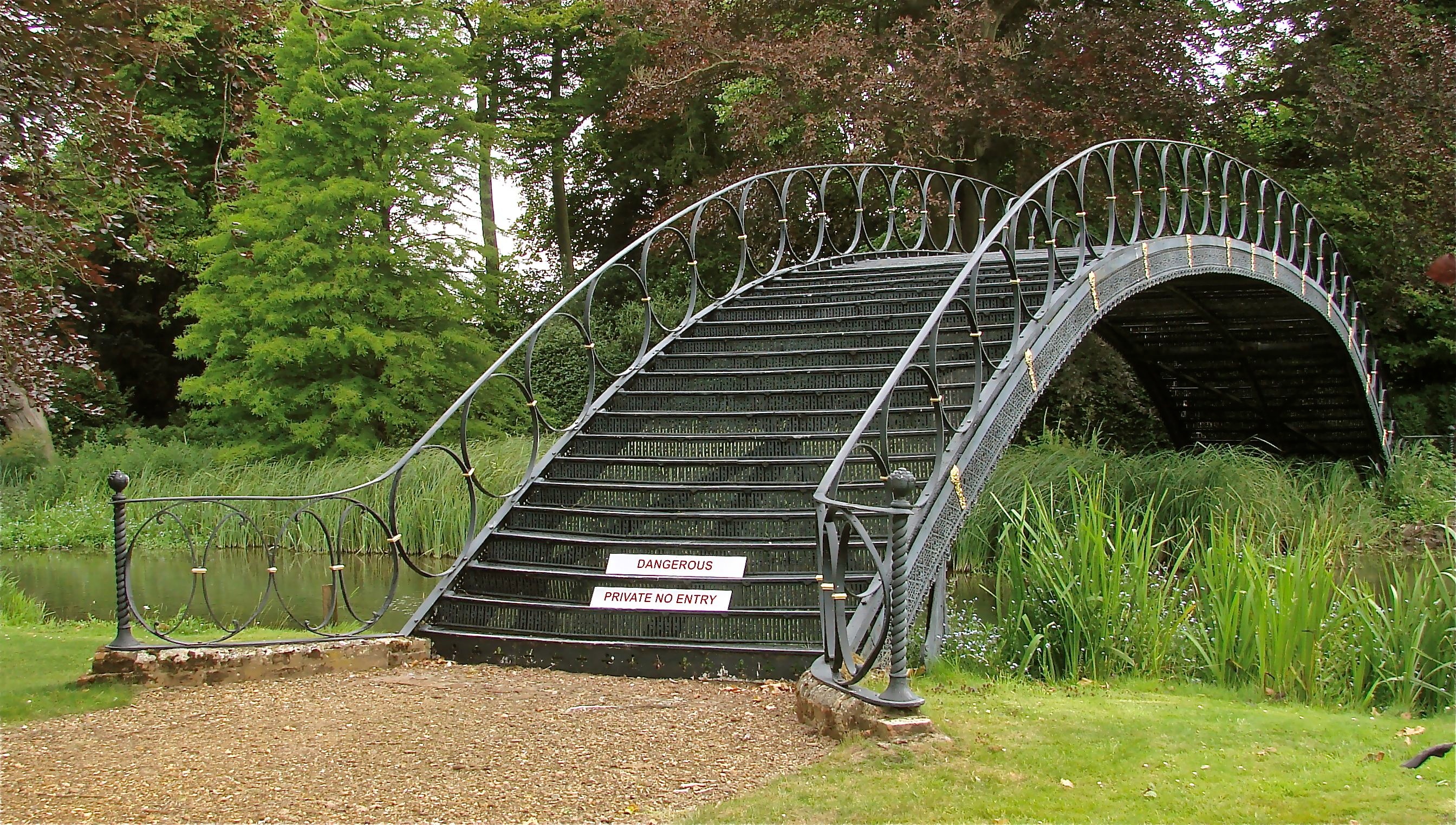
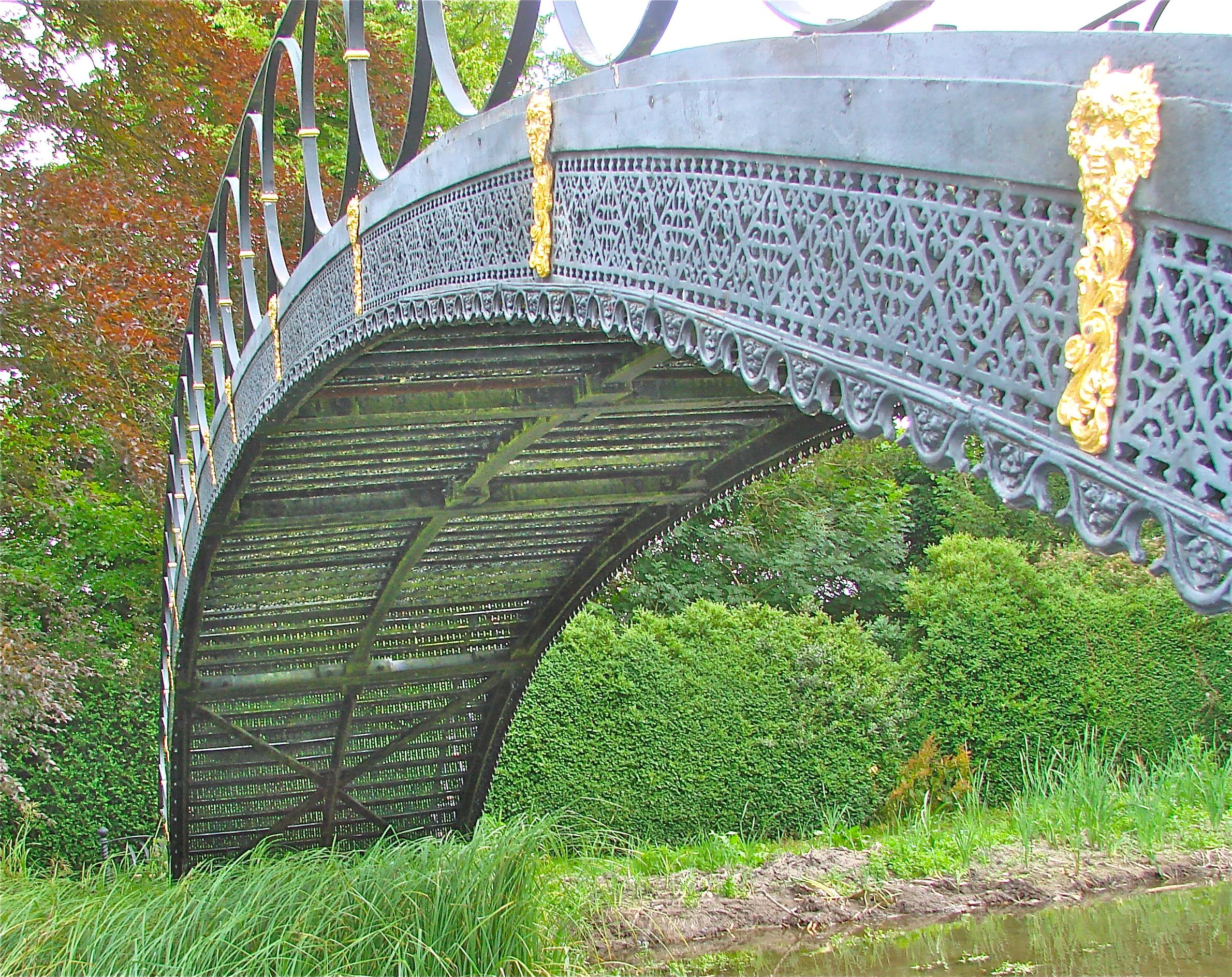
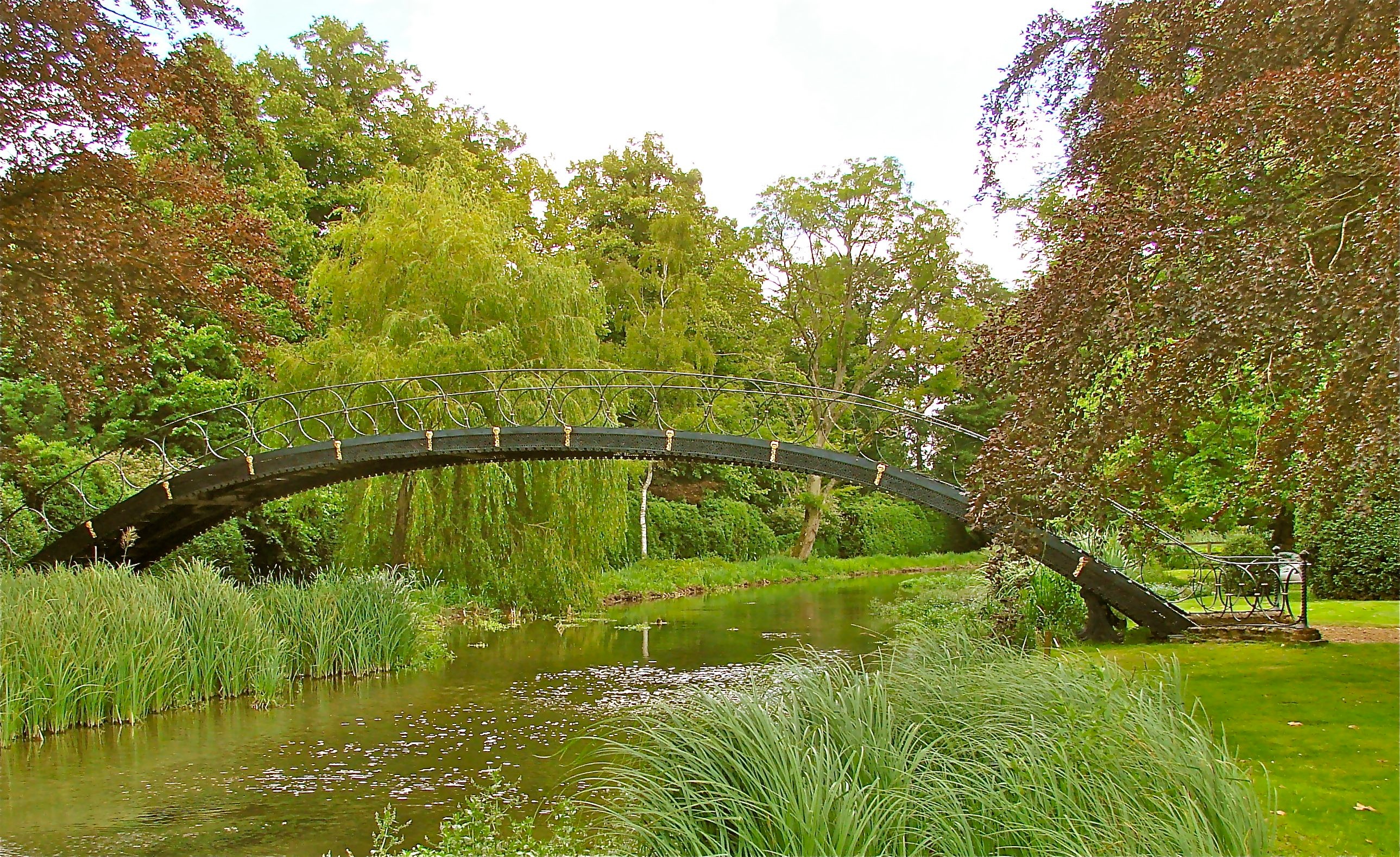
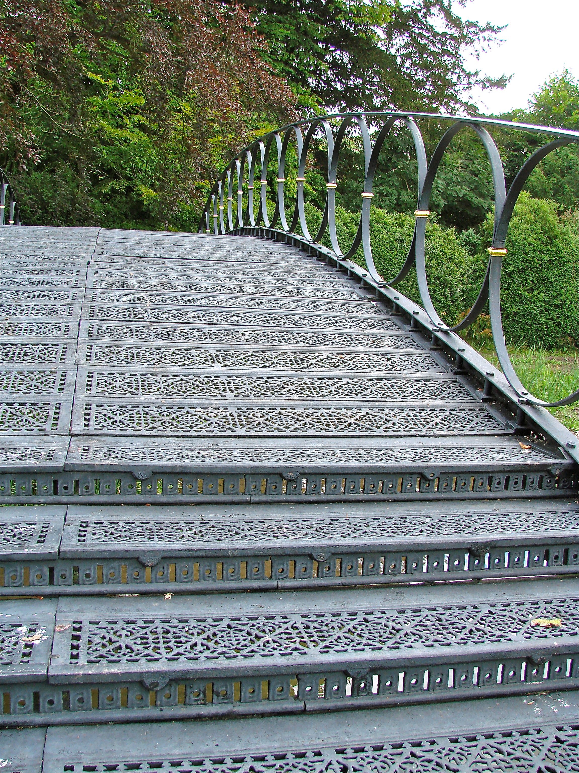
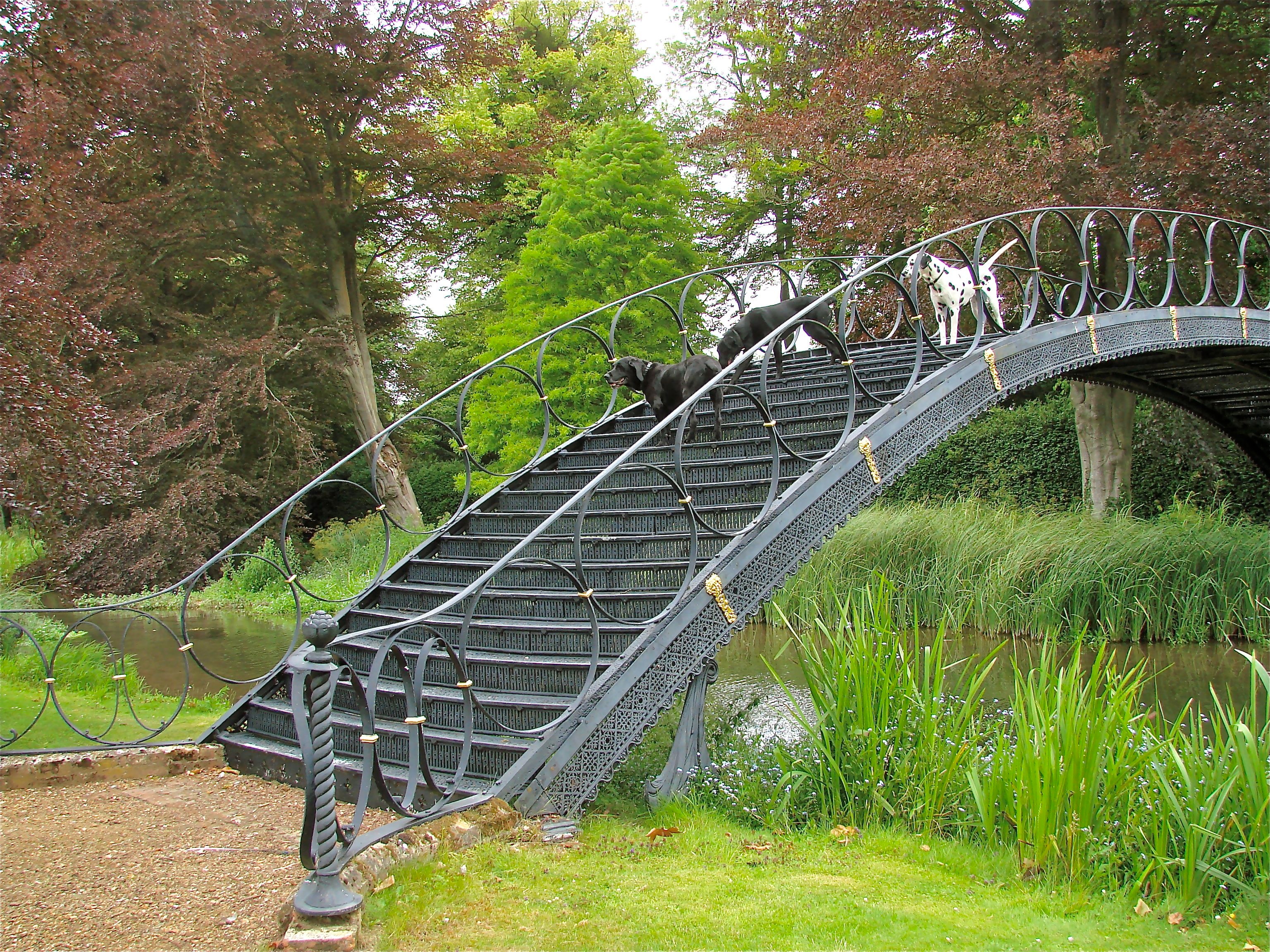
PRIVATE PROPERTY This early Victorian bridge of the mid-1800's, in the gardens of the 1811 home of the Earl Temle was cast by the local Kings Worthy Foundry, but when the Hall was sold after World War Il, all the family papers were burned and there are no records of who designed it or when exactly. It spans 50 feet across an ornamental lake with a very high arch. Like a Chinese bridge, steps across the width of the bridge lead up to the top on both sides. The decking, the steps and the risers are all make of decorative cast iron plates sitting on an iron frame and they even embellish the arched edge girders. The railings which flare out at the ends are made of circles in lieu of ballisters. The bridge was disassembled and repaired in the mid 1990's. It is in a private garden and permission to visit is required.
- Details
- Written by: Administrator
- Category: Hampshire
UPPER CLATFORD (Clapford?) BRIDGE 1843 Andover Hampshire HEW 502 SU357 435 {N51o 11' 22.6" W1o 29' 19.8"}
A two-span bridge in cast iron from the foundry of Tasker and Fowle at Andover. It crosses the River Anton. All components are of cast iron, including the river pier, wing wall, and abutments. They all slot together without bolts. Only ten patterns were required. It is possible the firm hoped to mass produce such bridges. The river pier is a cast-iron plate 5/8” thick on edge but stiffened at two foot centers with 2 inch thick ribs. This bridge is a twin of the Ladies Walk Bridge in Andover by the same firm, but the twin is a footbridge a little over 5 feet wide while this model is twelve feet wide.
This bridge is not easily found in the maze of lanes and roads around Andover and there are many ways to approach it: here is one. Going in the London direction on A303, take the A343 towards Salisbury. Look for Foundry Road on the left with a sign to "Anne Valley & Clatfords". Proceed through the old village and take the third left over a stone bridge onto Church Lane and proceed to the iron bridge that is just past the Church which is on your left.

- Details
- Written by: Administrator
- Category: Hampshire
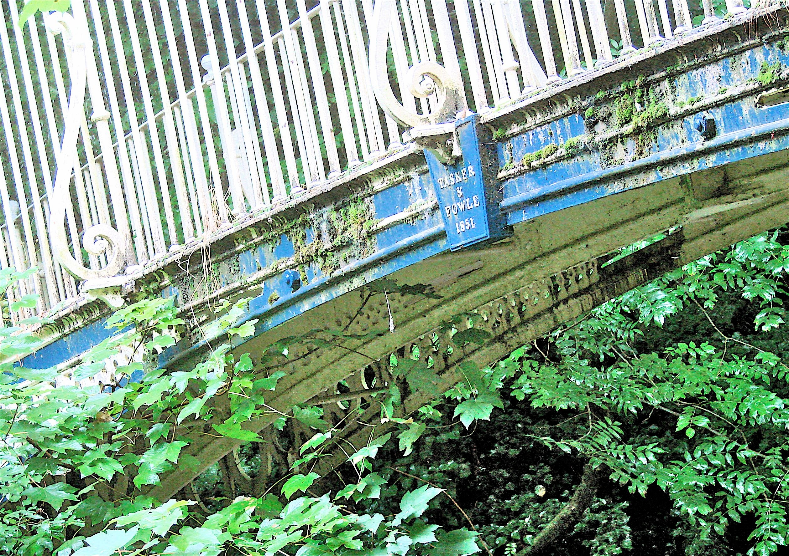
LADIES WALK FT BRIDGE 1851 Andover, Hampshire HEW 653 SU 375 452 {N51o 12' 17.4" W1o 27' 51.8"}

This elegant bridge was made by the foundry of Tasker and Fowle at Andover. It is a smaller twin of the Upper Clatford Bridge in Andover by the same firm. This bridge, a little over five feet in width, carries an unpaved carriage way or drovers lane across the now disused old London Road which lies in a deep cutting below it, both ways being surrounded by ancient trees in a forest setting.
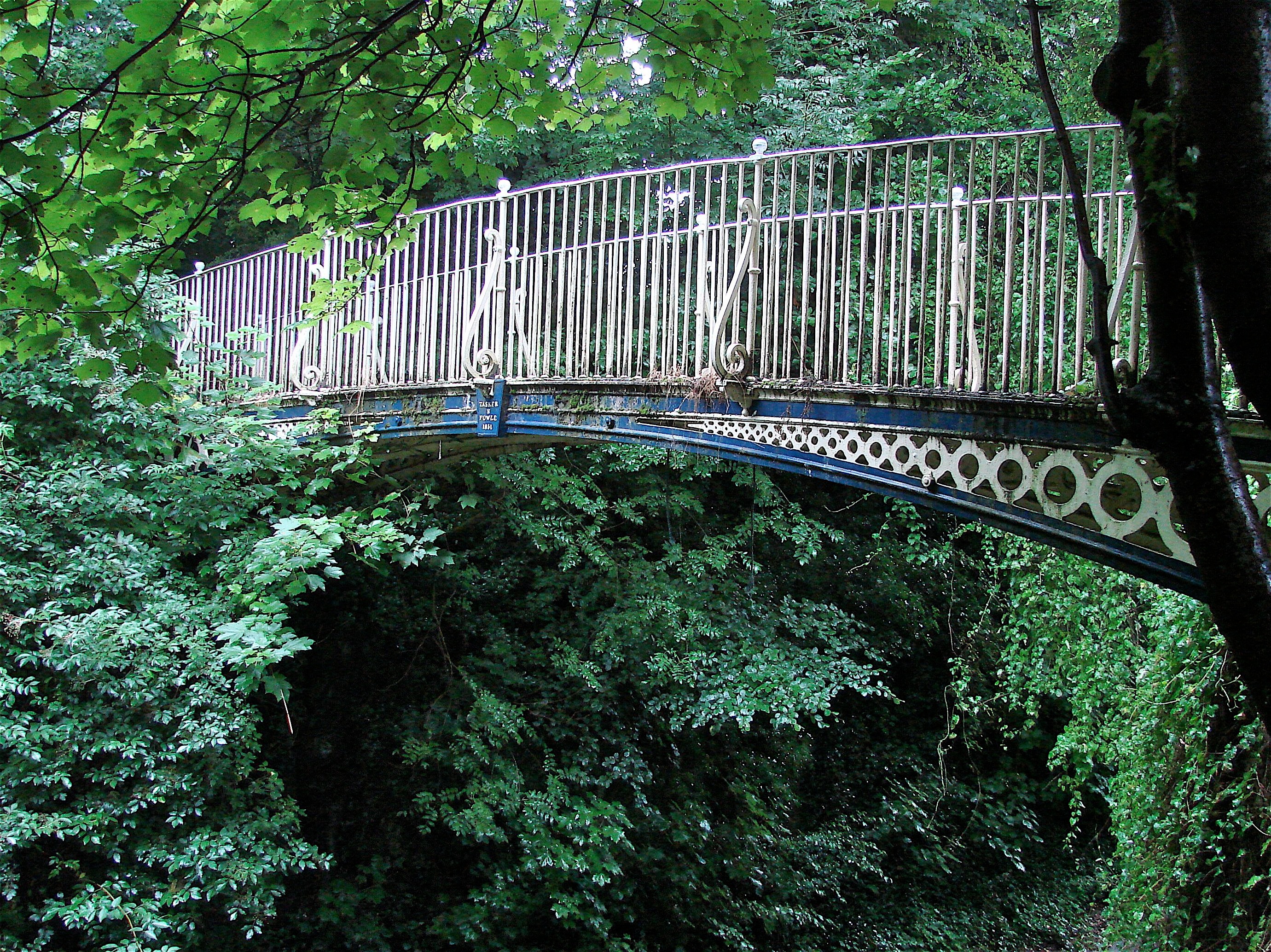
It is the devil to find since neither of these two paths can be reached by car. I never could find the two ends of that disused section of the old London Road which is now a bike and walkway, but the unpaved carriage way which leads to this bridge starts off a cul-de-sac at the end of a still used section of the London Road in a residential neighborhood just off the A3093 opposite to where B3400 comes in from Andover Down. There is a pedestrian footpath at that intersection going through to where you want to be, but to get rid of one's car, one must approach that residential neighborhood from a rotary on the "Churchill Way" section of the A3093, then come around to the street called London Road and park at the dead end. Take the paved footpath to the first right and go uphill on a steep gravel path to the top where you take a right turn again and walk along the old carriage way for about ¾ of a mile to the bridge.

- Details
- Written by: Administrator
- Category: Hampshire
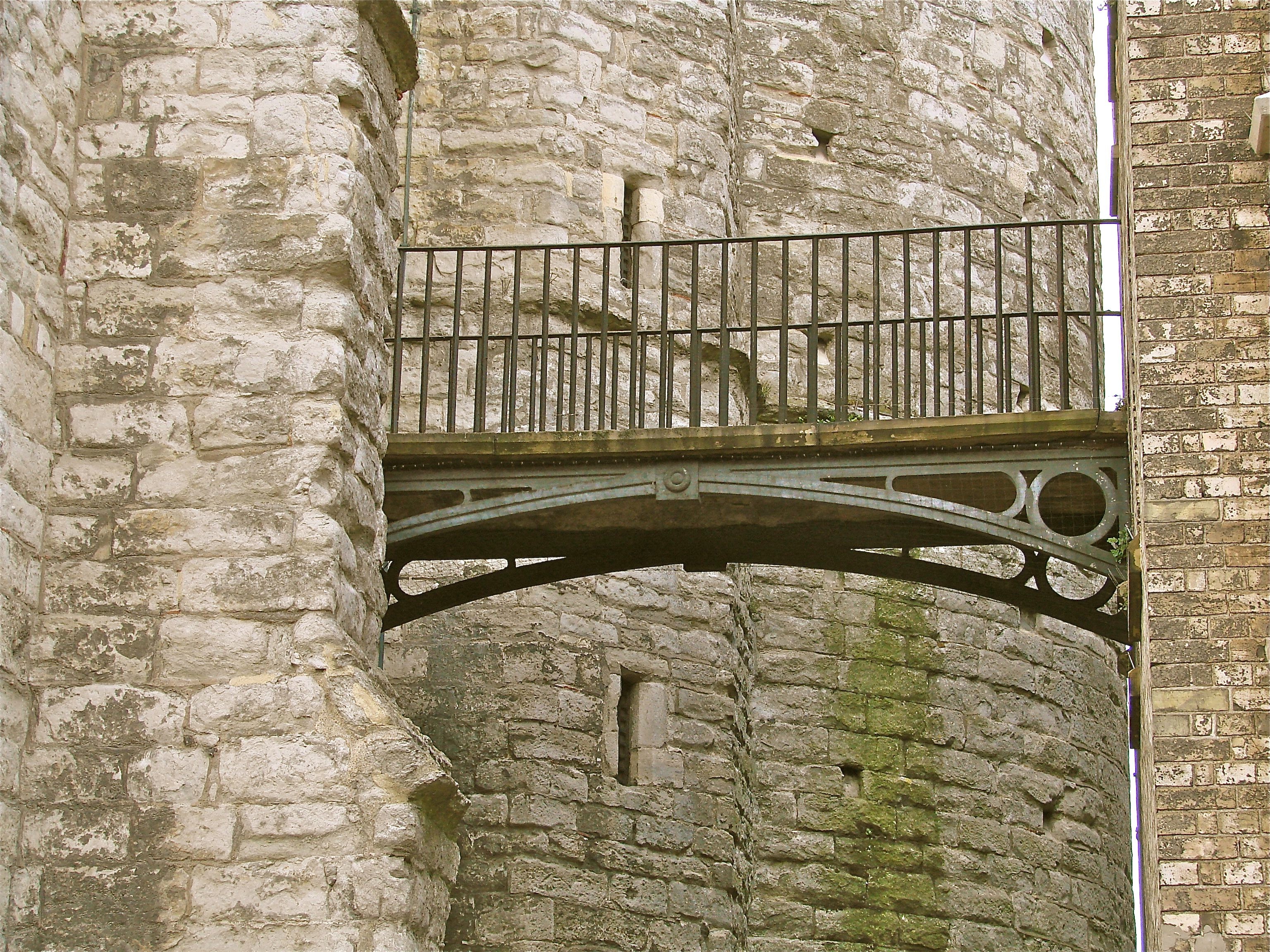
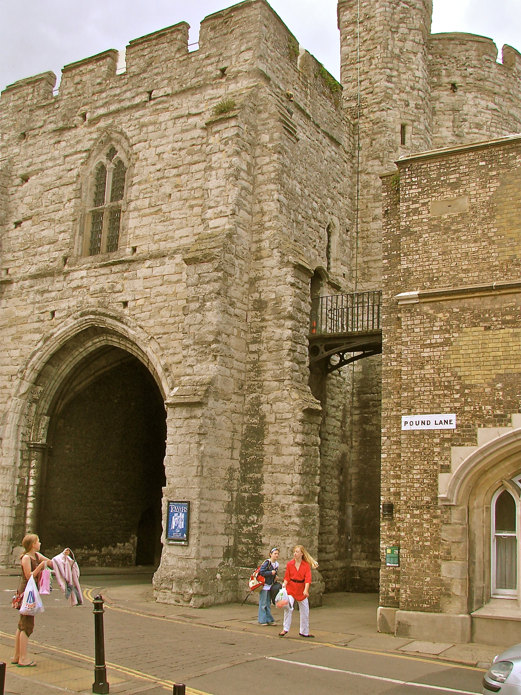
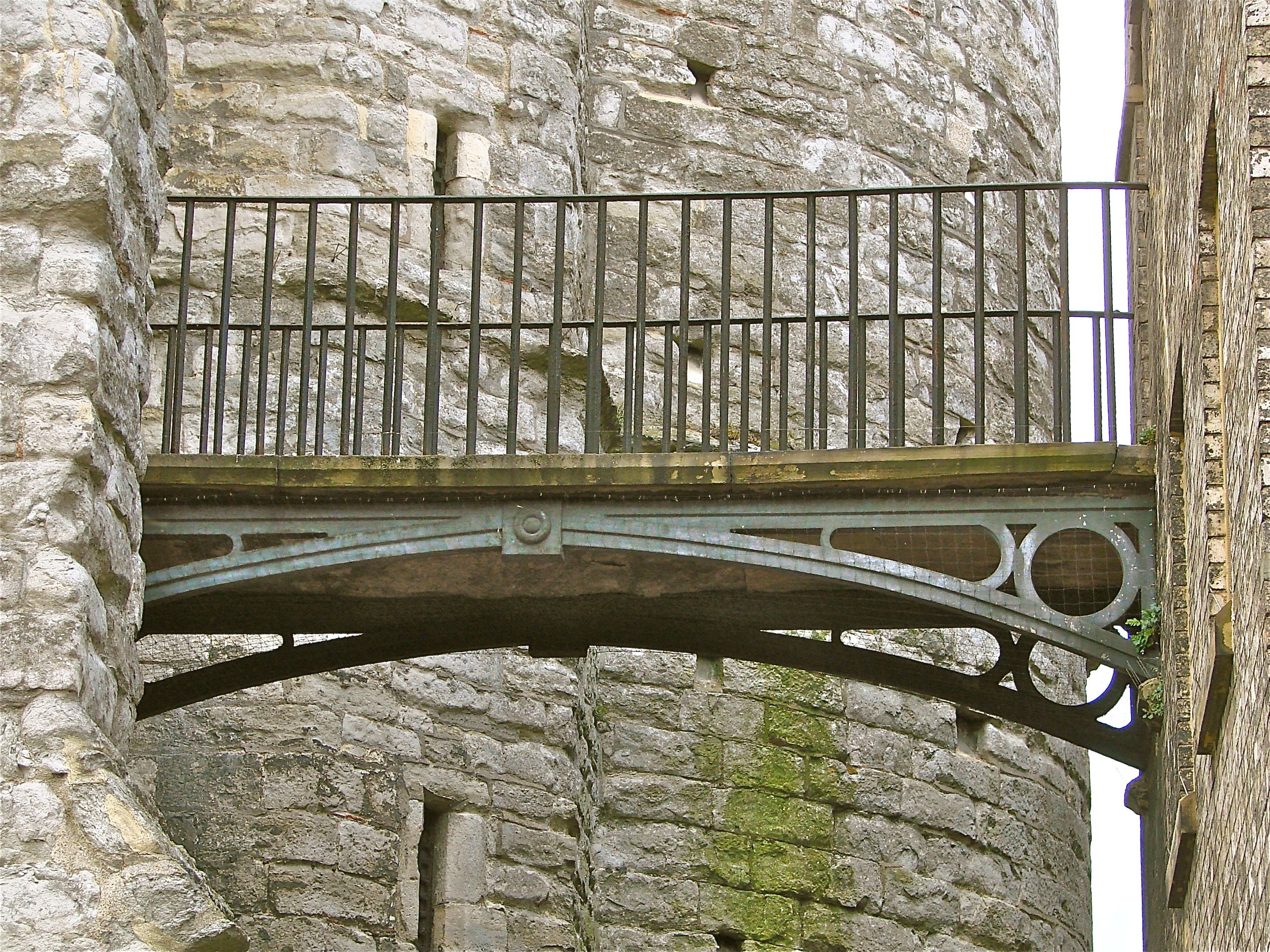
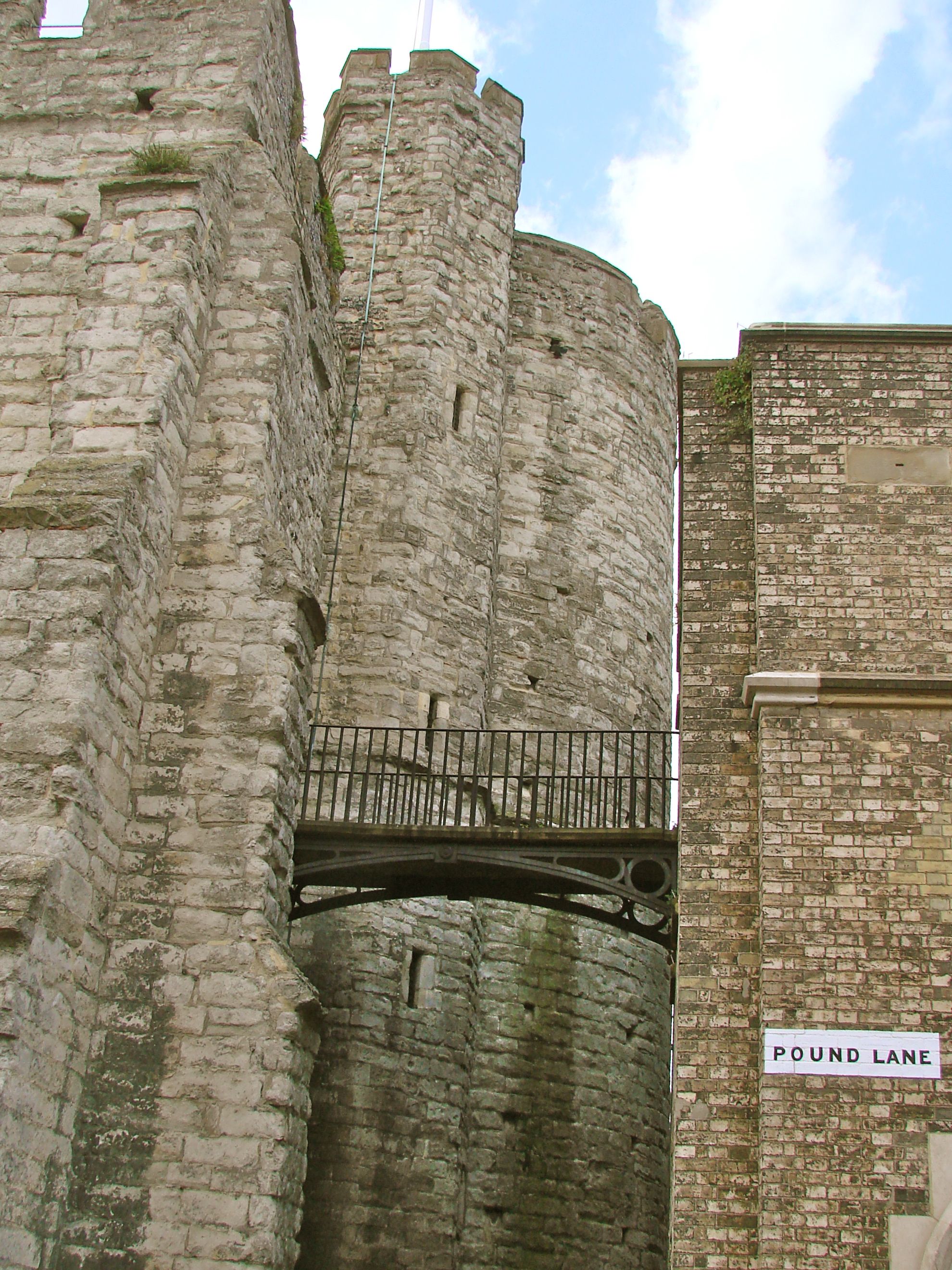
WEST GATE FOOT BRIDGE, CANTERBURY 1829 N52o 47' 30.2" W2o 1' 45.3"
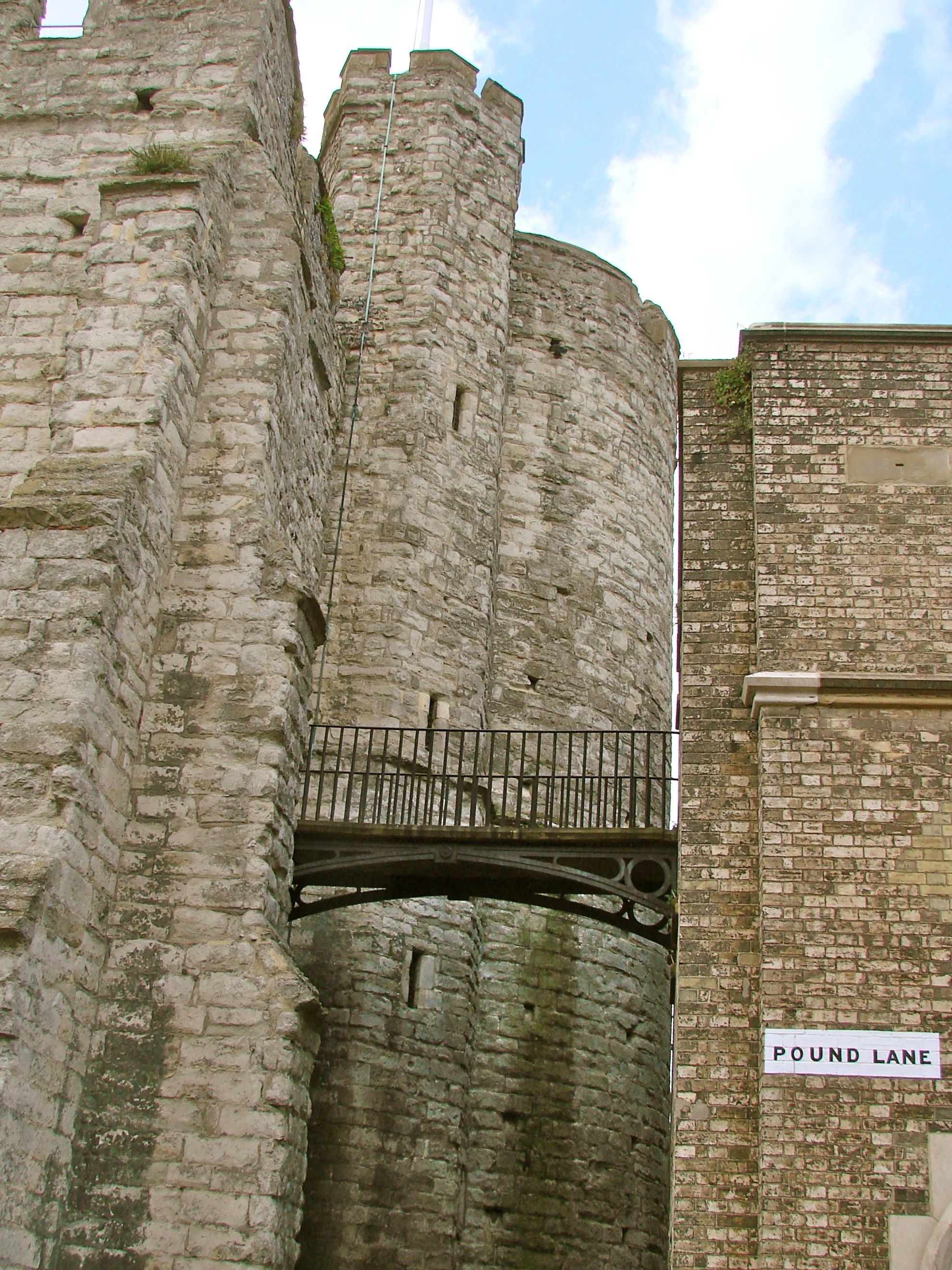
The fortified West Gate of Canterbury by which the London Road enters the city is of early medieval date, but beside it is a prison built in 1829 and the wrought iron bridge between the two towers is believed to date from that time. It is a small bridge of approximately five feet wide and fifteen feet long with diminishing circles in the spandrels. There is mention of it having been the work of Edward Blore.
- Details
- Written by: Administrator
- Category: Kent
